
Oxfordshire Branch
reports
on

Making our Plan... The Sections... The History of the Castle... The Dig... Visiting the Castle...
People Involved... Useful Links...

Oxfordshire Branch
reports
on

Making our Plan... The Sections... The History of the Castle... The Dig... Visiting the Castle...
People Involved... Useful Links...
Introduction
We went to Deddington Castle on the 29th of September 2001. There were two groups - one went in the morning and the other in the afternoon. It was raining hard for the first group but the sun came out for the other group. We aimed to measure the castle so we could do this guide. We got quite muddy when we were measuring around the ditches and near the end we took some photos. Some of the photos are down below.
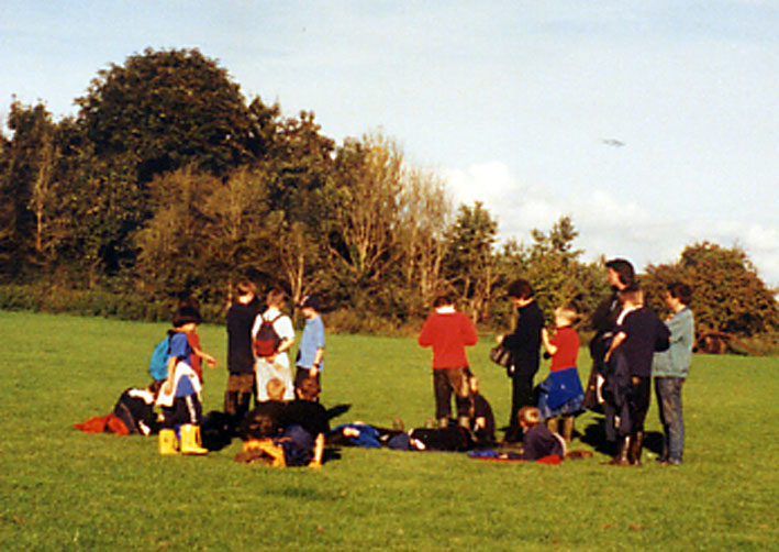
The team set up base camp on the outer bailey
We split up into groups then walked round the ditches and banks measuring our route with a compass to find the direction we were going and our paces to find how far we had gone. Some groups used a special measurer which was a wheel that went round once every metre, another group had a long tape measure. In the afternoon some more groups climbed up and down the banks to measure how high and wide they were. Back at the museum we started to draw the outline of the castle. After a lot of work we ended up with our plan.
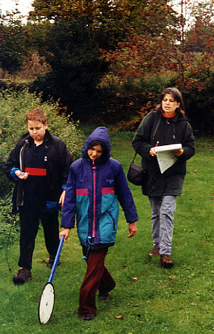
Using a trundle wheel to measure distances
Run the pointer over our plan to see where we measured the banks and where they may have been stone buildings
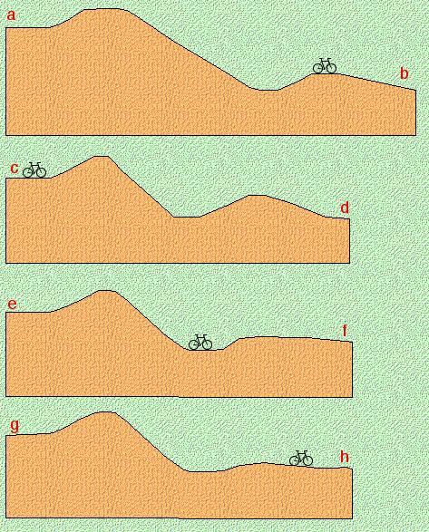
Here are the sections we drew. It was very hard work scrambling up and down the steep banks. These are the finished drawings, the bicycles are to scale and show just how enormous the earthworks are.
When was it built and who built it?
The
castle was built shortly after the Norman Conquest (1066) for Odo of
Bayeaux, the half brother of William the Conqueror. It was the centre
of his large estate. During the 12th century, at the time of the civil
war, the castle was strengthened by William de Chesney. In the 13th
century the descendants of the Chesneys styled themselves ‘Lords of
Deddington Castle’.
What did it look like then?
At the beginning ,the castle was made mostly of earth and wood. By the
mid 12th century it had been rebuilt in stone to include walls, towers,
a solar wing, hall and kitchens.
What happened to the stone castle?
In
the 13th century the castle fell into decay. In 1281 an attack on it
broke down the gates and doors, but by then the castle was already
‘weak, old and demolished’. A chapel on the site was still in use in
the 14th century, but by then stones were being robbed from the site
and sold. By the 16th century nothing survived above the ground.
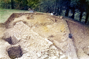
In
1978 Stephen and Verna helped with an excavation at the castle. It was
organised by Queens University. Belfast and was set up to find out more
about the castle following an earlier dig in 1949. Work was done on the
large tower or keep on the east side of the inner bailey. One of the
more unusual finds was a wheelbarrow buried by a local postman who had
been doing some unofficial digging in the 1940s! Here are some
photographs of the excavation.
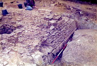
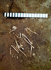
There was a mystery surrounding a find made in the bottom of a cleared out cess pit. Lying at the bottom of the pit was the complete skeleton of a hawk or falcon! How on earth did it get there?
The people who worked on this were:
Camilla, Christopher, Morgan, David, Alexander, Jason, Paul, James, Robert, Russell, ,Alice, Patrick, Dan, Mary , Sam B , Andrew, Richard, Matthew K ,Thomas, Julian, Jamie, Dickon, Jim, William B, Charlotte, William F, Amy, Sam G, Katie,Tamoya, Alexander B, Thomas, Naomi, Matthew J, Thomas E, James M, Lewis, Fay and Lily.
Thank you to Carol, Stephen, Verna, Keith and Alexander's dad for helping us.
How did he get there?
Here are some links connected with the work we did at Deddington that you might find useful.:
Deddington's Own Web site, for more information about this historic town
Multimap have some fantastic aerial photographs, check out this one of the castle site
Your own YAC home page to see what else is going on
The Oxfordshire Museum at Woodstock which was our base for the day
Here are a couple of web sites dedicated to castles: Castles of Britain and Castles on the Web