March 2016
Back to Project Contents and Introduction
After a certain
amount of excited anticipation the 'big digger', all 35 plus tonnes of
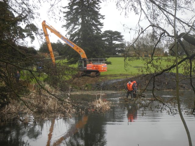
it, arrived on Tuesday March 1st. After carefully tracking across the
park from College Farm it was set up on the banks of The River to
commence the de-silting operation. As it happened most of the debris
turned out to be floating masses of bull rushes with accompanying
roots. This was mostly pulled out but did leave behind a kind of bull
rush root soup which presumably will regrow in short order, the whole
lot needs 'sieving'... good luck with that. The digger perched close to
the bank and managed to sink itself in to some depth, particularly
exciting for those of us watching from a distance was the point at
which the machine (Did I mention it weighed 35 tonnes?) started to
slide into the water... fortunately the operator saved the day by
getting the 20m boom in position and pushing back. Once it was all over
and the odd fish rescued and tossed back in we inspected the large
mound of... well sludge is really the only word for it. Peter ran his
detector over it all, rien, and I looked for evidence of early silts or any other kinds of material, also rien.
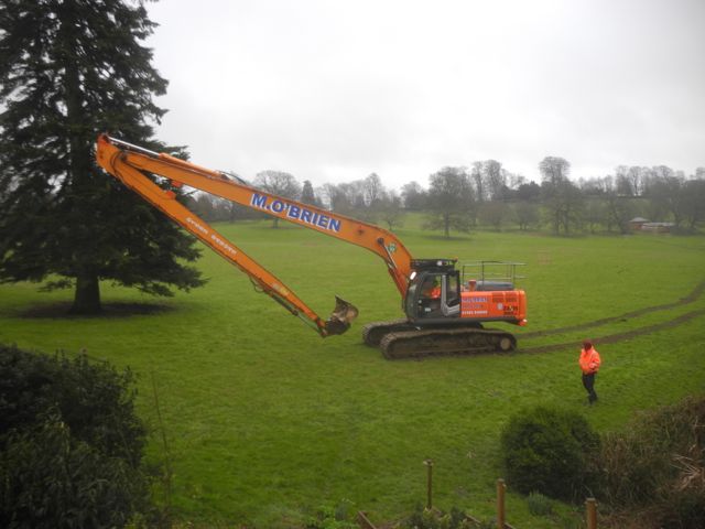
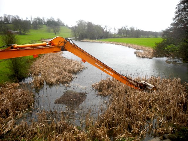
The big beast arrives, impressive reach! And starts removing the bull rushes.
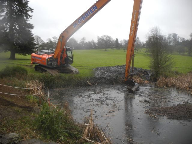
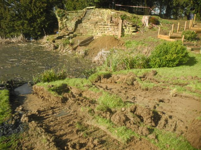
Hmmm.... looking a little unstable. The aftermath and the slippery slope
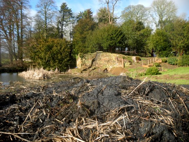
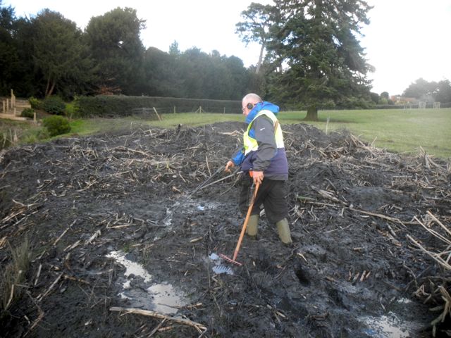
Large amounts of sludge with Peter boldly going plus detector.
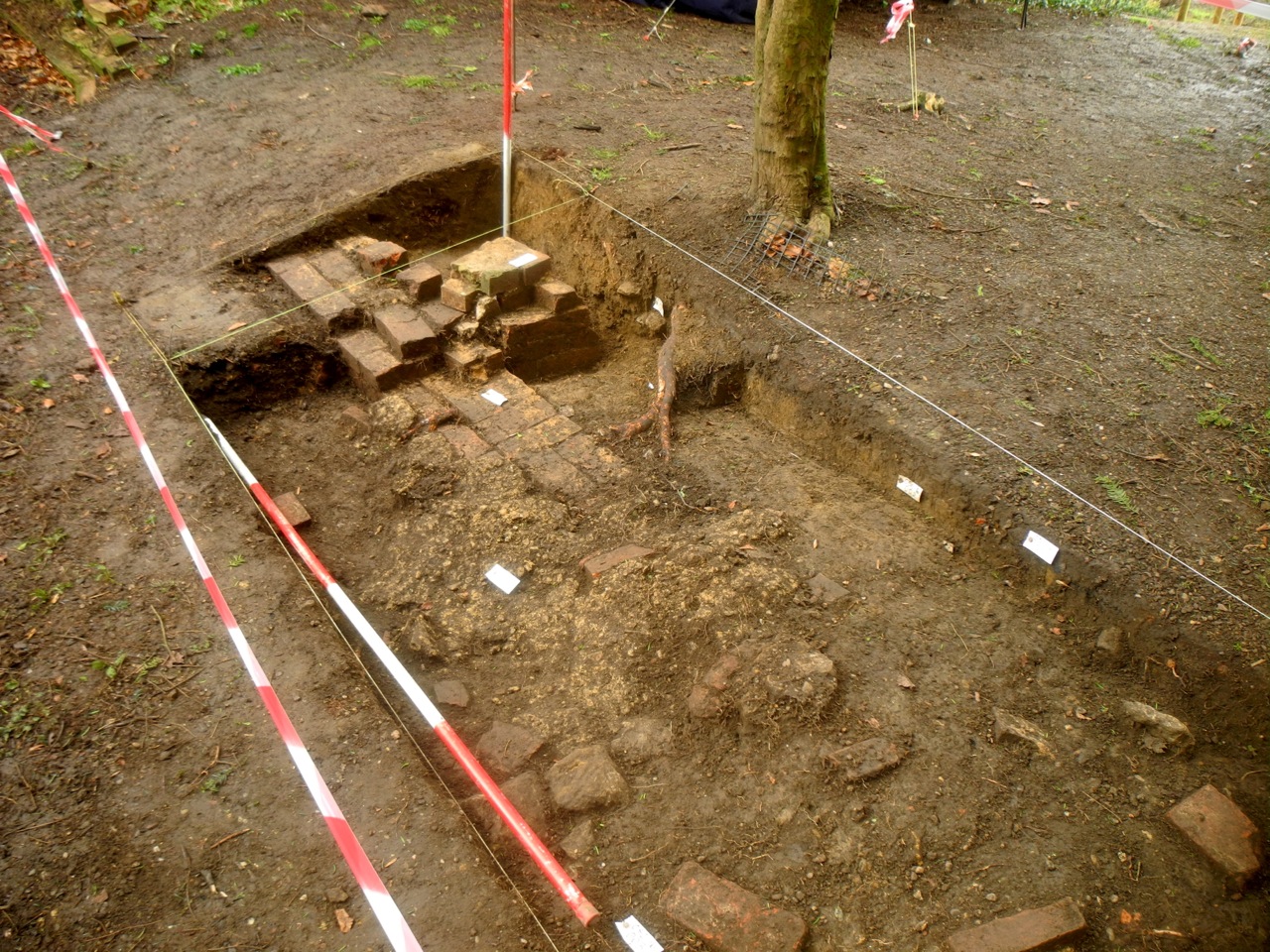
Trench C on the estate wall with the east pier and a curious deposit of mortar plus aggregate.
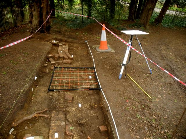
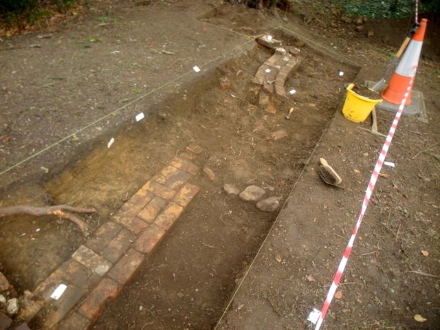
Drawing underway then coming close to identifying the cut for the pipe and what are those three stones doing?
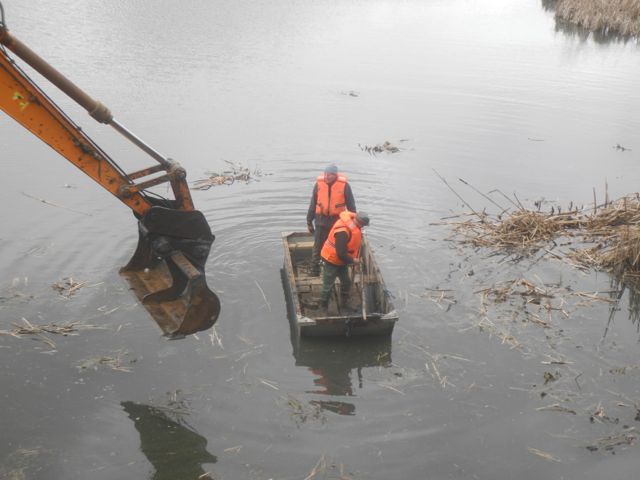
Richard and Ian getting ready to fasten the iron fence panel via some ropes onto the digger then a small but hardy group do some sub-aqua weeding.
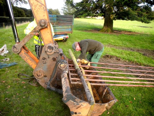
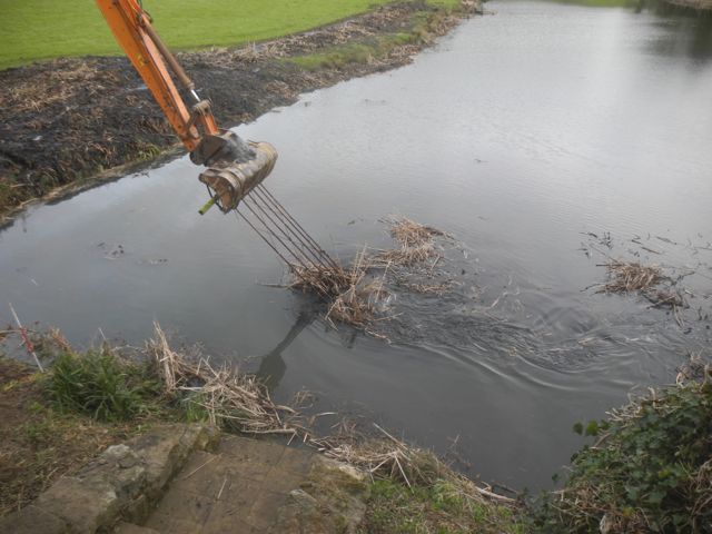
The last resort: a farm gate... gets a little traction.
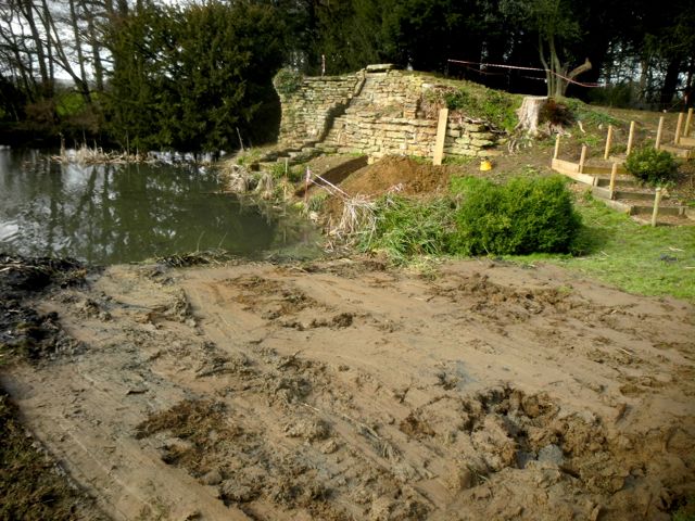
After it's all over... still a few reeds remain.
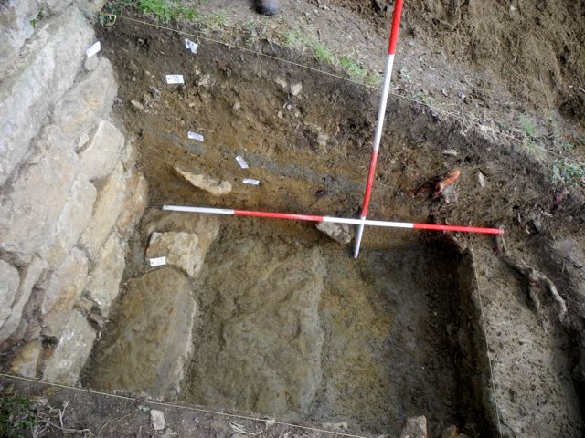
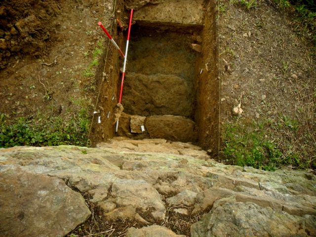
Back in trench A, a further foundation slab viewed from the west and from above.
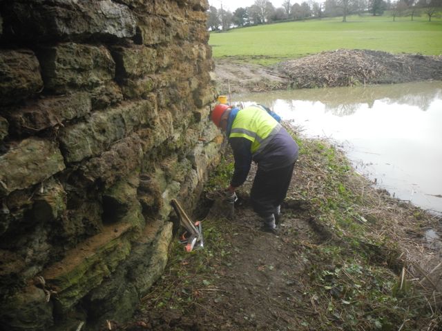
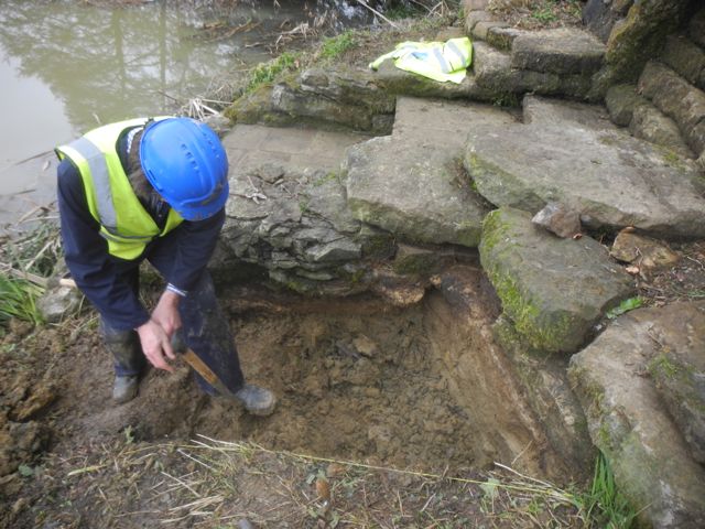
New trenches sanctioned Peter starts work on E and I get stuck in to F.
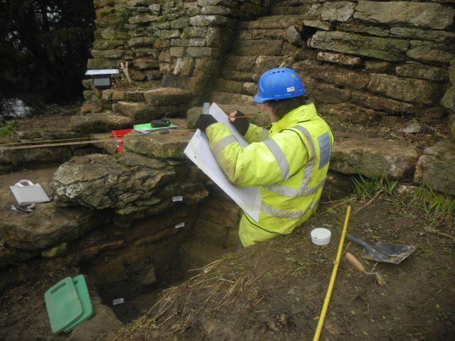
... and once it's all dug then it has to be drawn.
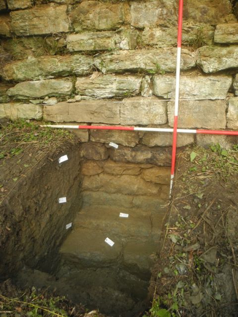
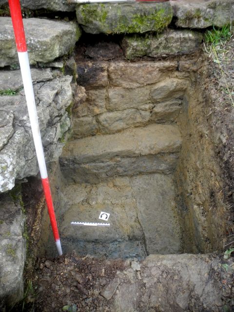
Trench E, foundations looking north east. Trench F, foundations looking north.
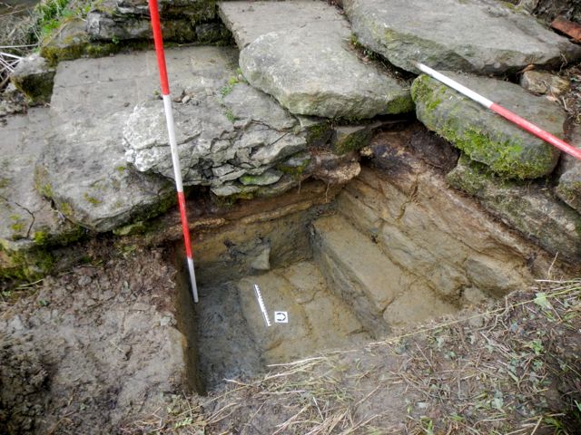
Trench F, the sequence of the original wall, clay bank and subsequent extension shows clearly here, view looking north west.
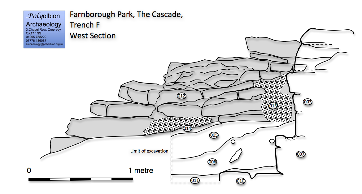
... and even more clearly in the section drawing.
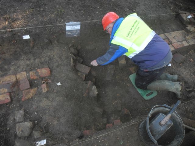
Back in Trench C Peter excavates the line of the pipe work supplying the cascade


The big beast arrives, impressive reach! And starts removing the bull rushes.


Hmmm.... looking a little unstable. The aftermath and the slippery slope


Large amounts of sludge with Peter boldly going plus detector.
Meanwhile we continued to explore
the curious stretch of estate wall which seems to have been broken
through, pre-1772, to provide access to the Dairy Ground. As noted last
month an extraordinarily complex structure with two potential gate
piers which simply don't match. They both have a couple of chamfered
courses of brickwork but the one to the east is wedge shaped !?*?!*!

Trench C on the estate wall with the east pier and a curious deposit of mortar plus aggregate.
There was a lot of recording to do:
context sheets to fill in and a plan to draw. Once that had been done
some of the more recent material was removed in order to chase the wall
through but also identify the cut or cuts used to insert and then
replace the pipe up to the cascade. A little group of stone
blocks reminded me of the timeless archaeological words of wisdom: one
stone's a stone, two stones are an alignment and three stones are a
wall. There is something interesting happening as they clearly mark a
big change in soil colour and texture.


Drawing underway then coming close to identifying the cut for the pipe and what are those three stones doing?
Meanwhile out on the lake there
were still some reeds that remained out of reach of the big digger and
so, with varying degrees of inventiveness, other measures were tried.
The first of these was an attempt to get a weighted chain
around the back of what we thought was a semi-floating mass so it could
then be pulled in towards the digger and removed. This failed because
it proved impossible to force the punt around the back of the reeds on
account of fallen branches and shallow water. Next a weighted iron
fence panel was dropped on top of the reeds and dragged across the top
but this did little more than comb them out. Some clearing was done by
hand as a team of volunteers pulled them up and finally a large iron
farm gate was lashed onto the digger's bucket in a final attempt to
pull the reeds in towards the shore. This met with some success but a
sizable lump remained defiant even after the digger had covered its
tracks and slunk away.


Richard and Ian getting ready to fasten the iron fence panel via some ropes onto the digger then a small but hardy group do some sub-aqua weeding.


The last resort: a farm gate... gets a little traction.

After it's all over... still a few reeds remain.
Whilst all this had been going on
we wisely stayed out of the trench at the foot of the cascade, after
all if the digger had toppled in it would have made a heck of a splash.
However, once peace returned I took a look at the mix of ironstone
fragments with clay which we thought underlaid the foundation
course of the cascade terrace walling and represented the natural. In
fact this represented a small build up on top of a much larger
foundation slab projecting out a further 60 cm. It's beginning to look
increasingly as if water did originally lap up against the base of this
wall.


Back in trench A, a further foundation slab viewed from the west and from above.
On March 7th. we held a site
meeting to examine the results to date and in view of the depth of the
wall exposed and the nature of the foundations it was decided to to
explore the foundations of the west wing of the cascade (Trench
E) and, as it was looking increasingly likely that the cascade
had been modified at least once a further trench (Trench F) was put in to explore the relationship between the extension and the main body of the cascade.
We were able to show in fairly short order that the west wing did
indeed have similarly massive foundations although they did not
protrude as far as those on the east wing. Furthermore it became very
clear that the additional shallow steps to the cascade were a later
addition built on top of the clay bank that had been piled up against
thy face of the original wall which rose directly from the lake side.
This is quite an important discovery and yet again it illustrates the
difficulty of assuming that what one sees is what was originally built.


New trenches sanctioned Peter starts work on E and I get stuck in to F.

... and once it's all dug then it has to be drawn.


Trench E, foundations looking north east. Trench F, foundations looking north.

Trench F, the sequence of the original wall, clay bank and subsequent extension shows clearly here, view looking north west.

... and even more clearly in the section drawing.
What all this now throws up is the
question as to how the cascade should ultimately be restored. Does it
go back to its original 1740s configuration or are the later additions
( I would guess early nineteenth century ) to be preserved. The
business of the restoration of gardens and their features is full of
pitfalls, I'm glad it's not our decision. Whilst the debate went on we
did a little more work on the estate wall but then decided to pull back
until work began on the monitoring once the contractors were on site.

Back in Trench C Peter excavates the line of the pipe work supplying the cascade