WEEK ONE
Monday July 5th.
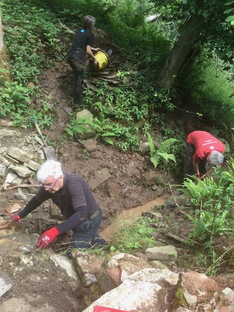
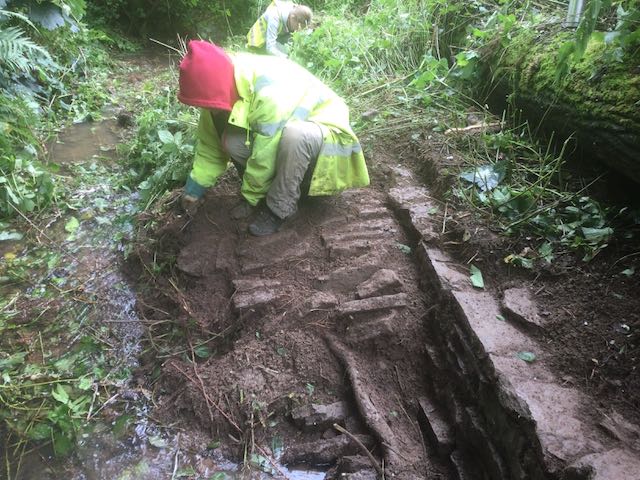
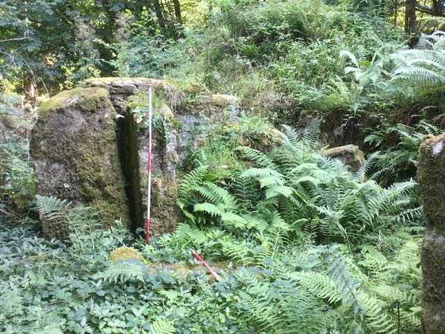
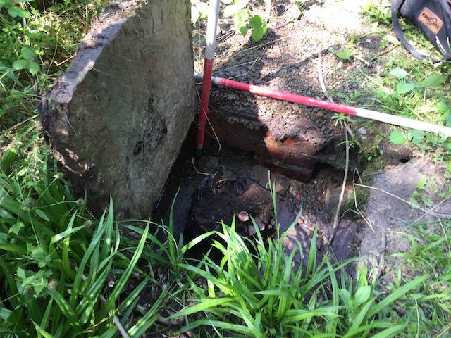
Of course it's essential that everyone is fully briefed at the outset of any operation but then as is often said, 'the best battle plans rarely survive the first contact with the enemy'. In our case my downfall came when we took on the conduit house and its in-coming flow of water. There was a cunning plan. I had obtained a considerable length of large diameter plastic piping to divert the spring over and out of the tank that could then be emptied by bucket but once we had started to lower water levels it became clear that we also had water leaking in from amongst the stonework on the uphill side. Plan B swung into action, thanks to the herculean efforts of John, Ian and Janine to lower the out-flow channel but a few measurements revealed we would eventually have had to delve very deeply so onto plan C, 'let's get hold of a length of hose-pipe and siphon it out', thanks Jason for the assistance. Again valiant efforts by all concerned but to no avail so finally... we gave up, and I resolved to bring a pump along for the following week at which point it was down to dam 4 to do some restorative drawing.
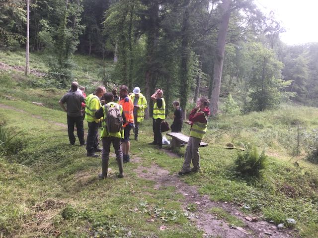
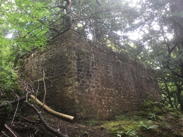
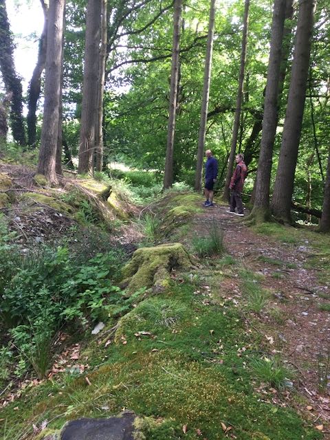
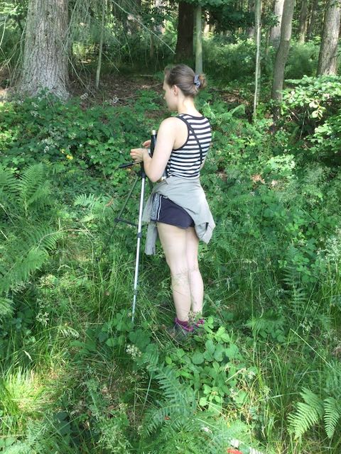
The start of the programme and the
team stand deep in thought at dam
3
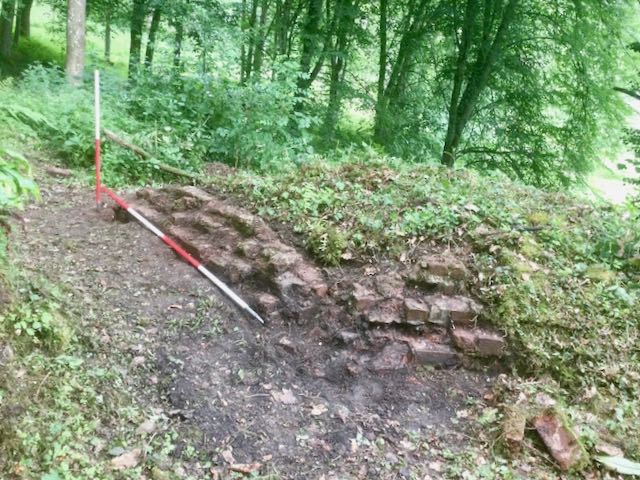
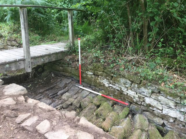
Channel
deepening underway at the conduit
house
... and knee deep in water pondering if we can possibly do under
water archaeology

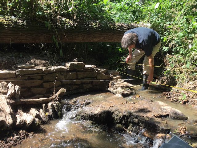
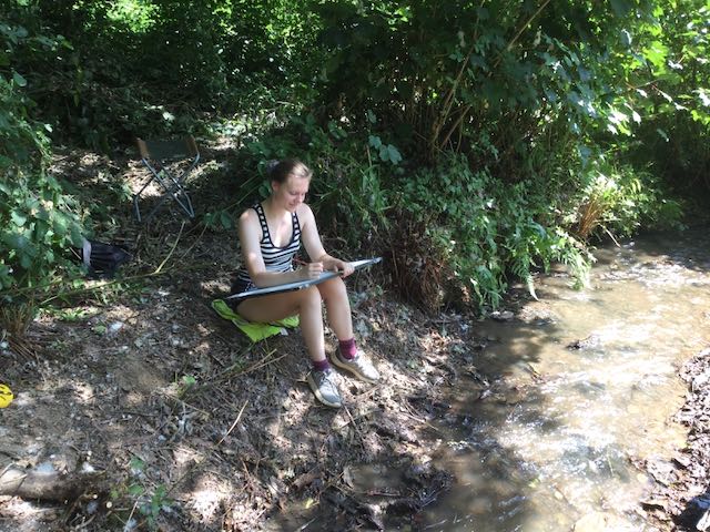
So back at dam 4 and the drawing and photography gets done.
Tuesday
July 6th.
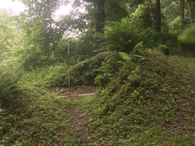
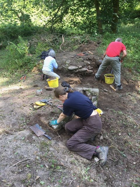
As well as the regular watching brief and completing outstanding tasks such as the excavation of the conduit house it was also agreed that we would try and extend our understanding of how the valley functioned overall and as part of that we would start to work our way through the Trust's HER index, first compiled in 2001/2, checking locations and descriptive details. Whilst our local volunteers David and Julie got to grips with some dangerously sharp looking implements and cleared a couple of sites next to dam 1 and the ice-house we examined a few sites at the lower end of the valley re-plotting their positions on the map with a natty new GPS receiver, the Geode. Once the undergrowth had been cleared we were keen to get to grips with one new site, some stonework seen close to the northern side of pond, and one old and well known one, the ice-house. The pond side site, IP22 as we know it, expanded rapidly as we started some in-depth archaeological weeding. pretty soon it was clear that we had, unusually, an incoming spillway flanked by a wall and lined with a pitched stone base, at this stage a unique feature within the valley. The big puzzle up at the ice-house was the entry in the HER that seemed to explore the option for it being a lime kiln.
As well as the regular watching brief and completing outstanding tasks such as the excavation of the conduit house it was also agreed that we would try and extend our understanding of how the valley functioned overall and as part of that we would start to work our way through the Trust's HER index, first compiled in 2001/2, checking locations and descriptive details. Whilst our local volunteers David and Julie got to grips with some dangerously sharp looking implements and cleared a couple of sites next to dam 1 and the ice-house we examined a few sites at the lower end of the valley re-plotting their positions on the map with a natty new GPS receiver, the Geode. Once the undergrowth had been cleared we were keen to get to grips with one new site, some stonework seen close to the northern side of pond, and one old and well known one, the ice-house. The pond side site, IP22 as we know it, expanded rapidly as we started some in-depth archaeological weeding. pretty soon it was clear that we had, unusually, an incoming spillway flanked by a wall and lined with a pitched stone base, at this stage a unique feature within the valley. The big puzzle up at the ice-house was the entry in the HER that seemed to explore the option for it being a lime kiln.
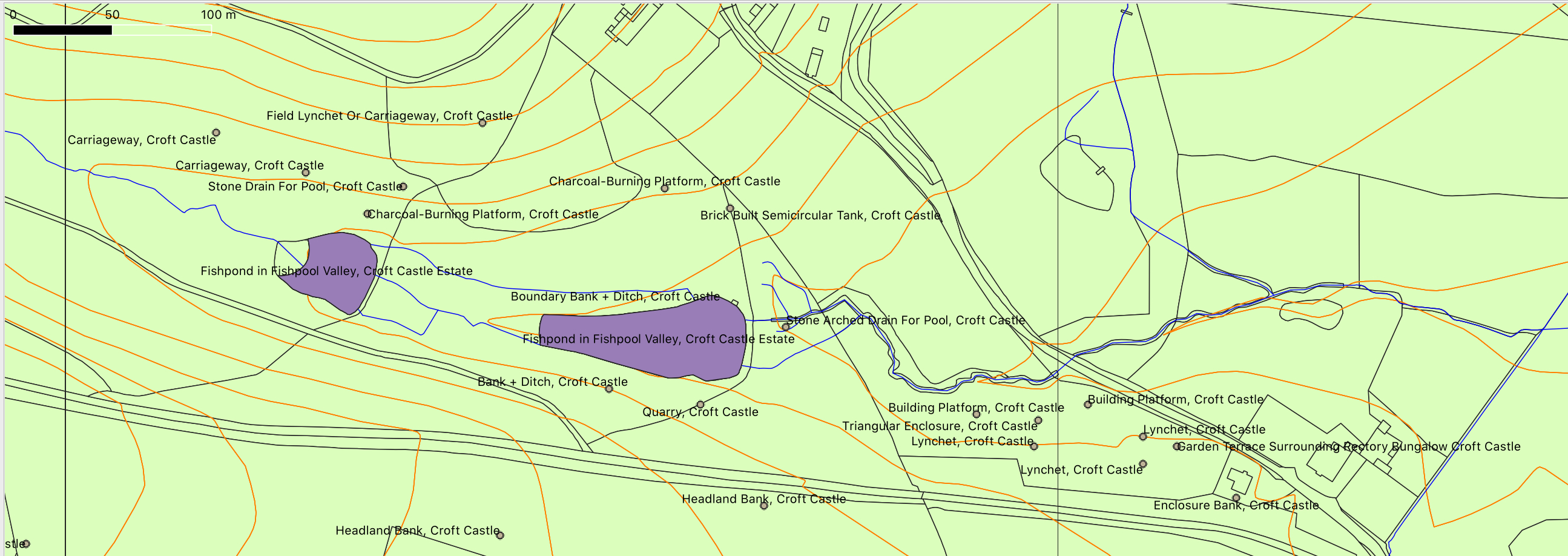
Here is an extract from the mapping project I have underway using a programme called QGIS to pull together the Trust's data with topographical information showing some of the sites that we started ticking off
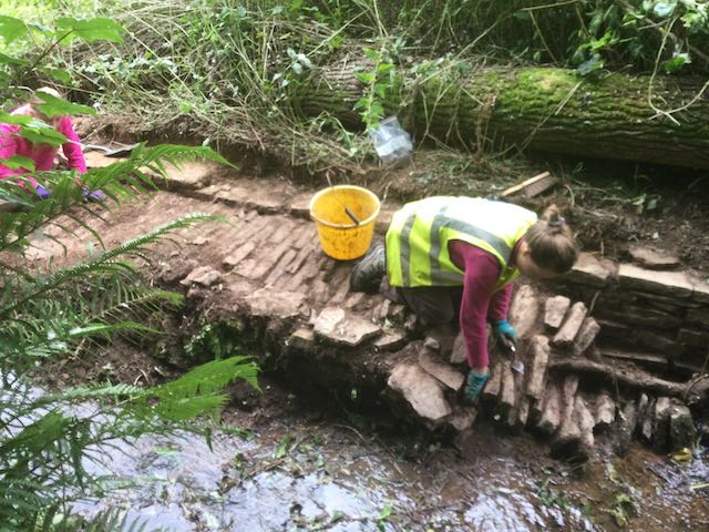
Strimmed and cleared, our first sight of the ice-house. Sarah and Katherine begin to dig the newly uncovered IP22. Back at Dam 4 I monitor the removal of the recent brickwork.
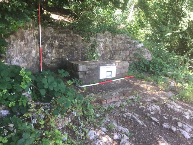
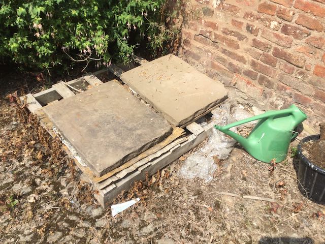
Also at dam 1, a quick job to record the small pump house, perhaps the easiest plan we've ever had to produce.
Wednesday July 7th.
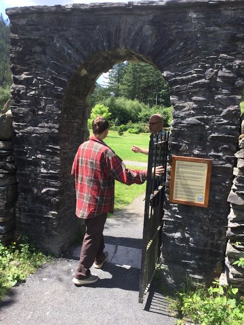
An important point we had established was that as part of the final season, and in preparation for the big write up, we should take time out to visit a number of other key sites in the locality to establish some sort of context for the works in Fishpool Valley and their 'picturesque' credentials. Our first key site then for a field trip was the formerly celebrated walks above the River Wye at Piercefield just north of Chepstow. Engineered in the 1750s by one Valentine Morris as an adjunct to his house and garden the network of paths and related attractions soon became something of a tourist sensation. Sadly for the modern visitor, despite efforts at restoration in 2010 the paths are quite treacherous in places, the monuments overgrown and the growth of trees such that the much vaunted views are few and far between. By the way, don't make the mistake we did of trying to complete the last section of the walk by cutting back along the main road, no footway makes the walk potentially lethal, much worse than falling off a cliff.
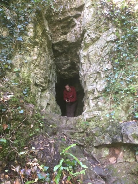
The first disappointment, struggling through the undergrowth attempting to access the ruins of the cold bath, the Giant's Cave was a touch easier to get at and led to the first VIEW.
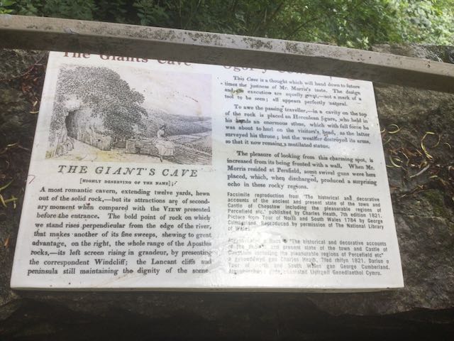
The walling and railing were well maintained here and there was even an information panel.
Sarah emerges unscathed from a brief exploration of an un-named little cave next to the path.
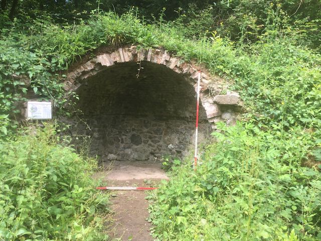
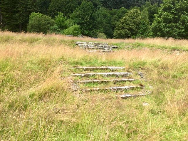
The next two monuments: the fragmentary Druid's Temple, just three stones left, and the obligatory grotto, much of the lining and facade gone.
... and two VIEW points, the first massively constructed but only trees to be seen, and the second known as the Alcove, a great stop for lunch.
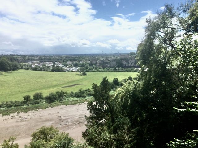
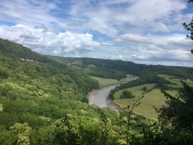
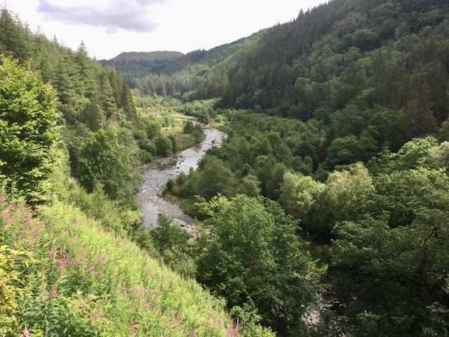
So two final VIEWS, from the Alcove across to Chepstow, with its castle and the Severn bridge beyond and from the Lovers Leap looking up the Wye valley.
Thursday
July 8th.
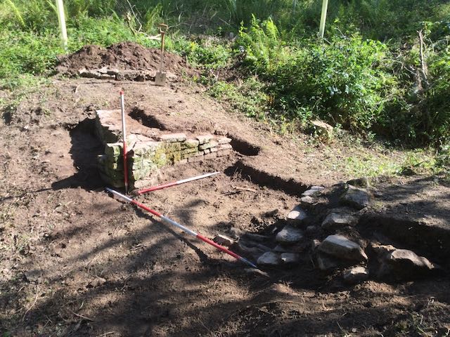
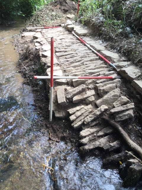
Whilst we were walking the walk at Piercefield Ian, Daren and Clive had done some clearing of the undergrowth obscuring the spillway an dam 3, for which huge thanks, so we could then crack on with recording the structure in plan, elevation and with photographs,Meanwhile Julie and Malcolm took up their trowels and continued to clear the spillway entering pond 1. We were also able to excavate a section of exterior and interior walling on the icehouse together with the brickwork along the north side of the entrance. The HER was rather equivocal about the ice-house bringing up the suggestion that as it lay next to a small quarry and there was evidence of burnt material from the interior the possibility existed that it could have been a lime kiln. Careful consideration of the structural details made this, to my mind, very unlikely and the presence of early twentieth century pottery amongst the in-fill of ash and cinders indicated material probably brought down from the castle for dumping.
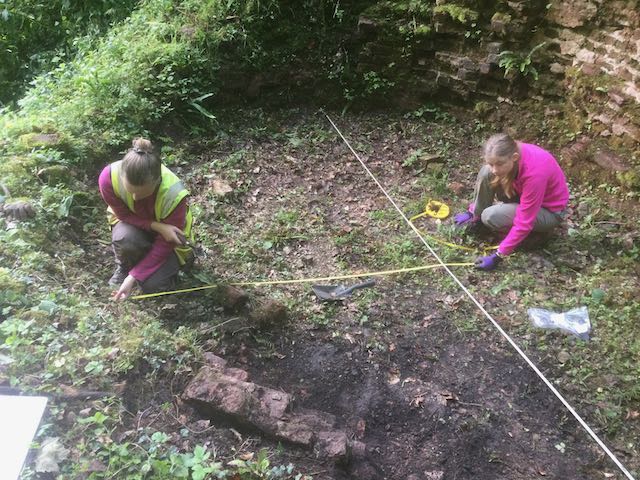
The inner brick lining to the ice house and Sarah and Katherine demonstrating the fine art of tape-swinging as we produce a measured plan
More drawing underway, this time an elevation at dam 3.
Julie and Malc have disappeared off for a well earned lunch break so I could photograph the great progress they had made.
One of the record shots on dam 3, photographs to keep for publication, were completed, the final clean underway on pond 1 and a taste of things to come next week on dam 3a, exciting stuff.
Whilst we were walking the walk at Piercefield Ian, Daren and Clive had done some clearing of the undergrowth obscuring the spillway an dam 3, for which huge thanks, so we could then crack on with recording the structure in plan, elevation and with photographs,Meanwhile Julie and Malcolm took up their trowels and continued to clear the spillway entering pond 1. We were also able to excavate a section of exterior and interior walling on the icehouse together with the brickwork along the north side of the entrance. The HER was rather equivocal about the ice-house bringing up the suggestion that as it lay next to a small quarry and there was evidence of burnt material from the interior the possibility existed that it could have been a lime kiln. Careful consideration of the structural details made this, to my mind, very unlikely and the presence of early twentieth century pottery amongst the in-fill of ash and cinders indicated material probably brought down from the castle for dumping.
The inner brick lining to the ice house and Sarah and Katherine demonstrating the fine art of tape-swinging as we produce a measured plan
More drawing underway, this time an elevation at dam 3.
Julie and Malc have disappeared off for a well earned lunch break so I could photograph the great progress they had made.
Friday
July 9th.
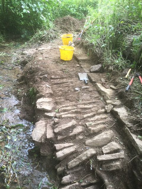
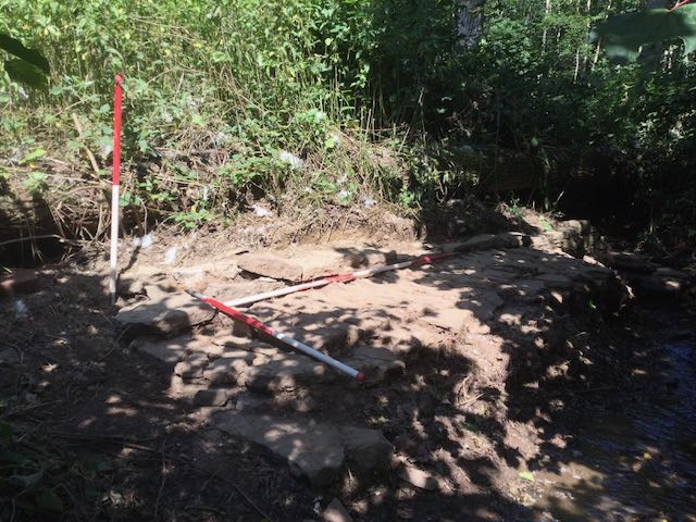
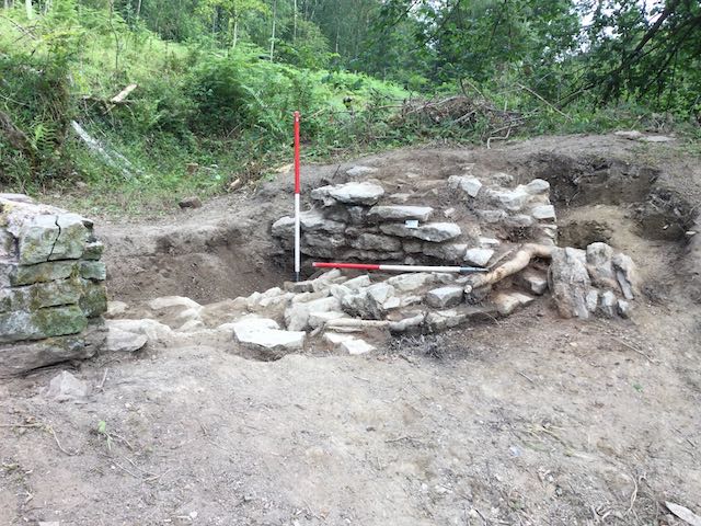
The morning saw us completing the plan down on dam 3 together with an extensive series of photographs, a measured profile of the ice-house and the final cleaning of the pond 1 spillway ready for recording the following week. Jason and Tom also introduced us to another new feature they had come across during their work in the valley, a stone built sluice on a by-pass channel on a small breached dam between dams 3 and 4, dam 3a perhaps?
The morning saw us completing the plan down on dam 3 together with an extensive series of photographs, a measured profile of the ice-house and the final cleaning of the pond 1 spillway ready for recording the following week. Jason and Tom also introduced us to another new feature they had come across during their work in the valley, a stone built sluice on a by-pass channel on a small breached dam between dams 3 and 4, dam 3a perhaps?
One of the record shots on dam 3, photographs to keep for publication, were completed, the final clean underway on pond 1 and a taste of things to come next week on dam 3a, exciting stuff.
WEEK
TWO
Monday July 12th.
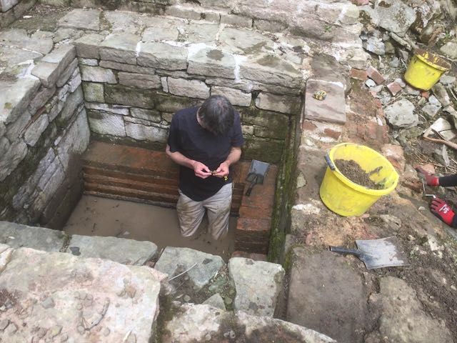
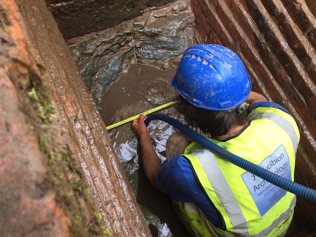
Back in action Monday afternoon but this time armed with a small but effective petrol driven one inch water pump we worked on a methodology for emptying then excavating the final depths of the conduit house. With only room for one person to dig at a time we worked on a system to remove the spoil in buckets then check it over for finds both visually and with a metal detector.
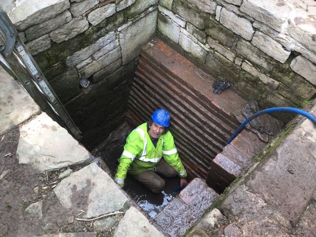
Sarah supervises the pumping before I climb down into the depths and start digging.
Katherine masterminds the search for artifacts
Monday July 12th.
Back in action Monday afternoon but this time armed with a small but effective petrol driven one inch water pump we worked on a methodology for emptying then excavating the final depths of the conduit house. With only room for one person to dig at a time we worked on a system to remove the spoil in buckets then check it over for finds both visually and with a metal detector.
Sarah supervises the pumping before I climb down into the depths and start digging.
Katherine masterminds the search for artifacts
Tuesday
July 13th.
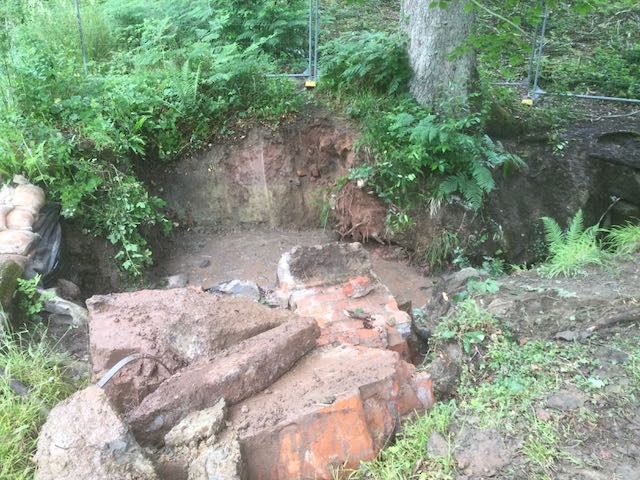
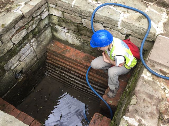
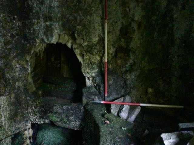
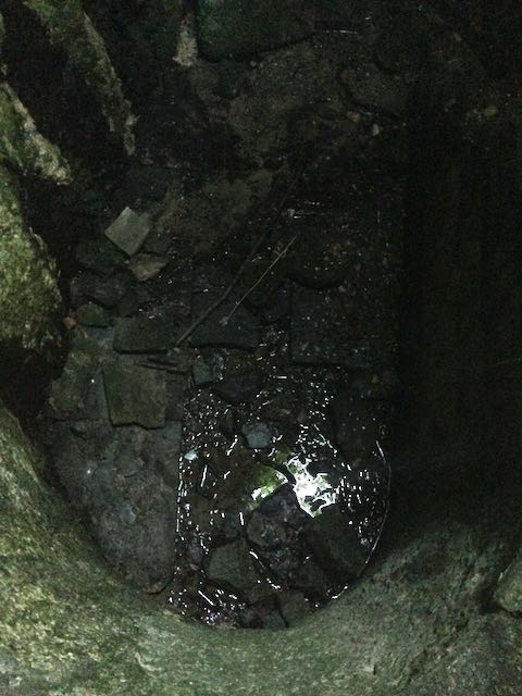
With more volunteers to hand Tuesday was all about the final push to complete the excavation of the conduit house tank and this is what we did. It was pretty hard going despite the efforts of a dedicated team of bucket shifters and around 11.00 there was a real low point when it felt as if the fallen mass of stone roof tiles would never get lifted but then a bit of a break through and suddenly we were below that layer and into a fine silty clay that was evidently the lowest level of silting within the tank. By mid-afternoon we could feel the the stone slabbed bottom and saw for the first time that the tank was being filled from a spring that was vigorously bubbling up from a fissure in the natural rock that the conduit house was founded on.
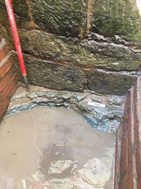
The first sight of the spring bubbling up with the 'living' rock beyond.
Wednesday July 14th.
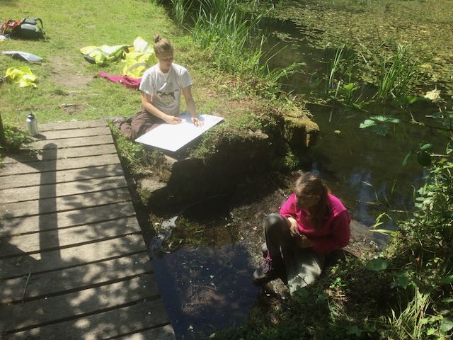
Our second field trip saw us driving westwards for a couple of hours to the magnificent park at Hafod where we were greeted by Dave the site manager and treated to a fantastic tour of the chief features of a landscape, partially engineered by Thomas Johnes, that practically defines the picturesque. Lots to think and write about here but to be going on with here are some photographs of the key locations. Massive thanks to Dave and Simon for their help and hospitality. Thanks also the the team of volunteers back at Croft who spent the day doing a preliminary clear of the ground over the newly discovered spillway on dam 3a.
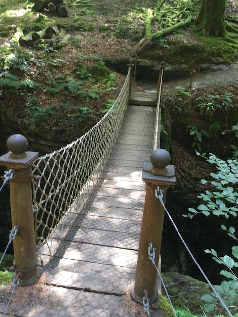
The Peiran Falls. Sarah and Dave contemplate a leat on the hillside above. The famous and distinctly bouncy Chain Bridge.
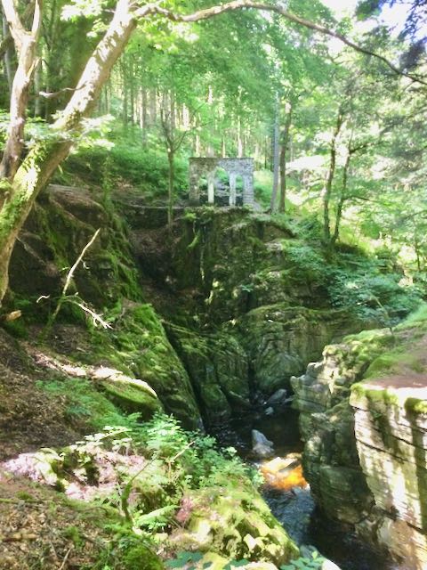
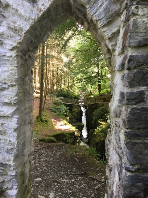
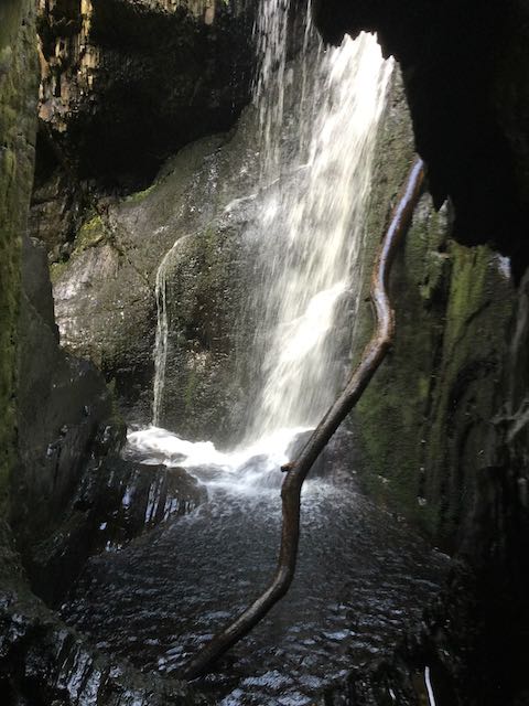
The Gothic Arches with the view back towards the Chain Bridge and the also famous and quite stupendous Cavern Cascade

The attractive little Dologau Bridge and Dave ushers Sarah into Mrs. Johnes' Flower Garden
Remains of the terraced formal gardens next to the site of the house and a final view looking eastwards along the Afon Ystryth
With more volunteers to hand Tuesday was all about the final push to complete the excavation of the conduit house tank and this is what we did. It was pretty hard going despite the efforts of a dedicated team of bucket shifters and around 11.00 there was a real low point when it felt as if the fallen mass of stone roof tiles would never get lifted but then a bit of a break through and suddenly we were below that layer and into a fine silty clay that was evidently the lowest level of silting within the tank. By mid-afternoon we could feel the the stone slabbed bottom and saw for the first time that the tank was being filled from a spring that was vigorously bubbling up from a fissure in the natural rock that the conduit house was founded on.
The first sight of the spring bubbling up with the 'living' rock beyond.
Wednesday July 14th.
Our second field trip saw us driving westwards for a couple of hours to the magnificent park at Hafod where we were greeted by Dave the site manager and treated to a fantastic tour of the chief features of a landscape, partially engineered by Thomas Johnes, that practically defines the picturesque. Lots to think and write about here but to be going on with here are some photographs of the key locations. Massive thanks to Dave and Simon for their help and hospitality. Thanks also the the team of volunteers back at Croft who spent the day doing a preliminary clear of the ground over the newly discovered spillway on dam 3a.
The Peiran Falls. Sarah and Dave contemplate a leat on the hillside above. The famous and distinctly bouncy Chain Bridge.
The Gothic Arches with the view back towards the Chain Bridge and the also famous and quite stupendous Cavern Cascade
The attractive little Dologau Bridge and Dave ushers Sarah into Mrs. Johnes' Flower Garden
Remains of the terraced formal gardens next to the site of the house and a final view looking eastwards along the Afon Ystryth
Thursday
July 15th.
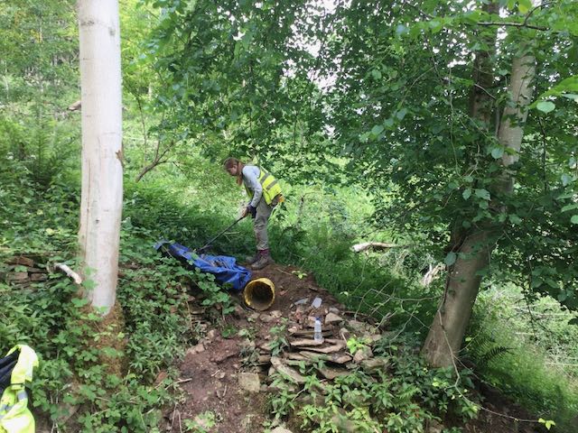
First thing Thursday morning it was back to the conduit house for a final clear up and recording session, photographs then drawing including an attempt to plan the base slabs by touch alone. Then it was down to dam 3a where Fran and Malc were getting going on further clearance of the stonework. Sarah and I plunged into the woods on the north side of the valley with Geode in hand to try and confirm and plot the location of some more sites for the HER record but apart from charting trackways we completely failed to find such sites as a pillow mound, charcoal burning platform, quarry and saw pit! I blame the undergrowth. So after lunch it was back to dam 3a to lend a hand on the digging for a couple of hours before mounting a further equally fruitless expedition up the valley to try and spot more features.
First thing Thursday morning it was back to the conduit house for a final clear up and recording session, photographs then drawing including an attempt to plan the base slabs by touch alone. Then it was down to dam 3a where Fran and Malc were getting going on further clearance of the stonework. Sarah and I plunged into the woods on the north side of the valley with Geode in hand to try and confirm and plot the location of some more sites for the HER record but apart from charting trackways we completely failed to find such sites as a pillow mound, charcoal burning platform, quarry and saw pit! I blame the undergrowth. So after lunch it was back to dam 3a to lend a hand on the digging for a couple of hours before mounting a further equally fruitless expedition up the valley to try and spot more features.

Pump and ruler in hand to draw the bottom of the tank. How we left it all after bidding a fond farewell.

A more hi-tech approach, Sarah sets up the geode to record a carriageway
Everyone is busy now excavating the spillway a on dam 3a
Friday
July 16th.
A little more tidying up on the dam 3a spillway and an intense burst of drawing down on the in-coming spillway on pond 1 brought the working week to an end.
A little more tidying up on the dam 3a spillway and an intense burst of drawing down on the in-coming spillway on pond 1 brought the working week to an end.
Spillways sitting in the sun at the end of the day on Friday.
WEEK
THREE
Monday July 19th.
The final week was characterized by blistering heat and the arrival in the valley of Meadow Arts and their collection of art installations under the title of 'All Alone', of which more later. After lunching we joined the crayfish crew who were just completing their rescue mission on dam 3 in time to observe and record the cut through the dam to insert the temporary drainage pipe the lower the water level. After that it was down to pond 1 to complete the recording on the newly uncovered in-coming spillway, drawing and photography as always.
Nick, in full PPE considers the depth of the trench on dam 3
After setting up our complex network of strings and tapes it's time to measure and draw...
... before the final set of photos get taken after a lengthy wait for a passing cloud to even out the lighting.
Tuesday
July 20th.
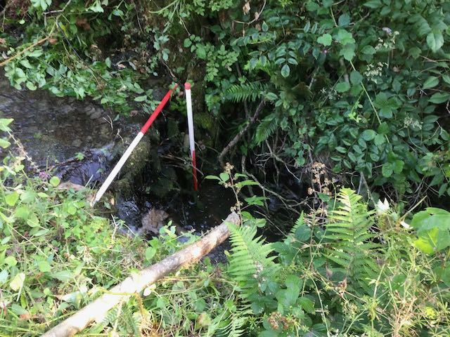
The heat really started to make itself felt as we were joined by local volunteers Ian and Darin together with our inestimable partners from the Trust Janine and Viviana on the excavations of the spillway over dam 3a. Having such a wealth of talent on board meant that Sarah and I could catch up with some identify and locating using GPS key sites in the valley as well as coming across the first evidence of the artistic invasion that was underway.
The heat really started to make itself felt as we were joined by local volunteers Ian and Darin together with our inestimable partners from the Trust Janine and Viviana on the excavations of the spillway over dam 3a. Having such a wealth of talent on board meant that Sarah and I could catch up with some identify and locating using GPS key sites in the valley as well as coming across the first evidence of the artistic invasion that was underway.

Setting up the Geode, this time on the viewing platform, whilst the digging goes on and I rest for a moment on.... a piece of art!
Wednesday
July 21st.
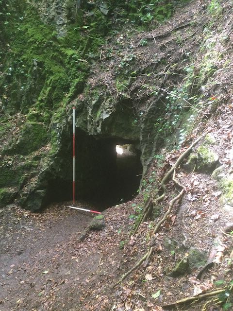
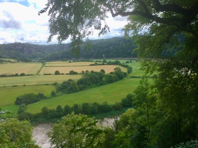
Our third and final field trip began, disappointingly with a walk up the beautifully named 'Sunny Dingle' in an attempt to identify and examine a series of ponds and other features in the valley associated with Moor Park, formerly the property of the Salwey family. There were things to be seen but some of the ponds had been drained and a number of key features were overgrown or inaccessible behind high deer fencing. After a break for lunch in Ludlow it was on to Downton Gorge where we had negotiated special permission from Natural England to access this SSSI, normally closed to the public. Our parking permit entitled us to a space on a lay-by overlooking Forge Bridge then there was a walk of around 1.5km up the valley below the gothic pile of Downton Castle built by that famed master of the picturesque Richard Payne Knight in the 1770s. The valley itself was a curious mixture of the romantic and the industrial and disentangling the various features in the landscape was not always easy. We followed the path along the north side of the gorge for around 1km, the highlight being, undoubtedly, the remarkable cold bath and associated structures, before retracing our steps to cross Castle Bridge and visit the cave on the south side. A memorable excursion by any standard. Special thanks to Ian and David who back at Croft examined the gully below dam 3 and investigated a brick structure on the south side of the valley in the blistering heat.
Our third and final field trip began, disappointingly with a walk up the beautifully named 'Sunny Dingle' in an attempt to identify and examine a series of ponds and other features in the valley associated with Moor Park, formerly the property of the Salwey family. There were things to be seen but some of the ponds had been drained and a number of key features were overgrown or inaccessible behind high deer fencing. After a break for lunch in Ludlow it was on to Downton Gorge where we had negotiated special permission from Natural England to access this SSSI, normally closed to the public. Our parking permit entitled us to a space on a lay-by overlooking Forge Bridge then there was a walk of around 1.5km up the valley below the gothic pile of Downton Castle built by that famed master of the picturesque Richard Payne Knight in the 1770s. The valley itself was a curious mixture of the romantic and the industrial and disentangling the various features in the landscape was not always easy. We followed the path along the north side of the gorge for around 1km, the highlight being, undoubtedly, the remarkable cold bath and associated structures, before retracing our steps to cross Castle Bridge and visit the cave on the south side. A memorable excursion by any standard. Special thanks to Ian and David who back at Croft examined the gully below dam 3 and investigated a brick structure on the south side of the valley in the blistering heat.
A glimpse of an unattainable cascade half way up Sunny Dingle
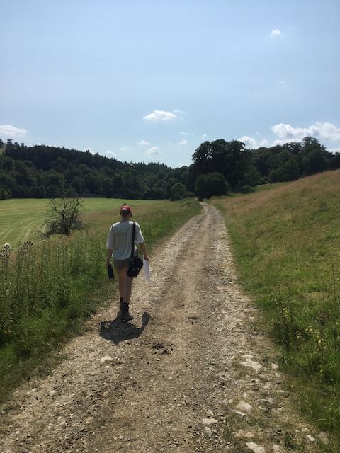
Sarah strides out leading the way past...

... Downton Castle.
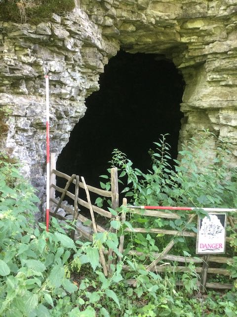
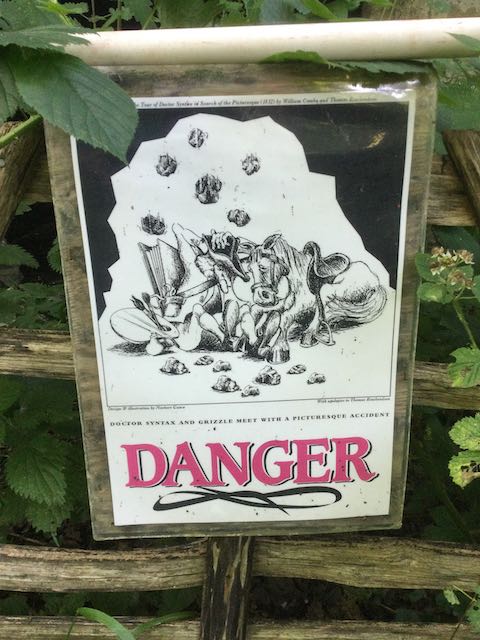
The first feature we viewed, a hermit's cave, and an unusually humorous take on the 'keep out, danger' notice.
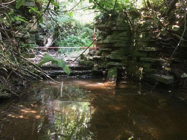
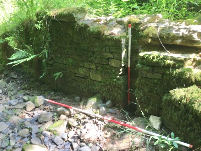
Further along a curious little weir and later still a stone pier, one of a pair with a vertical groove: sluice gate or portcullis?

Essential supplies for exploring a picturesque landscape: a map, a water bottle and Turkish Delight... of course.
The first sight of the cold bath and the niche and basin in the central chamber
Looking down into the depths of the cold bath and the alternate entrance.
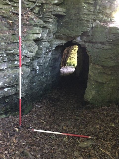
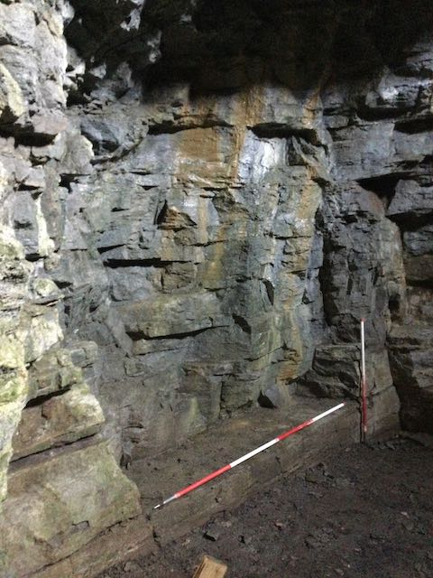
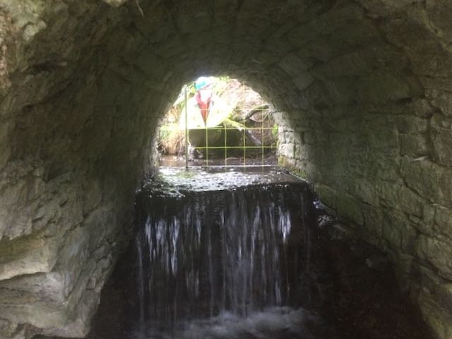
On the other side of the River Teme: a tunnel and a dramatically lit cave.
Thursday
July 22nd.
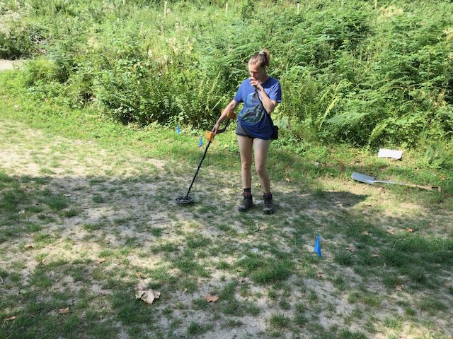
The penultimate day had been set aside to examine evidence for the routes of potential pipelines in the valley using a metal detector but after a fruitless and frustrating morning we gave up on the attempt and returned to the dig on dam 3a where we relieved Ian and David so they could climb the valley side to further examine their brick structure. Once the digging was done the race was on to complete the drawing and photography.
The penultimate day had been set aside to examine evidence for the routes of potential pipelines in the valley using a metal detector but after a fruitless and frustrating morning we gave up on the attempt and returned to the dig on dam 3a where we relieved Ian and David so they could climb the valley side to further examine their brick structure. Once the digging was done the race was on to complete the drawing and photography.
A quick check on a possible mini-cascade below dam 3... it wasn't one, with Sarah searching for pipes before frustration set in.
A quick check in the gully below the conduit house, still searching for pipe,s and then the final polish to the dig site before it gets its picture taken.
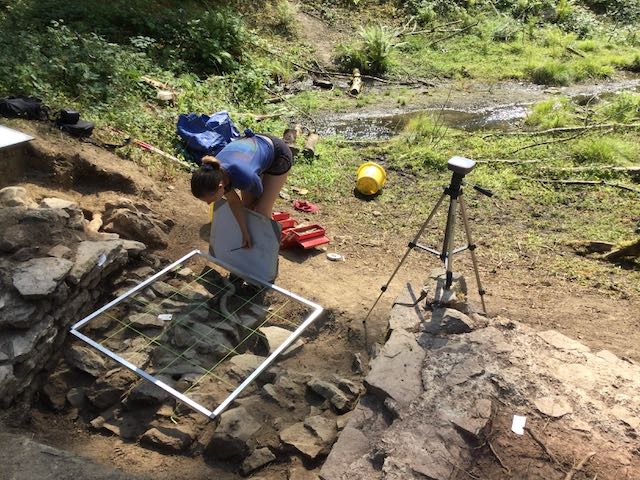
And the last few squares get recorded with the drawing frame, the end is nigh.
Friday
July 23rd.
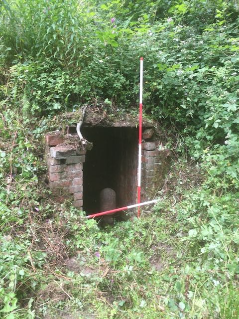
At last, our final day (wipes away a manly tear) involved a lot of last minute checking up of locations, plotting some features and recording a mysterious brick setting that looks like an inspection chamber but for what? We also took time to fully appreciate the art installations within the valley, worth recording as a cultural event and part of the valley's story in its own right.
At last, our final day (wipes away a manly tear) involved a lot of last minute checking up of locations, plotting some features and recording a mysterious brick setting that looks like an inspection chamber but for what? We also took time to fully appreciate the art installations within the valley, worth recording as a cultural event and part of the valley's story in its own right.
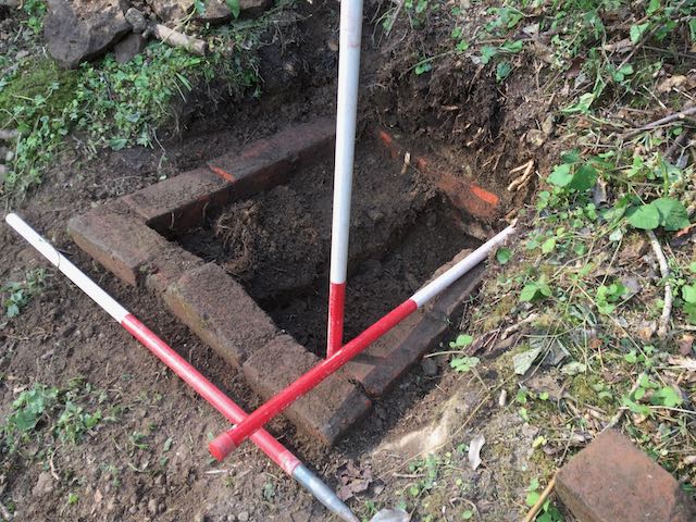
It's oblong, it's brick, it's quite deep, it's a .... ? A quick look at the inscribed slab from the arbour and the replica that has been made of it.
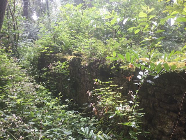
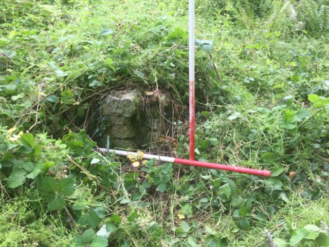
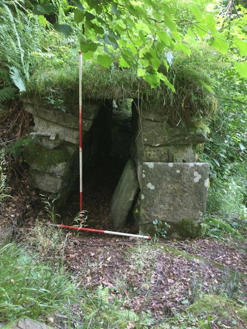
Not easy to see but proof that the conduit house would have been a striking feature half way up the side valley when viewed from the east.
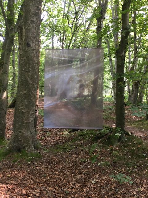
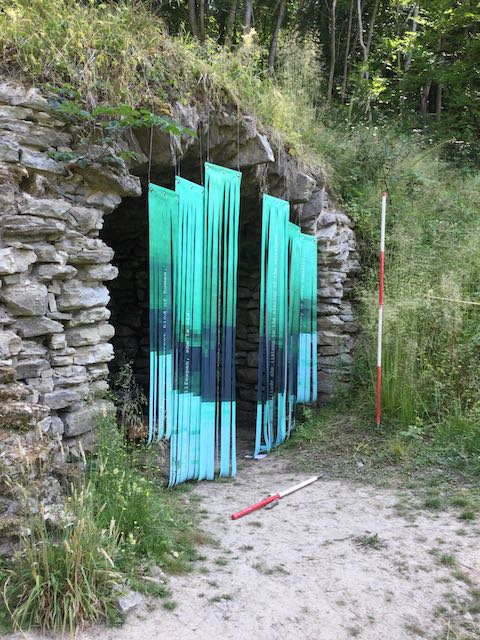
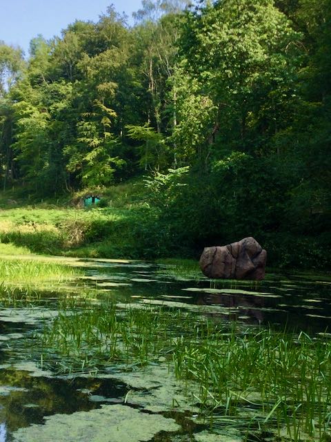
... and finally: Waldenskamheit by Simon Roberts, Un_Being by ...Kruse and The Weight of Things by David Bethell.
and that's it, until the next time.....