Church     The Wormleighton Survey            Church


CONTENTS


Introduction             Day One         Day Two       Day Three       Day Four


Days Five to Ten - Winter 2016        Days Eleven to Sixteen - Spring 2017         In the Office - Summer 2017


The Churchyard Dig September 2018


Ideas for Teachers


 The Graveyard Survey - Results                                              Graveyard plan showing locations of stones


The W.I Scrapbook


Wormleighton

THE PLAN

INTRODUCTION

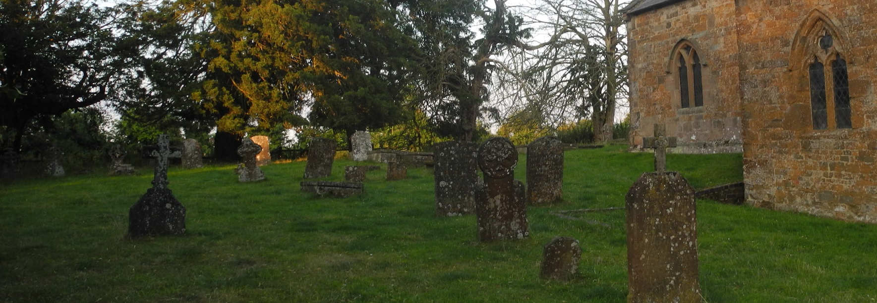
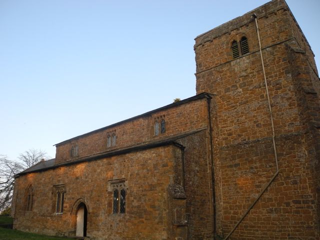
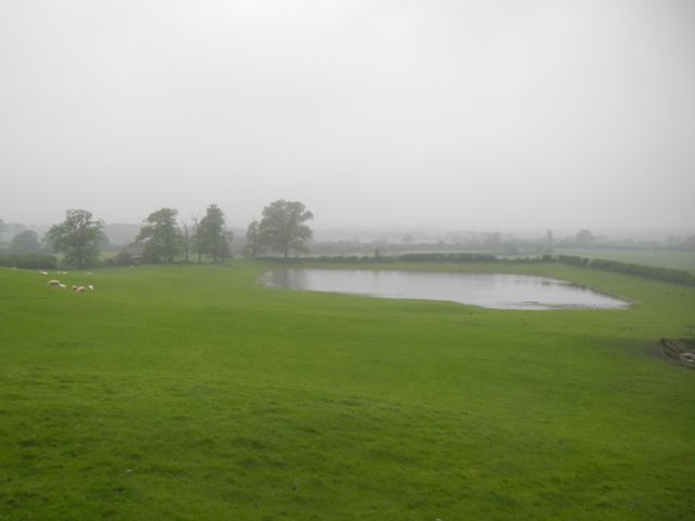
Not only is St. Peter’s Church a remarkable building in its own right it is also part of a landscape which reflects over a thousand years of 
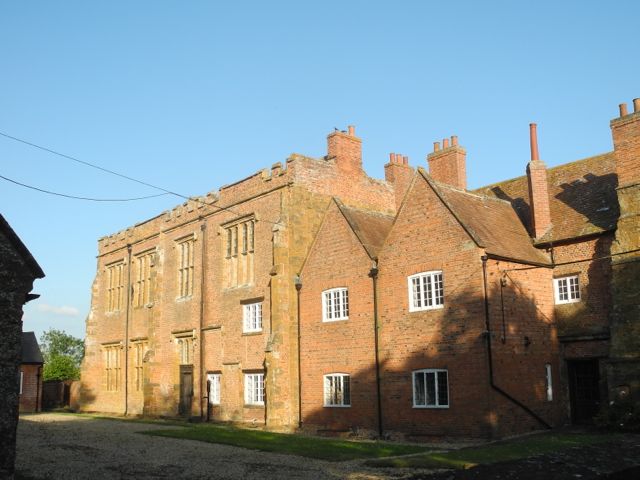
occupation and development. To the south lie the impressive remnants of the great sixteenth-century manor of the Spencer family 
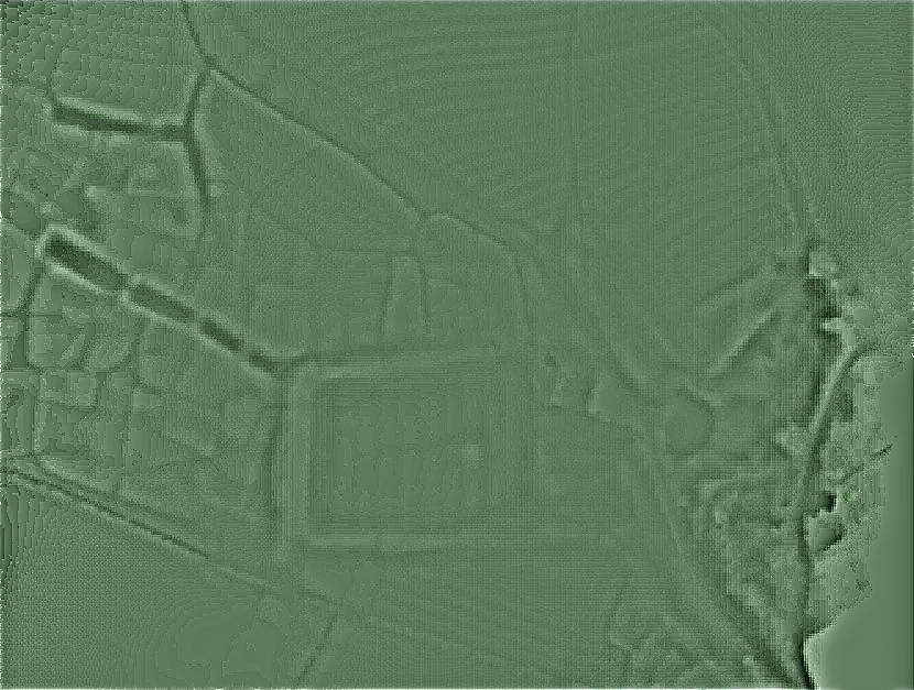
whilst to the north-west are the extensive earthwork remains of the medieval village and later park and garden. The deserted medieval village of Wormleighton is well known to archaeologists yet the whole complex of manor, church and village has never been subject to detailed archaeological investigation. Furthermore the area, tucked away as it is from the main road past the village, remains largely unknown to the wider public, both locals and those who may be attracted to the area by its proximity to Oxford, Stratford-Upon-Avon and Warwick.


Wormleighton Wormleighton
The Church of St. Peter, tower and north aisle, view looking south east.
Surviving block of the Spencer mansion view looking south east.


RESEARCH
In connection with an application for HLF money a proposal was put forward to generate materials to support St. Peter’s Church as a venue to which groups may be brought for educational purposes and which may also be used to inform visits by the general public. As part of developing a wider understanding of the church and its community a graveyard survey was also suggested. In both cases the involvement of  the local community as expressed in the Bridges Group of Parishes and other heritage groups based in Warwickshire, Northamptonshire and Oxfordshire as well as local schools was considered as essential.

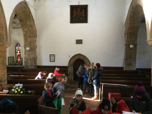
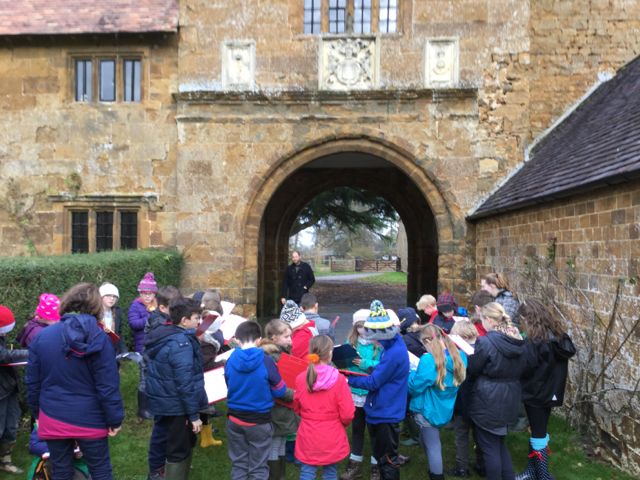
The plan therefore is to research, publish and distribute an education pack mainly targeted at pupils aged 7 to 11 which as well as providing factual information about the church and its surroundings also makes detailed suggestions for a range of practical activities which support all aspects of the curriculum from art through to science. A further outcome of this will be the production of other materials for adult visitors to enhance and expand the existing range of leaflets available in the church. 
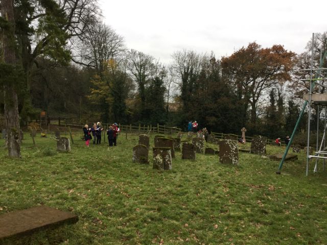
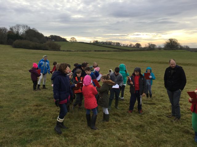
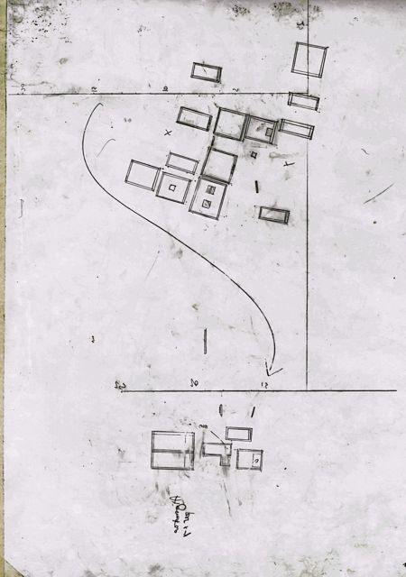
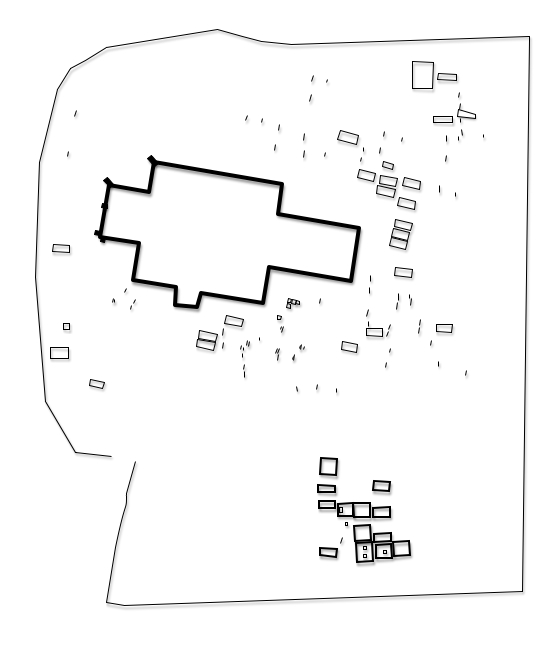
Field work will be undertaken around the village to clarify aspects of its historical development, questions of access and to gather illustrative material.


Wormleighton Wormleighton
LIDAR view of part of the medieval village and later park. The large rectangular pool refilling? View looking north west.


GRAVEYARD SURVEY
It has become widely recognised over the years that the graveyards of our parish churches are valuable repositories of historic information regarding earlier populations. Furthermore because of the inevitable processes of erosion and decay this record, as preserved on gravestone inscriptions and decorations, is a fragile one. This understanding has lead to many local history groups carrying out graveyard surveys to preserve this information, a process which has not been undertaken at Wormleighton. The graveyard at St. Peters contains in the region of 120 historic stones from the seventeenth century onwards. Five of them are listed and an initial visual inspection suggests that the overall condition of the monuments in general is poor. In addition the churchyard has a number of historic trees and some significant earthwork features. The proposal is to carry out a detailed archaeological survey of the graveyard and its immediate environs including the exact position, dimensions and orientation of all surviving stones and other features. This would then be used as a key to identify each stone which would then be recorded on an individual pro forma which would take  in information on dimensions, materials, inscriptions, decorative details and condition. All of this work is carried out by teams of volunteers with professional support. Subsequent to this a limited amount of analysis would be carried out to report on any archaeological or historic findings which may emerge and the materials gathered together to create an archive that would then be deposited with the appropriate authorities.


DAY ONE - TUESDAY JUNE 28th.


Yard
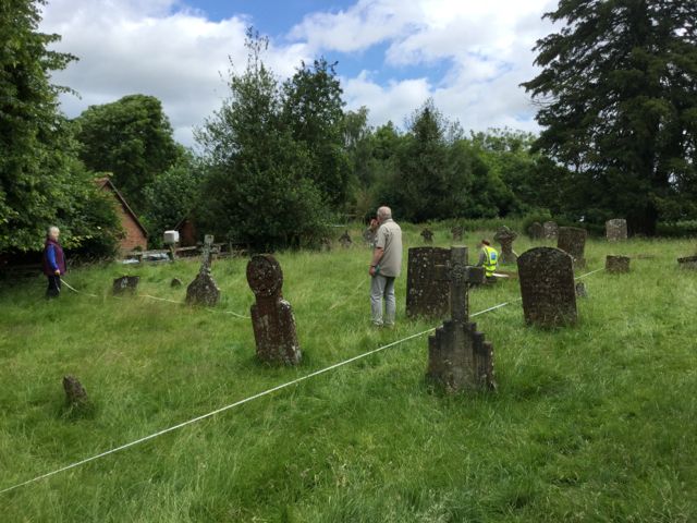
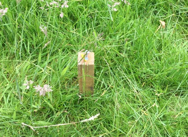
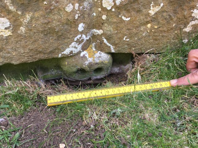
One of several lonely looking pegs scattered round the churchyard.


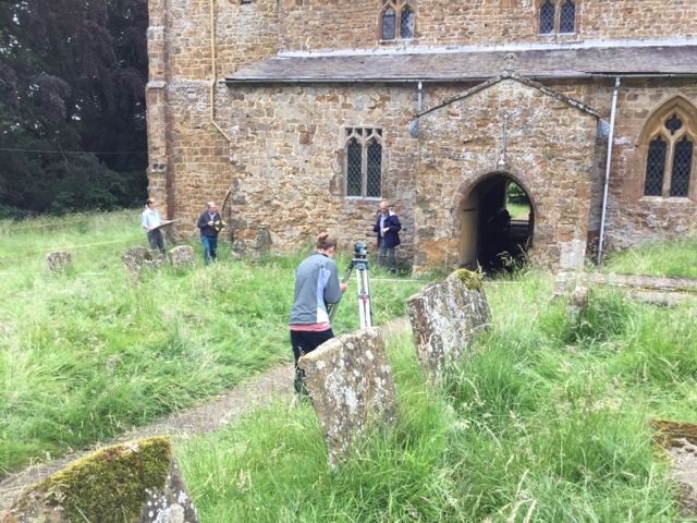
A few days earlier I'd spent some time in the churchyard with Mark's assistance and measured in a whole series of what we called fixed points, wooden pegs accurately located within the plot which can then be used to attach tapes to for all our measuring requirements. So it was was when, on the first full day of 
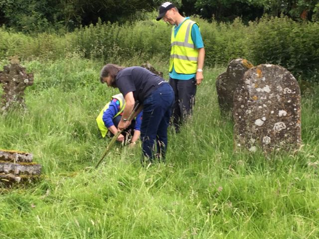
work in the churchyard, we needed to start on the master plan everything was ready to go. We had an excellent turn out, nine volunteers in all and after a certain amount of head scratching ended up with two teams of three doing sterling service each in their own quadrant of the churchyard. The plan was to survey by offsets, this is essentially surveying by co-ordinates so that positions are fixed by measuring along a tape and then out from it at right angles. In order to fit everything in we opted for quite a small scale of 1 to 100 which meant that 1m on the ground was worth 1cm on our plan. People soon mastered the arcane art of swinging the tape and we made brilliant progress.


Yard Yard
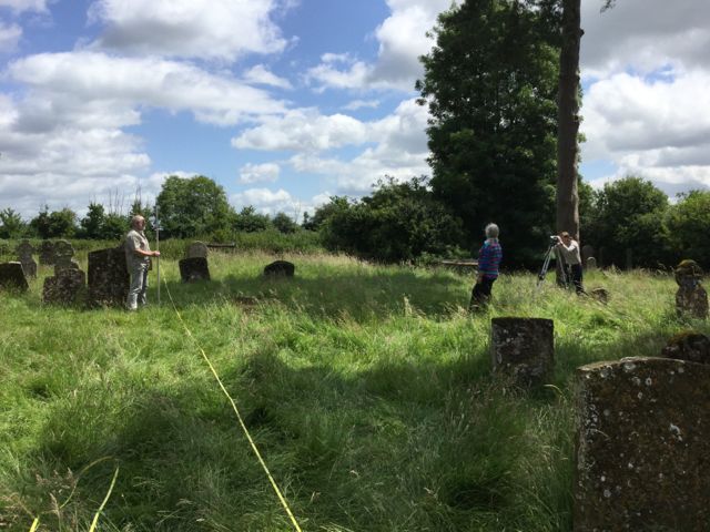
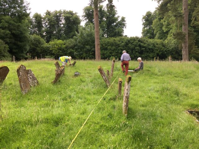
 Team 1 do a little gentle trimming and weeding to uncover the limits of a kerbed plot...
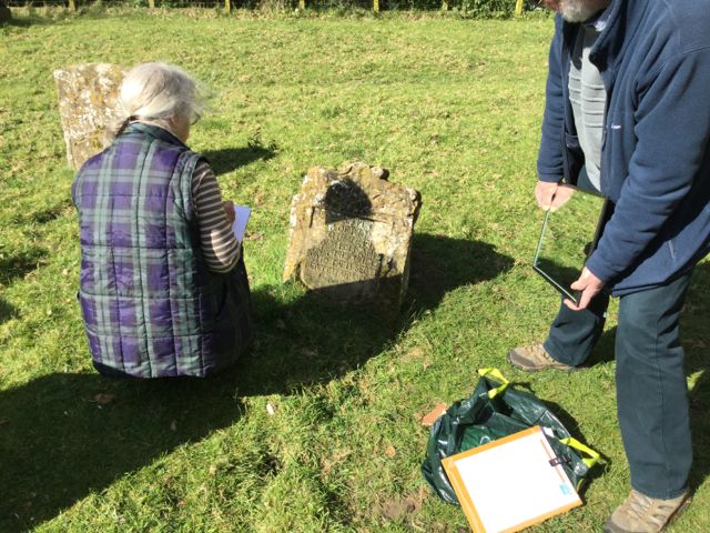
... whilst team 2 cope with the problems of measuring tilted gravestones


Yard
Strimmer to the rescue.


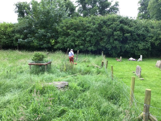
The sheep who are there to keep the grass down had clearly been lying down on the job, literally, so it was some relief that we were able to make way for one of our volunteers with his strimmer. As well as plotting the features of the churchyard 
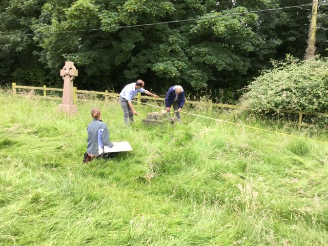
in two dimensions we also needed data on heights so a third team was formed who worked with an optical level, a staff and a measuring tape to measure up for a couple of profiles: the first running east to west just north of the church and the second running north south to the east of the church.


Yard Yard
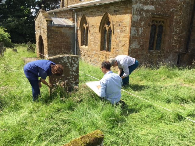
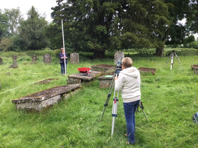
We make a start on drawing  profiles of the humps and bumps within the church yard.
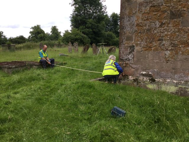
   And we don't forget to measure in the location of the church itself.


Bad weather had been forecast for later in the day with heavy rain from around 3.00 p.m. and for once they were spot on, we managed to clear all the equipment into the church before the first raindrops hit us and hopefully everyone was able to get home in a reasonably dry state. Despite a late start we got loads done so many thanks to the groups of enthusiastic and newly skilled volunteers who helped get the show on the road.


Yard


Here's an early result, this is the transect measured running north south to the east of the church. It shows how the land falls away to the north but also the broad low bank which defines the ancient churchyard along its southern edge. Could this be a remnant of a former fortification associated with the early church as we see in so many villages, especially in south Northamptonshire.


DAY TWO - FRIDAY JULY 8th.

The second day some old faces, some new, but continuing to work around the east end of the church locating both gravestones and taking levels and the sun shone.


Yard Yard
Back to the beginning to check the base-line.
   And now venturing in a south easterly direction.


    i

Yard
Team work to the fore.

i


DAY THREE - SATURDAY JULY 9th.

Having extended the base line to the north of the church we were able to work our way round  past the west tower and once more volunteers arrived Helen and I walked up the road a pace to find a spot height so we could level back to our temporary site datum and establish exactly how high it was above sea level. We also spent a lot of time admiring the west tower both inside and out to the point where I was feeling confident about making a tentative suggestion about the date for the tower. there are many features which we will no doubt enumerate as we go through the project that make me think it was constructed in the 11th. century. If we can demonstrate that this is the case it goes some way towards re-writing the history of the building... we'll see.


n

Yard Yard
Helen helps taking levels through the south door and out of the north.
   Nearly done, the south west quadrant had few tombs but loads of grass.

n
DAY FOUR - WEDNESDAY JULY 13th.

No local volunteers this time but a Belgian student, Sarah, who is over on work experience, and I did the last few graves in the old part of the cemetery getting entangled with the thorns and brambles. We also pressed on with a more detailed plan of the inside of the church which I think will help understand the phasing of the different periods of construction more effectively. We also took the opportunity to revisit a few measurements and make sure that the plans drawn previously matched what we saw on the ground... sorry folks, just checking.


DAYS FIVE TO TEN - WINTER 2016

As well as carrying on recording gravestones when the weather permitted visits were also organised with a local primary school to try out some of the activities ties to be included with the new publication suggesting ideas for teachers who may wanted to visit the church. This was the plan:

Programme of visits /activities for Wormleighton Church

Friday November 18th.
9.00 – 10.00 Byfield School, Introductory talk: Being and Archaeologist
(I’ll bring all the necessary gear, projector lap top etc.

Session !: Making maps. We’ll divide up into teams of 3 (plus one adult per team would be ideal, some of the other local volunteers who have been helping with the survey work may be happy to come along and help).  We’ll by start planning out the location of some of the gravestones and perhaps the outline of the church. I’ll also set up a height measuring activity which can rotate the groups around so everyone has a go at it.

Equipment: Long tape measures, I’ll bring quite a few, does the school have any 10m or longer tapes? Clipboard / pencil and rubber for each group from the school. I’ll provide gridded paper for each group.

i

Yard
Getting to know the church.

i


Friday November 25th.
9.00 – 9.30 Byfield School, briefing on data collection re. gravestones. If we can use the class set of iPads to collect this on site it would be brilliant (the app used is called Form maker and if you can get it downloaded I’m sure I can let you have copies of the data collecting form we’ve written for it) if not I’ll provide paper copies of the form.

Session 2: recording the gravestones. Teams of 2 would be good.

Equipment: either appropriate number of iPads or clipboards and pencils plus each group will need a ruler or short tape measure and a protractor.

i

Yard
Survey work in the churchyard.

i


Friday December 2nd.
Session 3: The church and its fittings. An exercise in collecting images and information about the interior of this historic church. I would suggest a carousel of four activities lasting about half an hour each including:
1. careful sketching of wooden carvings in the style of archaeological illustrations. I’ll bring some examples along and discuss techniques.
2. recording the medieval tile floors. Some measuring some drawing and perhaps some rubbings
3. images of the coloured glass windows, fun with felt tip pens perhaps
4. Completing the plan of the inside of the church, revisiting skills from session 1

With permission some of these images could be used in the new education pack we will be preparing for future visitors.

Equipment: Clipboards, plenty of paper, pens, rulers and pencils, wax crayons for rubbings. I’ll bring long tape measures.

i

Yard
Looking around the village.

i


Friday December 9th.
Session 4: Landscape Detectives. This will take us on a guided walk around the site of the deserted medieval village and seventeenth century park with a peek at the remains of the mansion partly destroyed by fire in the English Civil War. Whilst out and about we will try some simple methods for drawing sketch maps involving the use of magnetic compasses and pacing.

Equipment: Clipboards and pencils, good quality compasses of the ‘Silva’ pattern if you have any.

i

Yard
Field work... in a field

i


And it has to be said it all worked out very well.


DAYS ELEVEN TO SIXTEEN - SPRING 2017

the final phase of repair work, after the aisles had been re-slated was to relead the roof to the tower. This meant putting scaffolding up round the tower and  gave access to the outside of the tower too. The suspicion had arisen that the tower may be significantly older than once thought so it was useful to get a close up look at the windows and the sculptures just below the parapet. Sadly these were all badly worn, except for one characterful hound. Several more visits were made to complete the recording of the gravestones and finally to check up on final details.


Yard Yard
The eroded corbel table on the south side of the tower.
   The views from the tower were terrific reminding us that it could also function as a look out.


Yard Yard
The lugubrious hound looking to the east
   Detail of the windows to the bell chamber, could these be reworked Romanesque windows?


Yard Yard
The last few stones, using a mirror to cast light on an inscription.
   Measuring a nearly buried skull above crossed bones


BACK IN THE OFFICE - SUMMER 2017

As I often say a day in the field means a couple of days in the office processing the data and what have you. In this case it meant scanning in the individual plans drawn  in the churchyard, matching them up and superimposing them on the OS map the drawing in the individual gravestones and numbering them.


Yard Yard
One of the field drawings scanned in.
   Beginning to put it all together, stones plotted but more to do.


Where life got difficult was when it came to transferring everybody's contributions: some from paper forms, some from the iPad. The details are tedious but it involved lots of reformatting (never put commas in data that has to be copied as something called a csv- comma separated values file). Then there were inevitably a few stones which just fell through the net and had to be revisited and of course everything had to be checked... and there will still be errors waiting to be spotted. All in all we didn't have the completed spreadsheet results for the survey complete until the end of June, nearly a year after starting.

BACK TO TOP