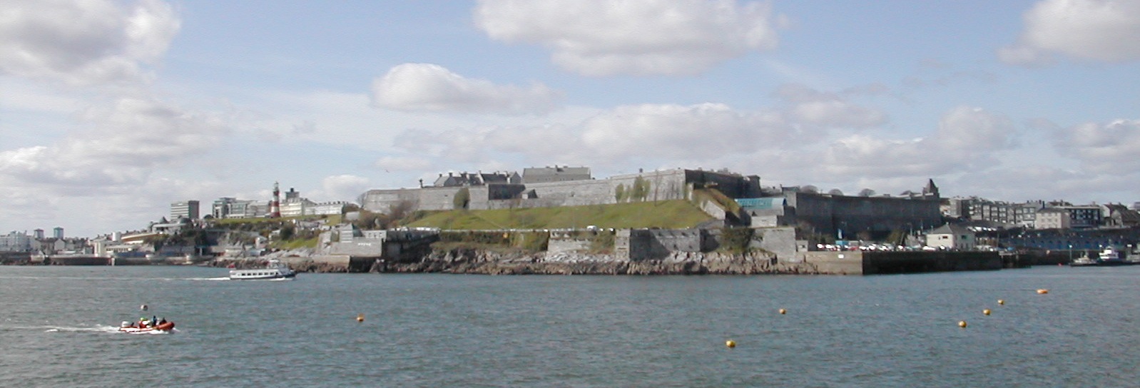
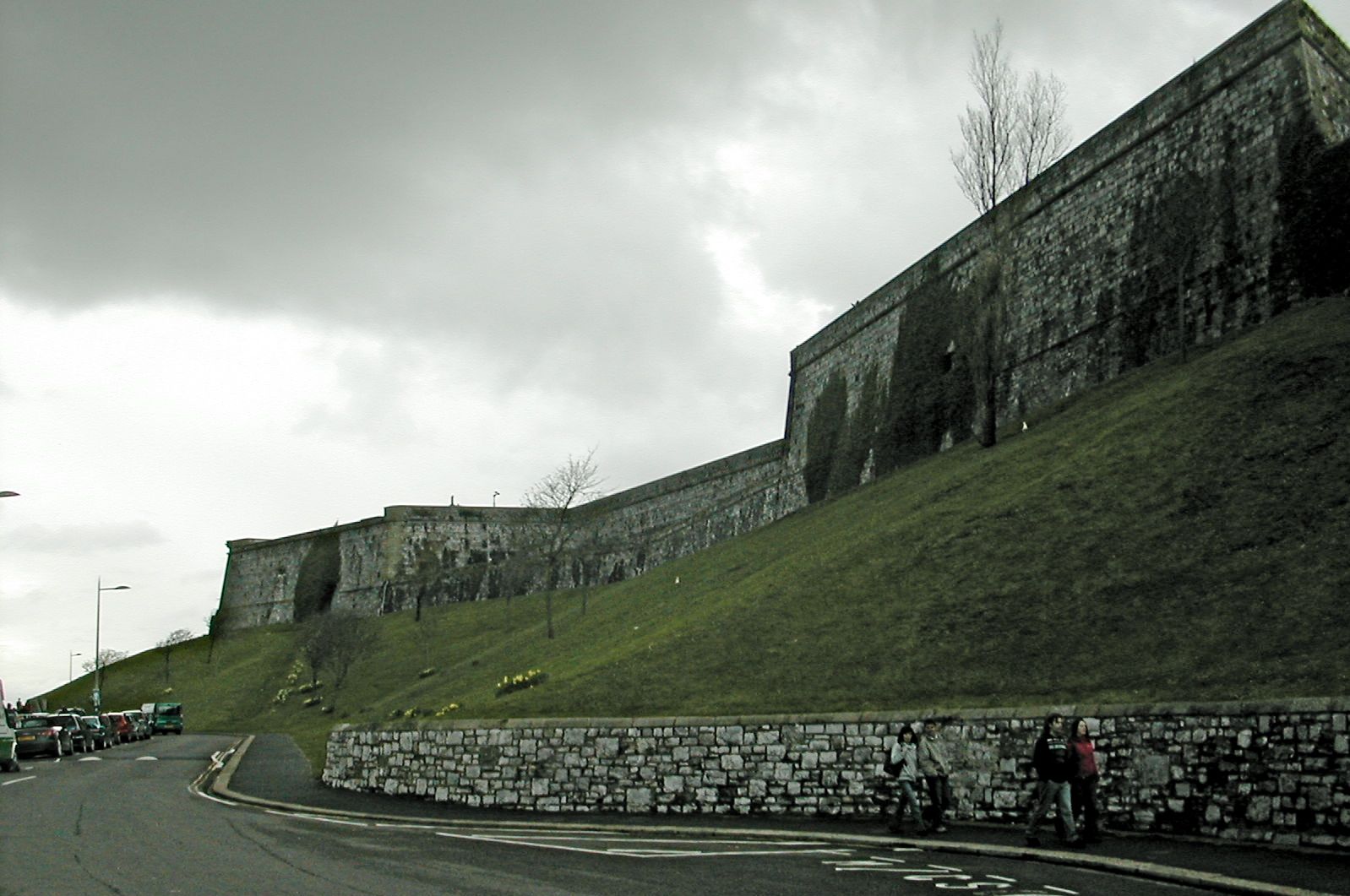
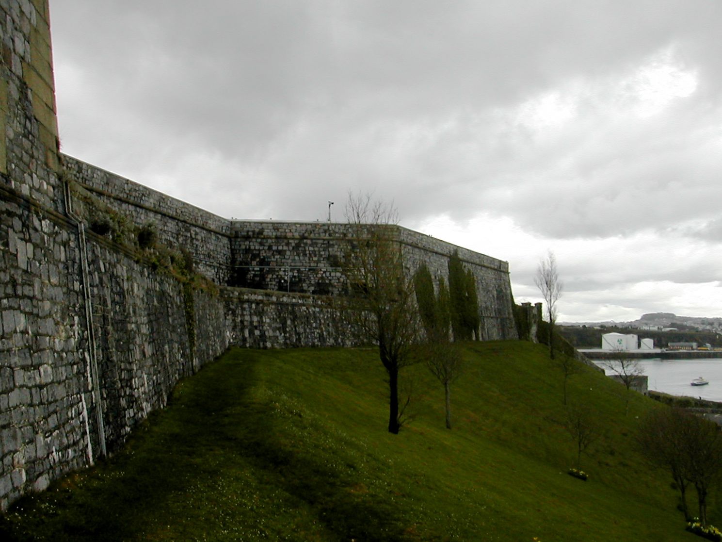
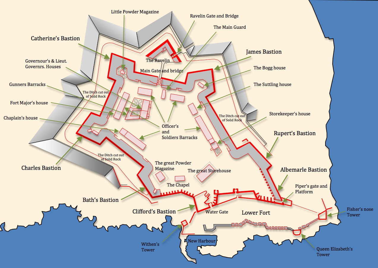
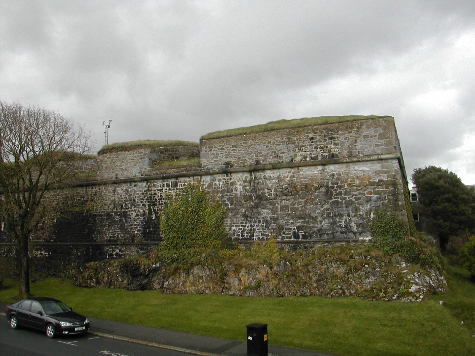
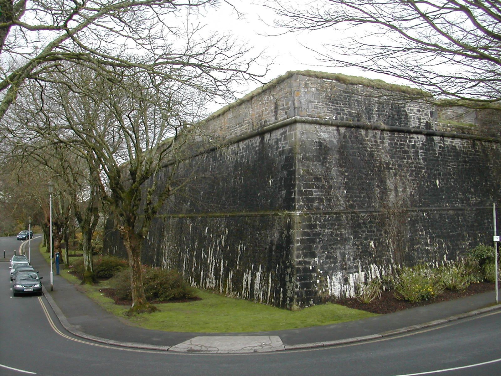
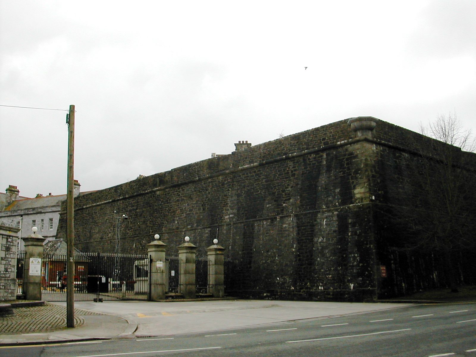
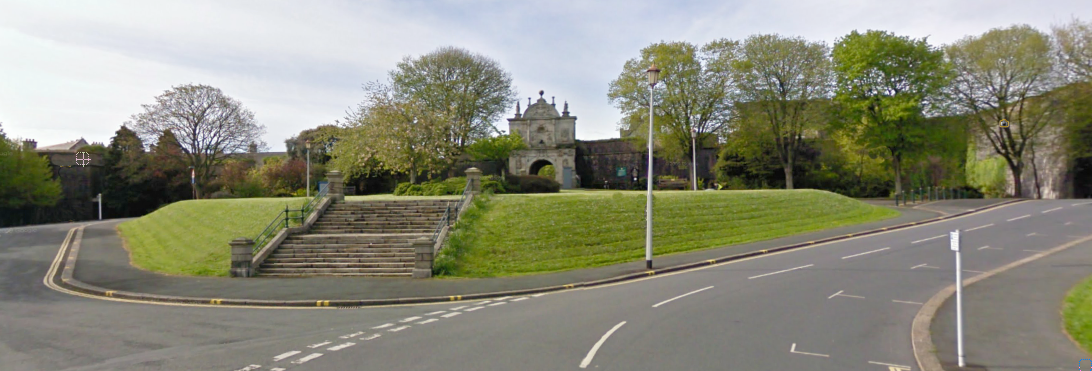
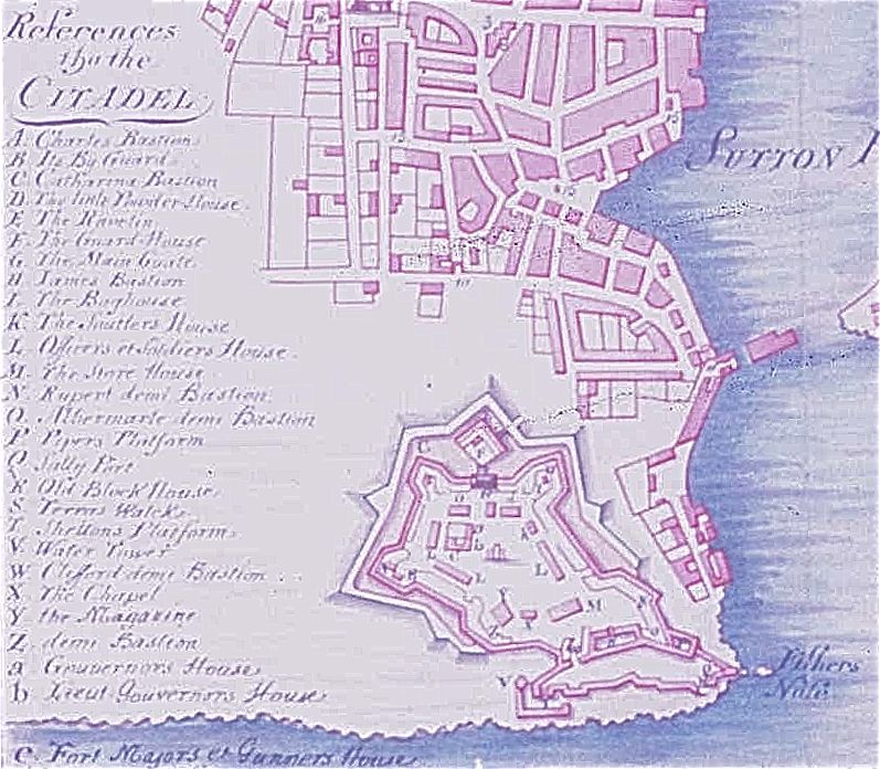
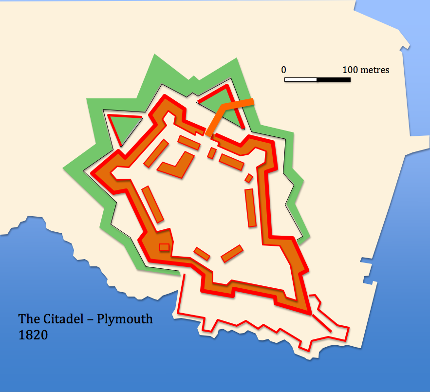
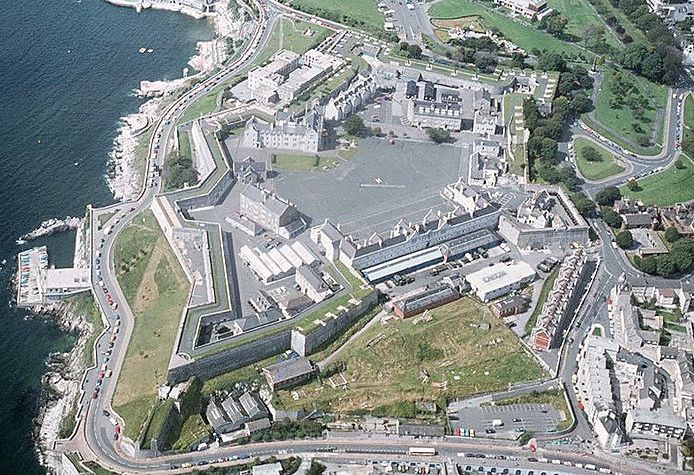
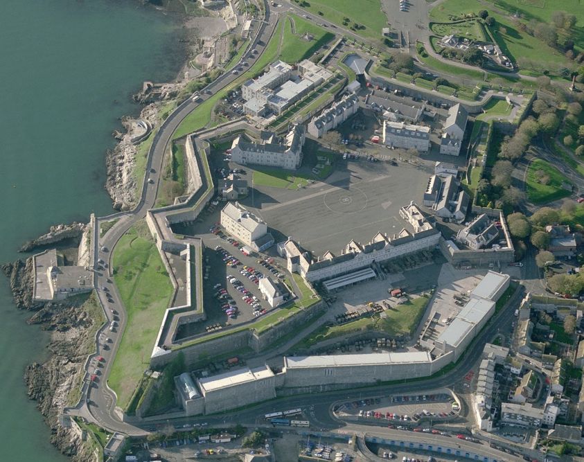
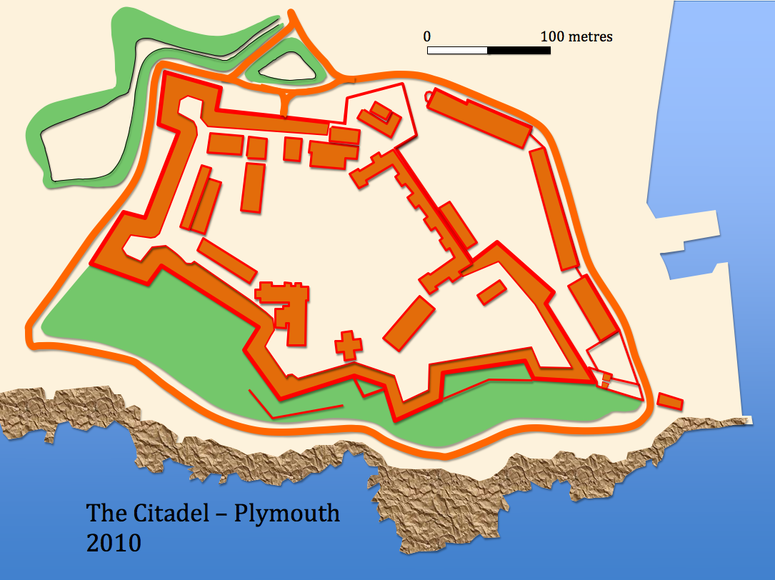
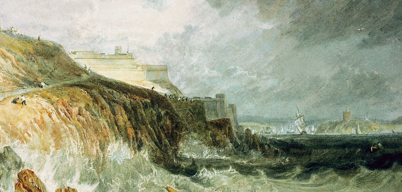
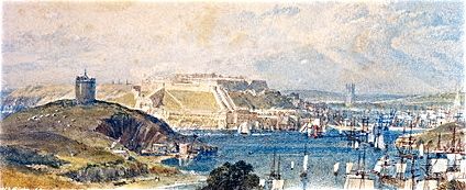
The Fortifications of Plymouth
The Citadel
SX481531

Citadel
The Citadel from Mount Batten to the south


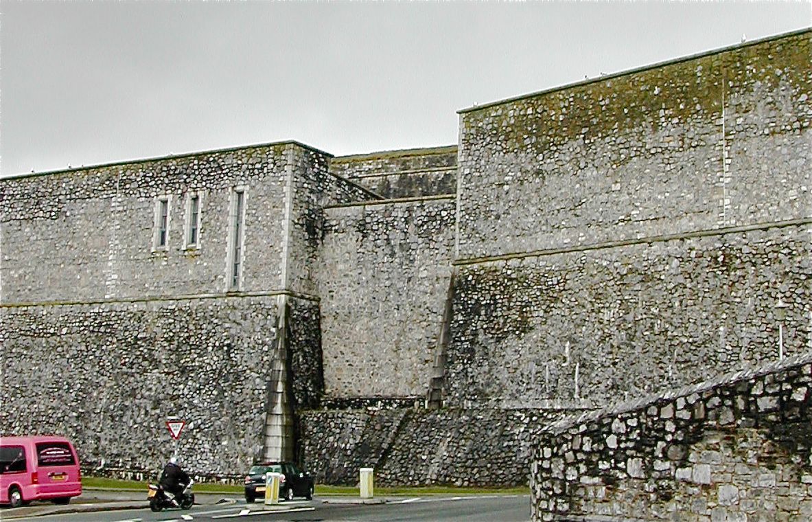
Plymouth's 'Royal' Citadel, as it is sometimes known stands on a rocky eminence: Plymouth Hoe, some 25 metres above sea level overlooking to the south Plymouth Sound and the entrance to Cattewater and the valley of the River Plym and to the north the the medieval centre of the city. With its commanding location it is hard to imagine, given the archaeological discoveries at Mount Batten, that there was not early settlement activity here but regular archaeological monitoring of work in and around the Citadel has failed to record any features earlier than the late medieval although, of course, it is possible that the extensive building work could have swept all traces away. The oldest 
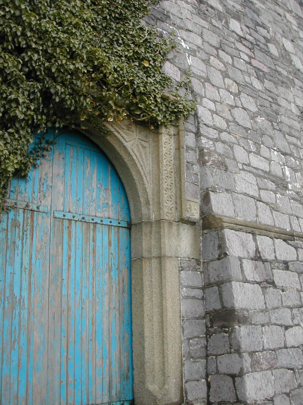
confirmed structure was the chapel of St. Catherine, shown on early maps with a west tower which functioned as a beacon for navigation and single nave and chancel. This was later rebuilt within the perimeter of the citadel. On the southern edge of the town lay the first military structure in the area: the medieval castle, a quadrangular work with four round towers with a portion of the gatehouse still surviving, however the earliest reference to defences on the Hoe itself comes from a mention of 'Thykpeny's bulwark' in 1486 for which William Bovey was paid the sum of seven shillings and six pence for its annual maintenance.

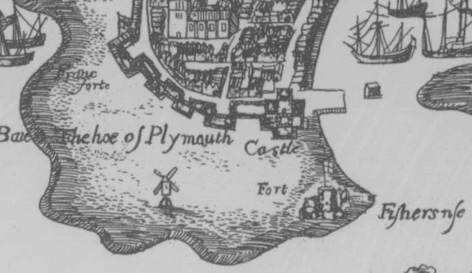
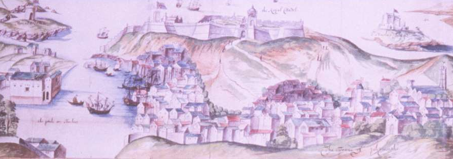
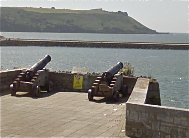
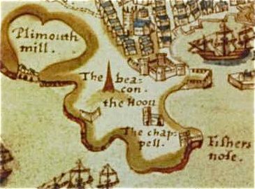
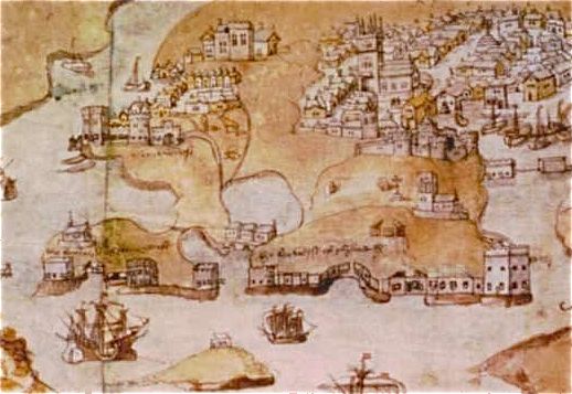
Municipal records (click here for extracts) for the sixteenth century describe an active programme of construction and repair work to 'bulwerkes' on the 'Howe' some of which were clearly earth and timber and well armed. The guns were kept in the guild hall and brought out at times of trouble and perhaps for exercises. There is a reference to gunners using floating barrels for target practice and money paid for repairs to the chapel following damage to the roof. The blockhouse at Fishers Nose was constructed along with a series of similar works along the south coast either late in the fifteenth or early in the sixteenth century but is certainly shown on a map from the early 1500s. A curious chevron shaped figure to the west of the chapel may represent one of the earthwork defences. A more detailed view from around 1540 not only portrays the Fishers Nose blockhouse but also a similar construction at the west end of the Hoe but also a series of defensive walls along the water's edge. Again just to the west of the chapel the drawing of an unusual wedge shape may be an attempt to show an earthwork defence with two embrasures.


CitadelCitadel
Maps: Early 1500s and 1540

Citadel
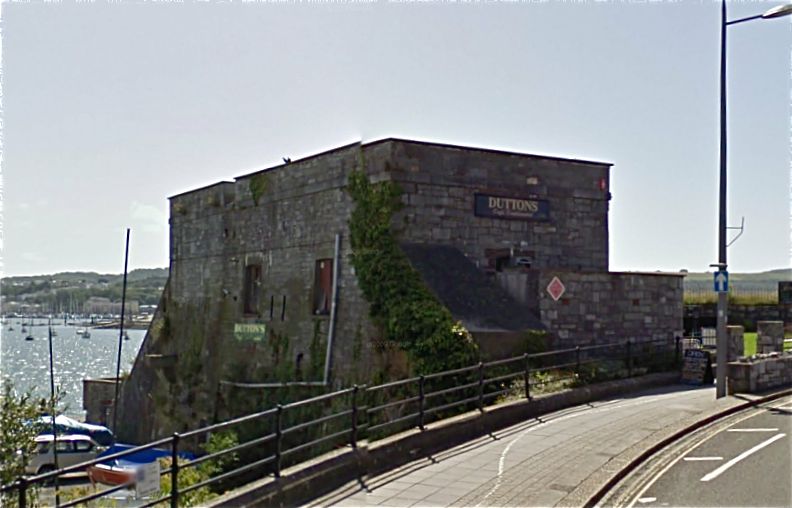
The blockhouse at Fishers Nose from N, possibly fifteenth century and later

On-going 
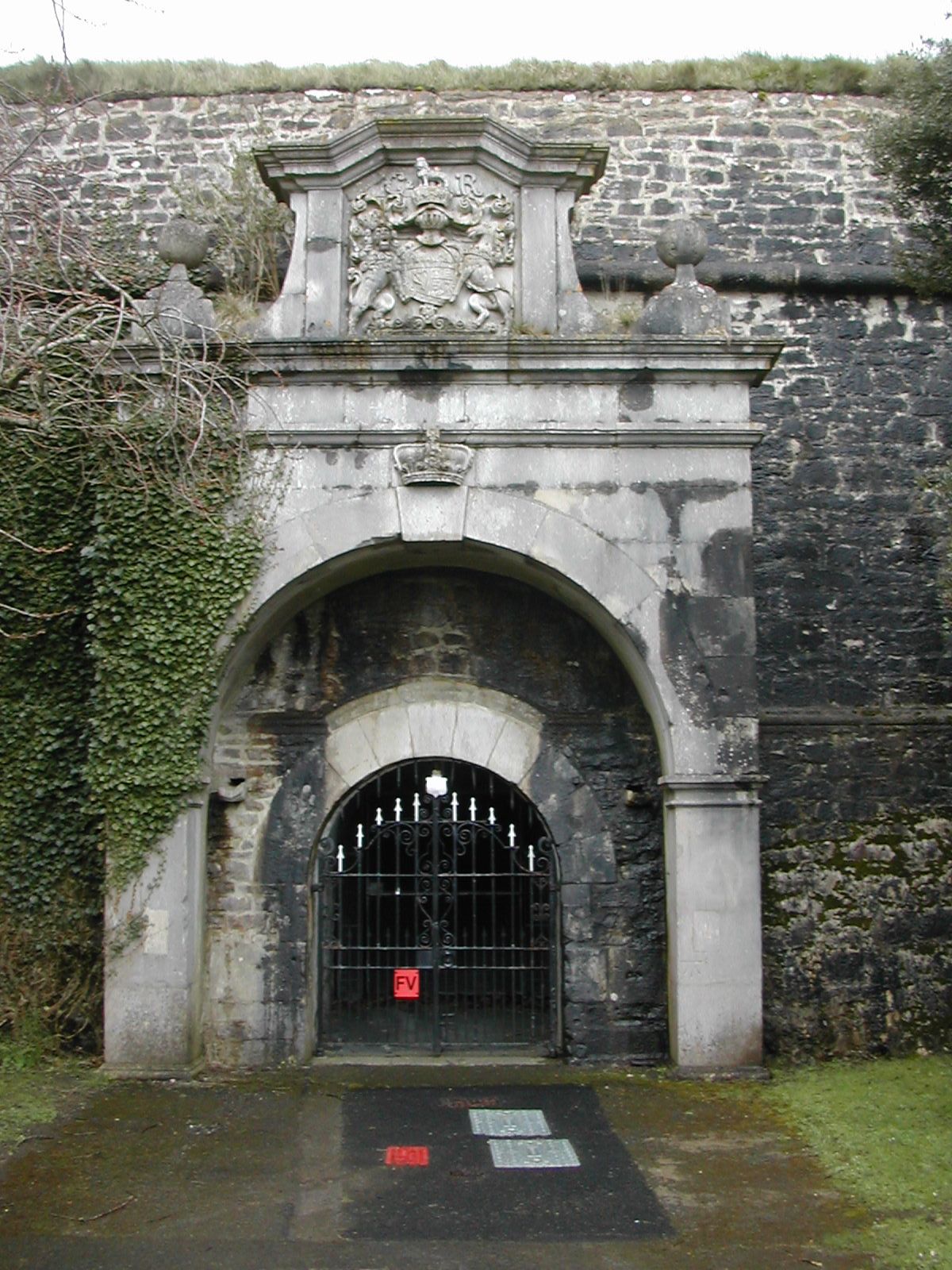
concerns about 'piracy' and continental rivalries lead to a proposal in 1592 by the royal engineer Robert Adams for a fort on the high ground of the Hoe "to guard against sudden surprise" although there are suggestions that the 
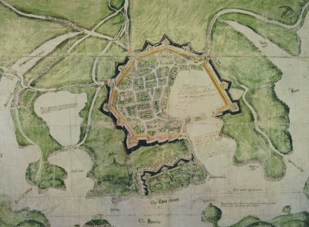
earliest fort was proposed by Sir Francis Drake in 1590. Work began the following year and was completed by 1598. A remarkable map is posted by Steve Johnson on his Cyber Heritage site. The map is undated and has no provenance but shows the town with a fully developed set of defences and a rectangular work on the Hoe. Could this be a map by the engineer Genebelli depicting his proposals drawn up in 1598 which were never carried out? It certainly shows the blockhouse at Fishers Nose and the series of emplacements along the water's edge and Saint Catherines Chapel is shown within the defences but nothing suggests the division into an upper and lower fort by a bastioned trace facing seawards.


Plymouth Fortification
16th century Proposal by Genebelli ?

The exact form of this work as actually built remains unclear but there are considerable surviving remnants. In 1994 trial trenches across the defences demonstrated for the first time that substantial remains survive with stone scarp walls and a rock-cut ditch being identified. Saunders (Fortress Britain 1989) describes the fort thus: "The fort was in two parts, an upper enclosure on the higher  ground and a lower one extending down to the water's edge. The upper fort was triangular with a ditch ( 20 feet ) 6 metres) wide, and two large bastions with flankers covering the approach from the land. The main armament was in the more irregular lower enclosure on the cliff..." Working from the extremely detailed plan of 1720 showing some of these remains incorporated into the later Citadel it is easy to see how the lower fort drew together a number of existing towers but presumably replaced some of the earthworks with a stone curtain pierced with embrasures along the cliff edge. Of the upper fort, taking account of the overall layout and the different ways in which the walls are portrayed, the Elizabethan work seems to be represented by a curtain with a central gate flanked by two demi-bastions facing south with a further length of curtain to the west. No doubt detailed analysis of the standing stone work around the south and east portions of the citadel would reveal further evidence of the sixteenth century construction but even a cursory examination suggest that the early work is built from much less well coursed random rubble. Piper's Gate and platform linking the Albemarle Bastion with the blockhouse at Fishers Nose are also presumably part of the Elizabethan fort.  Obviously any bastions overlooking the town to the north would have been destroyed by the later works.


Citadel         Citadel
Clifford's Bastion, south curtain and Albemarle Bastion from SE and SW, presumably largely of the late sixteenth century


The depiction of the defences of Plymouth from the Civil War period are perplexing. Obviously one has to allow for a degree of artistic license but it is hard to make sense of aspects of this portrayal. "A Trve Mapp and Discription of the Towne of Plymouth and the Fortifications thereof with the workes and approaches of the Enemy at the last Siege AD 1643" by Wenceslas Hollar shows a fort which appears to have a central tower with a perimeter wall with smaller towers but nothing representing a bastioned trace. Naturally this could simply be a conventional figure to signal the presence of the fort but it is odd given that other earthworks are shown at least in something resembling plan form. Another difficulty however  arises with the line of the town defences. Initially an earthwork was thrown up around the town but in 1643 this was upgraded by the addition of a stone wall. This is shown on the Hollar map to be outlined with rectangular bastions but excavations by Exeter Archaeology clearly show a system based on triangular or pentagonal bastions.


Citadel
Detail of "A Trve Mapp and Discription of the Towne of Plymouth and the Fortifications thereof with the workes and approaches of the Enemy at the last Siege AD 1643"

In 1665 Sir Bernard de Gomme,  engineer - general of the king's fortifications was charged with the task of creating a modern fortification to counter the threat from the Dutch navy. His initial plan was to construct a regular pentagonal work with five bastions to the west of the Elizabethan fort but by 1668 this had been altered to accommodate some of the existing structures thus making better use of the irregular area of the hill top and presumably achieving some savings in the construction of walls and bastions. Whatever the case the bill for the works carried out under the direction of the governor John, Earl of Bath came to a huge £20,544 by the time 1675 came round. Despite the fact that the three main bastions and the grand entrance gate had been completed by 1670 work went on in one way or another until 1683. An exceptionally fine a detailed plan of the works forty years later exists in the British Library (Shelf mark: K. Top Vol 11, Item No. 82) has been redrawn below with the contemporary names and labels attached. It is widely reported that an additional factor in the siting of this royal citadel was as a comment of the previous disloyal and parliamentarian leanings of the town of  Plymouth during the Civil War but this feels more like a local myth than an actual strategic or even tactical consideration. In 1698 the indefatigable traveller Ceilia Fiennes reported that the citadel, "Looks nobly... all marble full of towers with stone balls on the tops and gilt on the top."

citadel
This late 17th century view shows the newly completed Citadel from the S


Citadel


The original plan for a pentagonal fort is evident in the three bastions which form the western portion of the fortress. It may be argued that the magnificent north gate was designed to overawe the inhabitants of the town but in all truth it is the only sensible option for siting such a weak point in the defences. The gate's decoration, designed by Sir Thomas Fitz (or Fitch), is derived stylistically from the French baroque and is built in Portland stone. As described in Pevsner and Cherry's Buildings of England volume for Devon, "Below the portal has paired ionic pilasters with niches between them and garlands between the capitals; above, a centre narrower than the arch below and very bulgy unfluted Corinthian columns. large trophies in the flanking bays.Top with a big heavy segmental pediment. the armour and statues were originally gilded." In the pediment, is the Royal Coat of Arms supported by a lion and a unicorn, each holding a shield displaying the cross of St George.  Below that is the date 1670 with a flanking tablet bearing the inscription, "Carolus secundus dei gratia magnae brittaniae franciae et hiberniae rex ". The niche below the tablet was intended to hold a life-size statue of King Charles II but now holds three cannon balls instead.   Over the top of the archway itself is the coat of arms of Earl; Bath along with the Grenville motto of, "Futurum invisibile".


Citadel
North gate from SE


The massive walls were built of limestone with granite dressings and are between 7 and 8 metres high with an embrasured parapet at its thickest on the west and north sides at around 5 metres thick and with an overall wall thickness in the region of 14 metres. the lower portion of walls below the cordon have a slight batter around 6 degrees from the vertical. the top of the parapets curves gently. There is no evidence for echaugette (projecting sentry box at parapet level) except on James bastion where a base survives

Citadel
Clifford's Bastion from W with a later spur bastion


Citadel
Charles Bastion from W

Citadel
Catherine's Bastion from NW

 
Citadel
James Bastion from NE with base of echaugette.

Great use was not made of outworks. According to the De Gomme plan a ravelin covered the northern approach and a pronounced glacis slope made the most of the natural fall of the land. A west sally port with covering ravelin was added to the west curtain some time before 1820. Despite the moat having been filled in in 1888 and subsequent remodeling of the surroundings to create public pleasure grounds the bulk of these earthworks survive.

Citadel
North ravelin from S

CitadelCitadel
Glacis NW of Catherine's Bastion from NE, S side of west ravelin from S


The interior was marked with a number of fine buildings. the former seventeenth century governor's house was extended shortly after completion and is, again to quote Pevsner and Cherry, "of three stories, with prominent string courses and a modillioned cornice, paired windows, two re-used granite doorways with star pattern spandrel reliefs and shaped end gables." Other seventeenth century buildings include the guardhouse and the former store house. The chapel was rebuilt in 1845 but retains a seventeenth century granite door surround from the seventeenth century successor to the medieval building. Most other buildings grouped around the central parade ground are late nineteenth century.
Citadel
Map of the Citadel and town, early 18th. century

Like most military works the Citadel began to fall into redundancy as the nineteenth century approached. Even by 1717 , according to a report by Ordnance Office's third engineer, Christian Lilly, the lower fort, "had parapets entirely destroyed and the platforms ruined." The view from the sea indicates that many of the features of the lower fort may be preserved within the current arrangements for the coastal road and promenade as is the new harbour on the south side of the Citadel. A further example is the current viewpoint with two cannons mounted which is almost certainly on the site of Queen Elizabeth's Tower marked on the 1720 map but obviously considerably earlier. However, the Citadel retained mush of its former importance as headquarters for the Plymouth garrison. This order dates from 1805:

"Should an alarm be given of the approach of an Enemy to this Garrison by day 3 Guns will be fired in quick succession from Mount Wise, which will be answer'd by the same number of Guns from St. Nicholas's Island and the Citadel. Should the alarm first reach the Citadel or St. Nicholas's Island the same number of Guns will be fired in a similar manner as before directed from the Post first alarm'd and answer'd by the other Posts. Should the alarm be given by night the Guns will be fired as before order'd and three Rockets let off immediately after. The officer commanding Maker heights is also directed to fire three Guns in like manner and set fire to the Beacon in the Event of the alarm first reaching his Post and to answer the alarm by the other Posts by firing 3 Guns, but he is to be very carefull not to fire the Beacon until he is perfectly sure that there is good grounds for so doing. Immediately on the Alarm being made the different Regiments and Corps in the Garrison, including the Volunteers, will order their drums to beat to arms and the whole will immediately repair to their respective Regimental Parades and wait for orders from Lt. Gen 1 England. The officers and non-commiss d officers commanding those Posts are desired to give positive orders to their centinals to be very watchfull and be attentive both by day and night to those signals and upon the first alarm they are to call out the guard and to acquaint the commander of such a circumstance having taken place, who will immediately despatch a man to communicate the same to L l Gen' England at the Citadel and the Corps in the neighbourhood of his Post."

 Hogg (Coast Defences of England and Wales 1974) records that the armament for that year consisted of eleven 42-pounder, eight 32-pounder, twenty 24-pounder, seventeen 18-pounder, thirteen 9-pounder, three 6-pounder and three 18-pounder carronades

CitadelCitadel
Cannon mounted on the site of Queen Elizabeth's Tower, looking S to Staddon Point          Walls to early 21st. century E extension from E


Plymouth Fortification
 
During World War II the Citadel housed the Coast Artillery Training Centre. It is currently (2010) headquarters of the 29 Commando Regiment Royal Artillery. It is remarkably satisfying, although a melancholy reflection on the times, to find an historic military structure still carrying out a defensive function and guarded by armed troops - do ask permission before photographing them. A large extension was built along the east side of the Citadel in 2007 to offer secure accommodation and garaging for the transport section and again it is fascinating to gaze of these twenty first century walls  with their high parapet and slit windows and reflect on the continuity of it all. Whilst the exterior is freely accessible, because of its current military role, access to the interior is severely restricted but is available on the basis of guided tours on Tuesday and Thursday at 2.30 p.m. May to September, visitors need to contact plymouth.citadel.tours@googlemail.com to book a visit.

CitadelCitadel
Aerial views from the east around 1980 and after the eastern extension was built in 2007


Citadel


CLICK HERE FOR A VIDEO TOUR OF THE OUTER DEFENCES


       CitadelCitadelCitadel
Detail of S door from SW                                                                  Inscribed foundation stone on angle of Charles Bastion: "The Earle of Bath 1666"                                                     The west gate from W


J.M.W. Turner toured Devon and Cornwall in 1811, returning to Devon in 1813 and 1814. On these occasions he painted several views of Plymouth some of which offer useful images of the citadel in the early years of the nineteenth century.


Citadel
Plymouth Citadel, A Gale. This shows the Citadel from the W and close to the water's edge presumably Witham's Tower and Queen Elizabeth's Tower


Citadel
Plymouth Harbour: Towing in Giclee. Showing some of the detail within a battery


Citadel
Plymouth from Mount Batten