The Northern Line
Clicking on the map below will enlarge the
appropriate section:
 |
 |
Click here to see comparative plans of all the works to a common scale
This
northern line runs in an east west arc between the valleys of the
rivers Tamar and Plym, around 5 kilometres north of the city centre and
makes effective use of tributary streams and their valleys to create
the best possible defensive line. The largest fort in the line at
Crownhill lies at the highest point covering the watershed between two
streams and therefore protecting the easiest line of approach and of
course the main highway from the north. Of particular interest is the
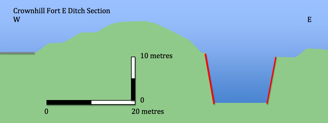
massive rock cut ditch that offered additional protection to eastern
section of the works and the military road which connected all of the
forts on the line and was protected by an extensive system of earth
banks. Apart from a few test firings the line was left largely unarmed
and
served for most of its time as barracks and stores.
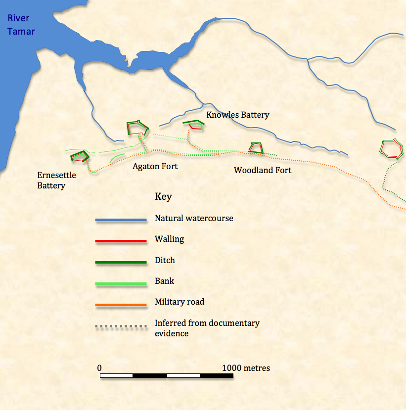
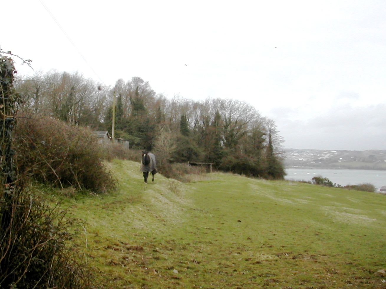
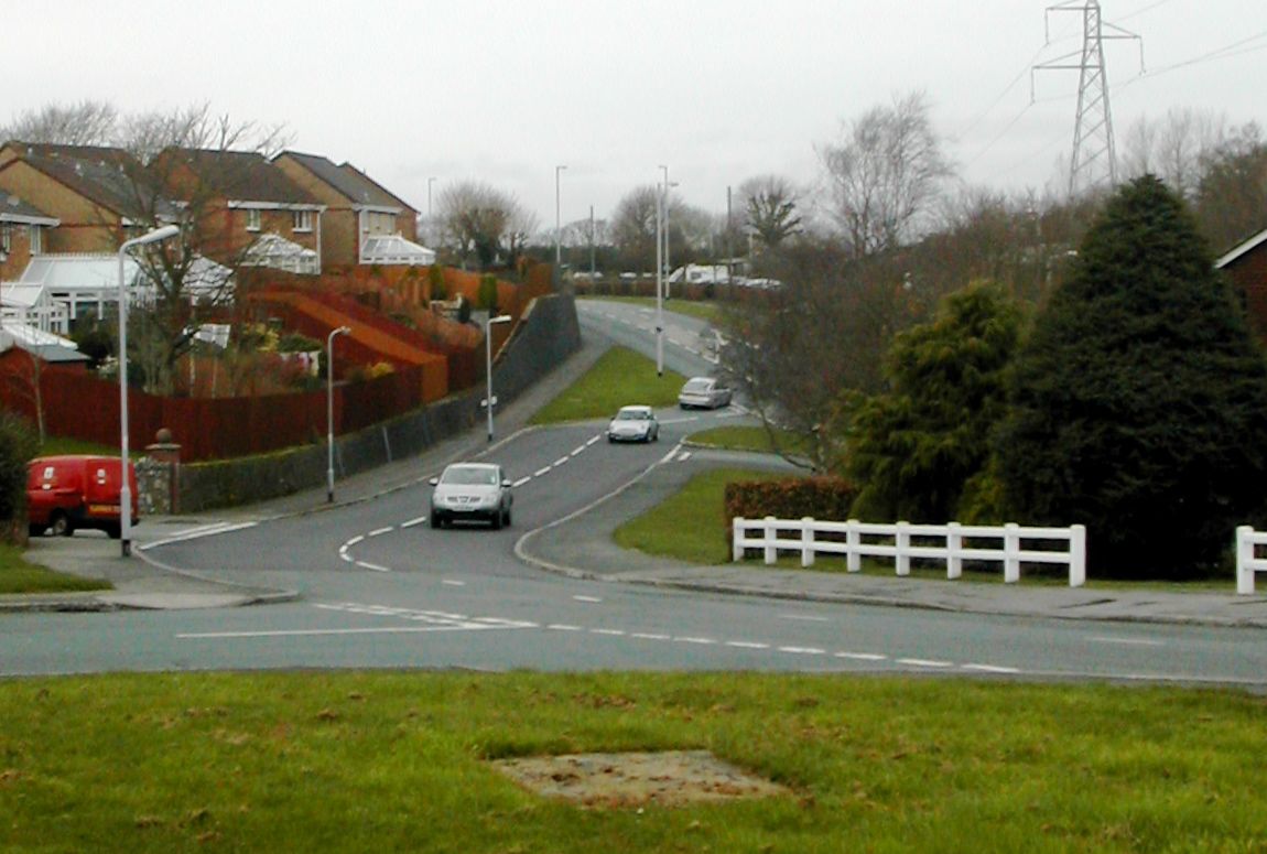
Ernesettle Battery SX 448592
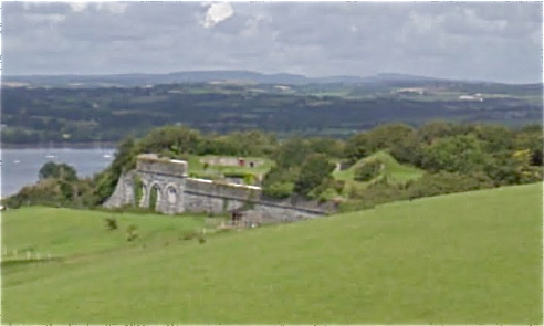
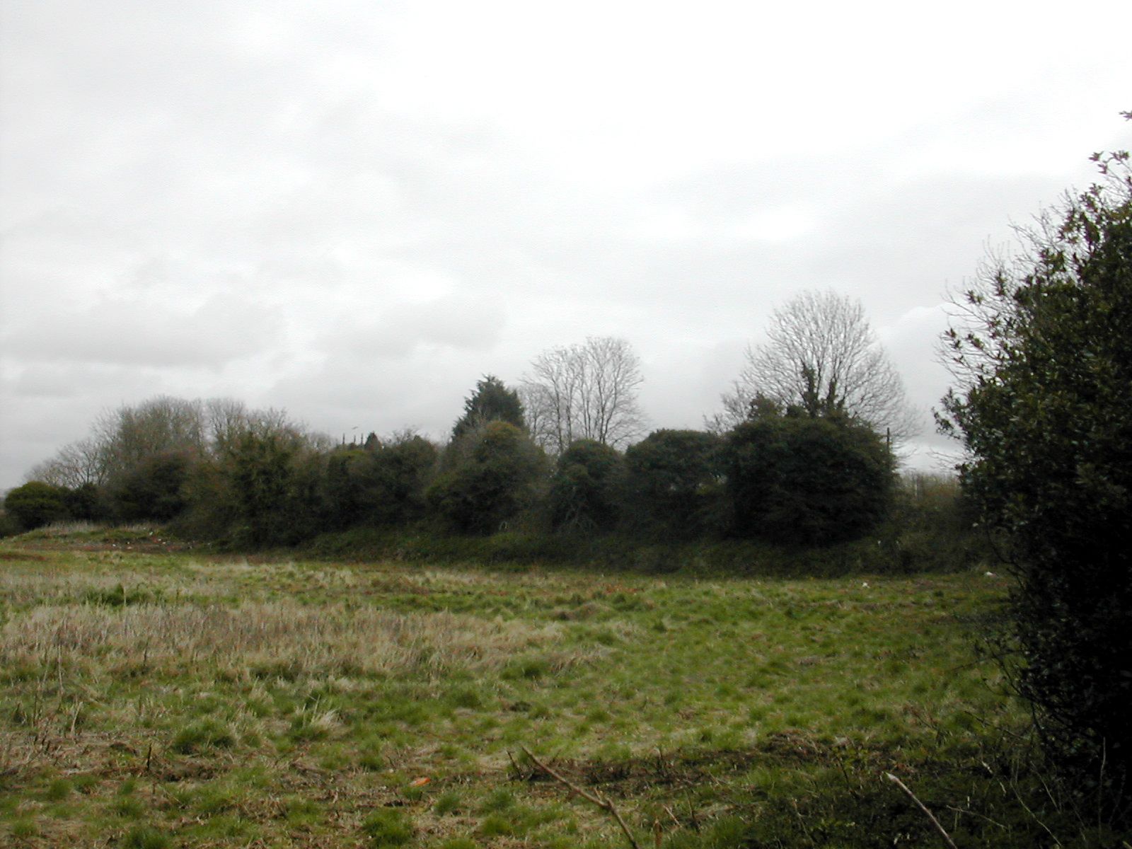
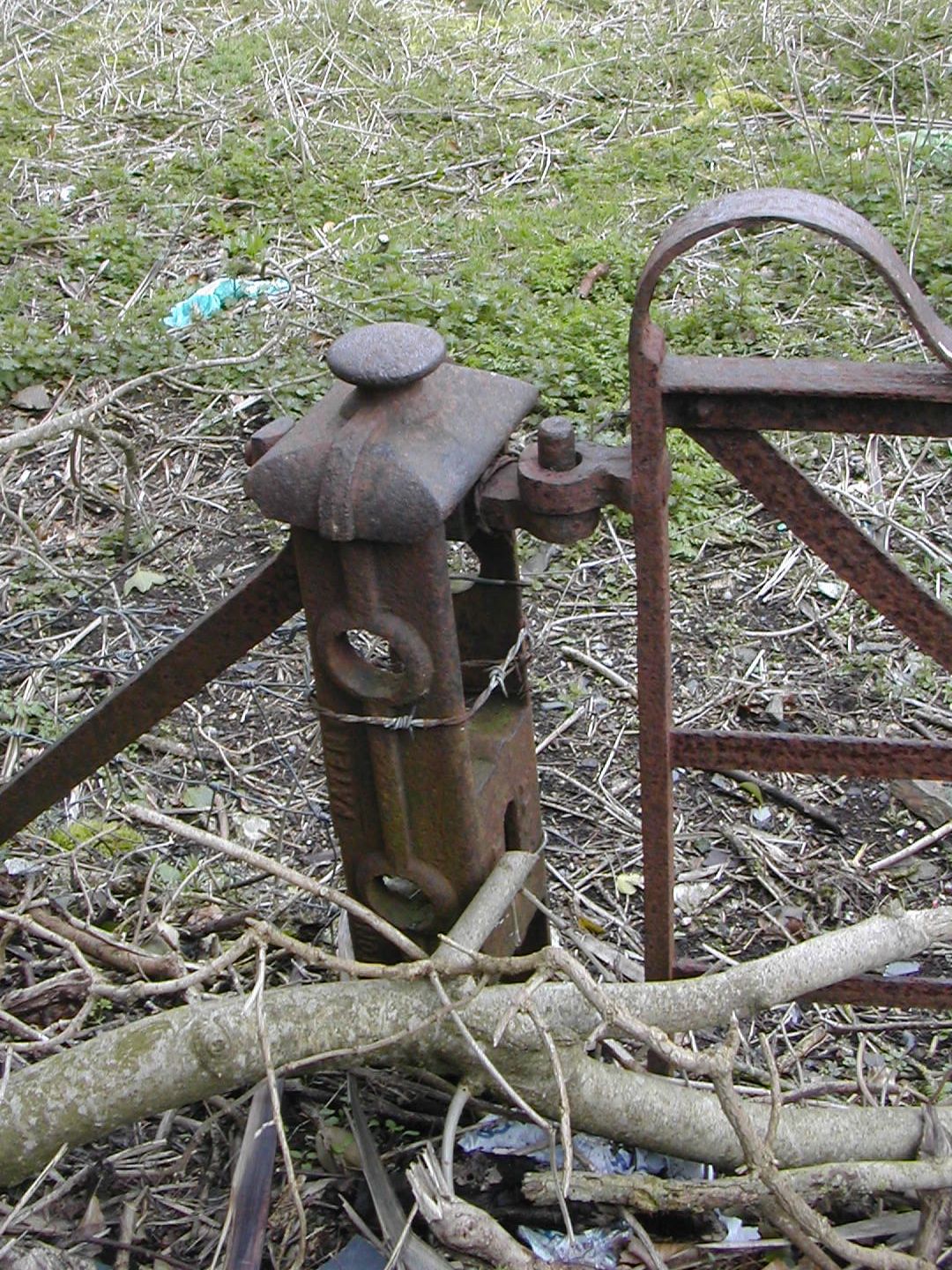
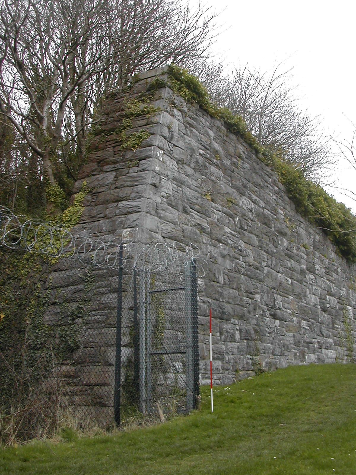
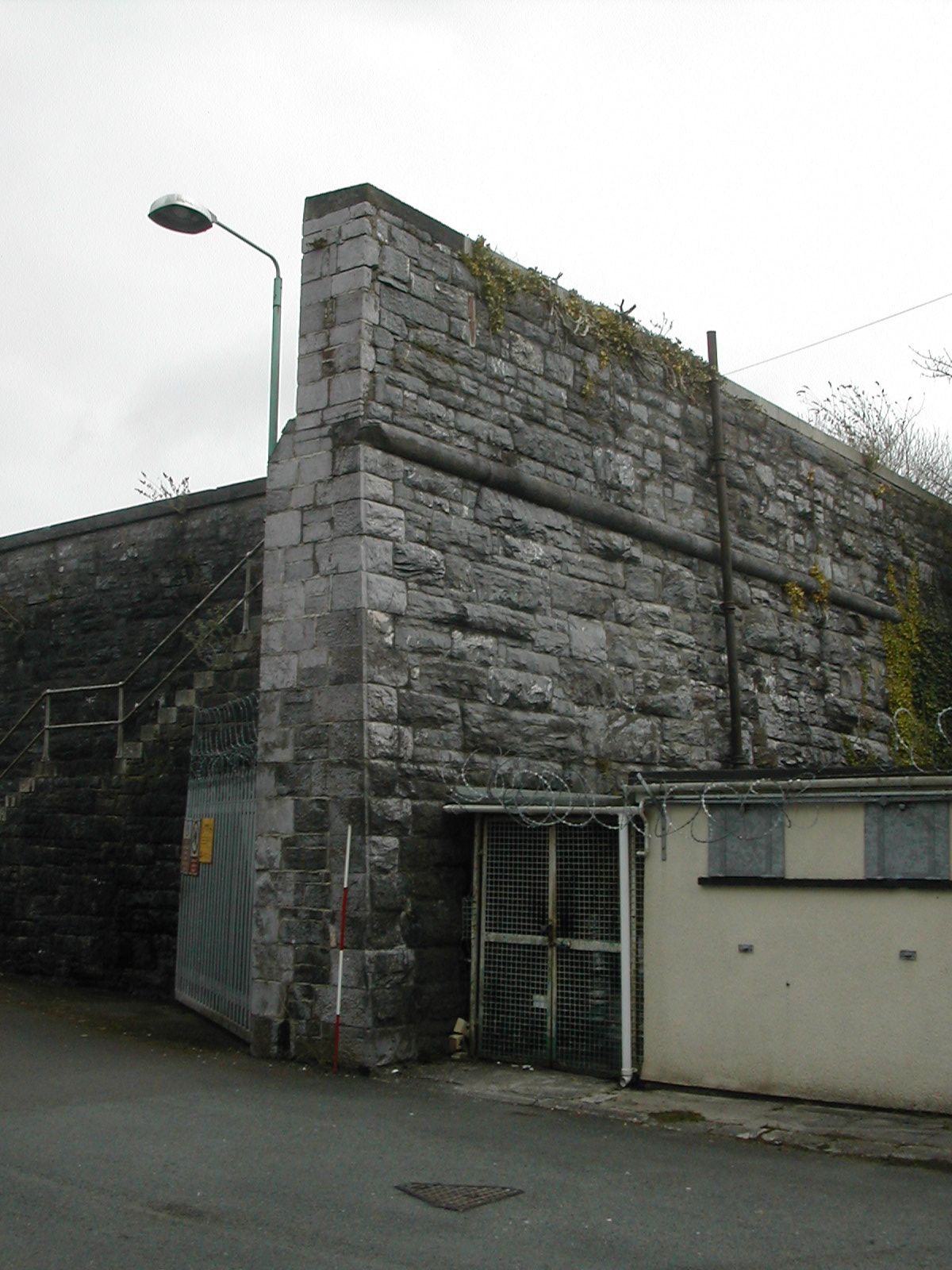
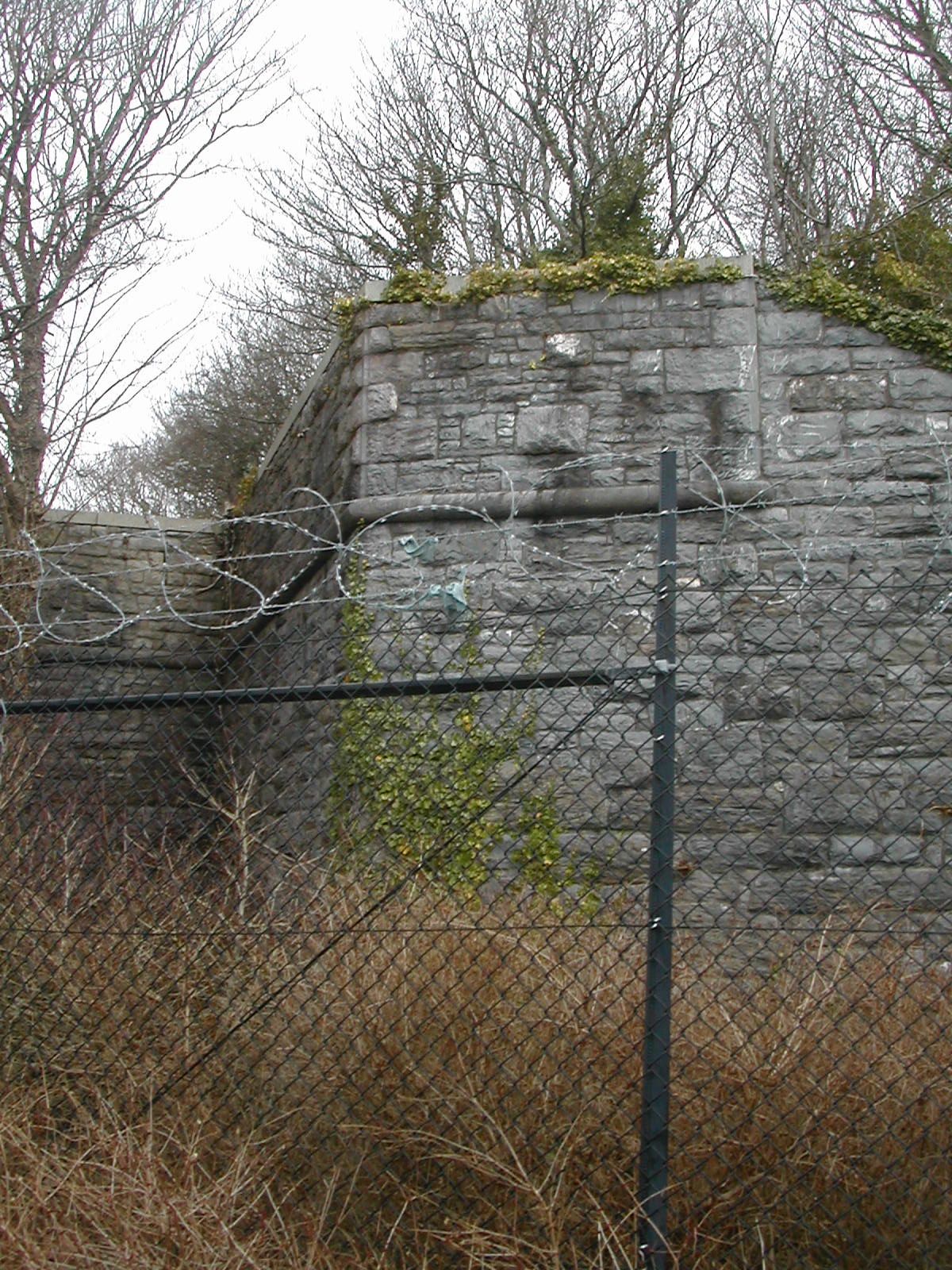
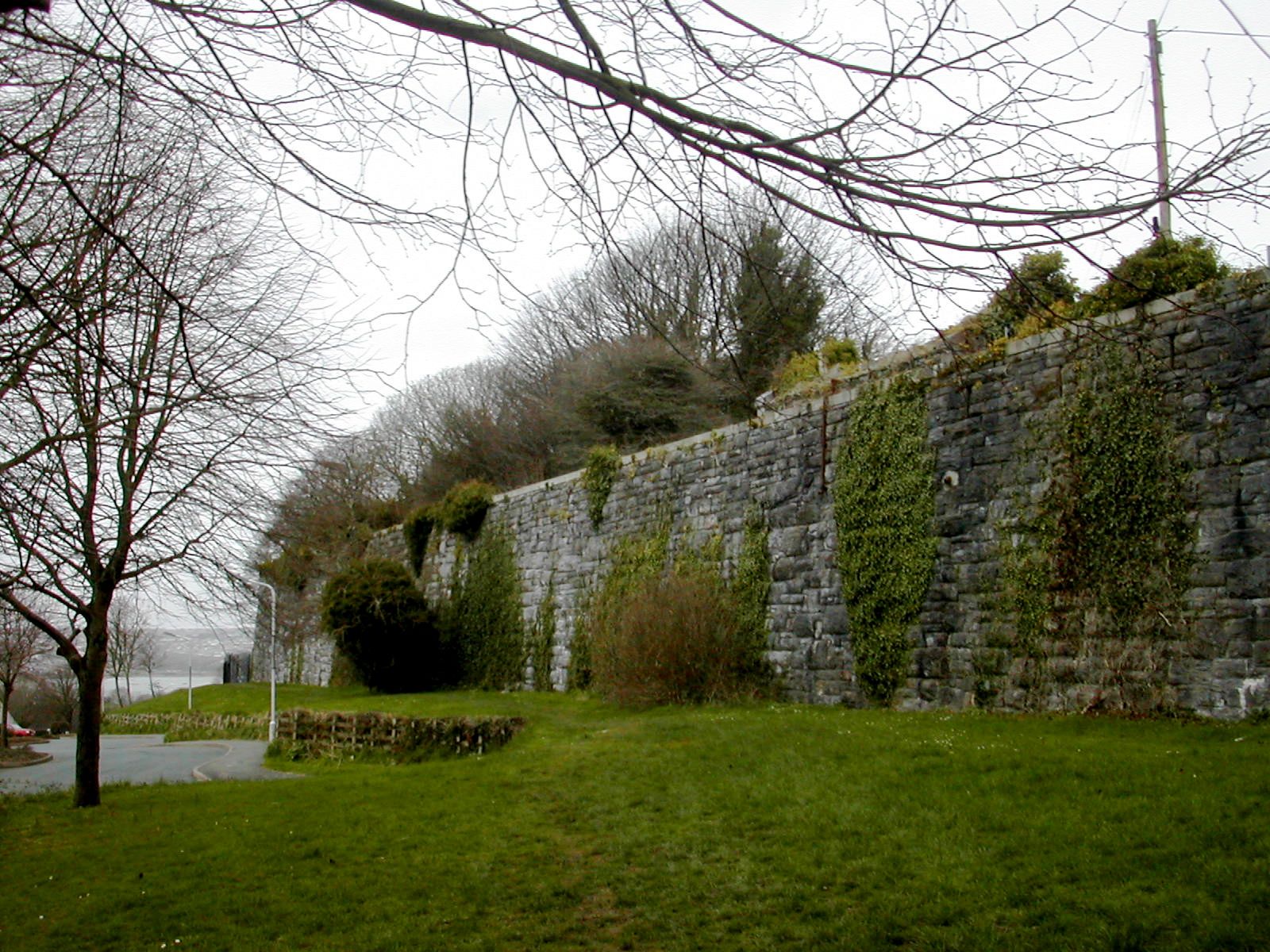
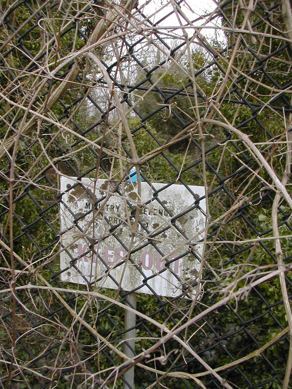
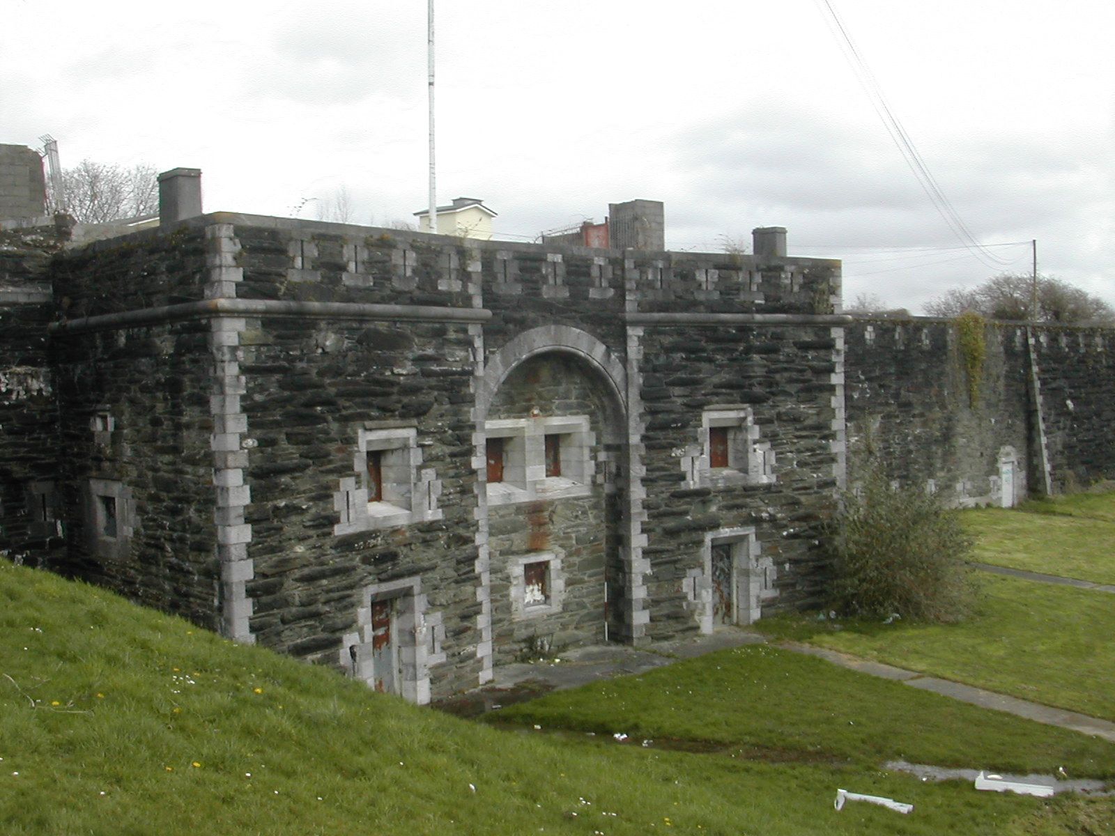
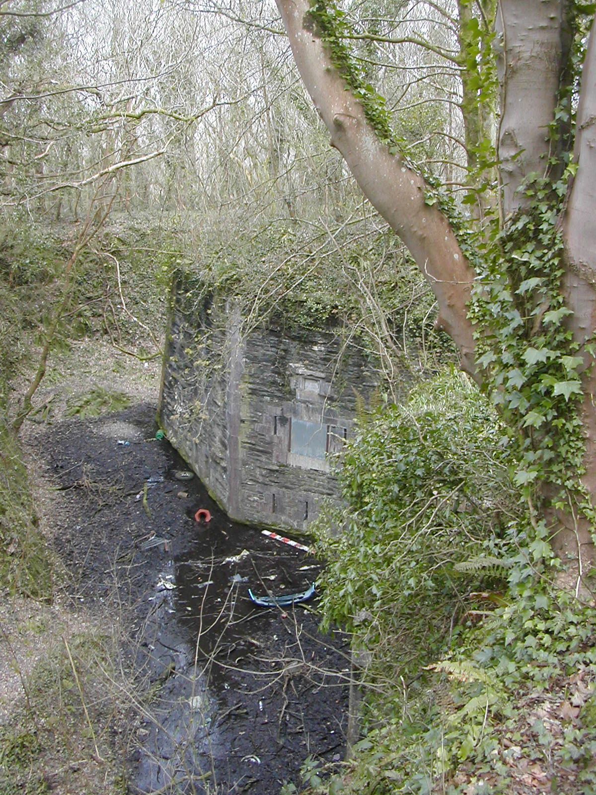
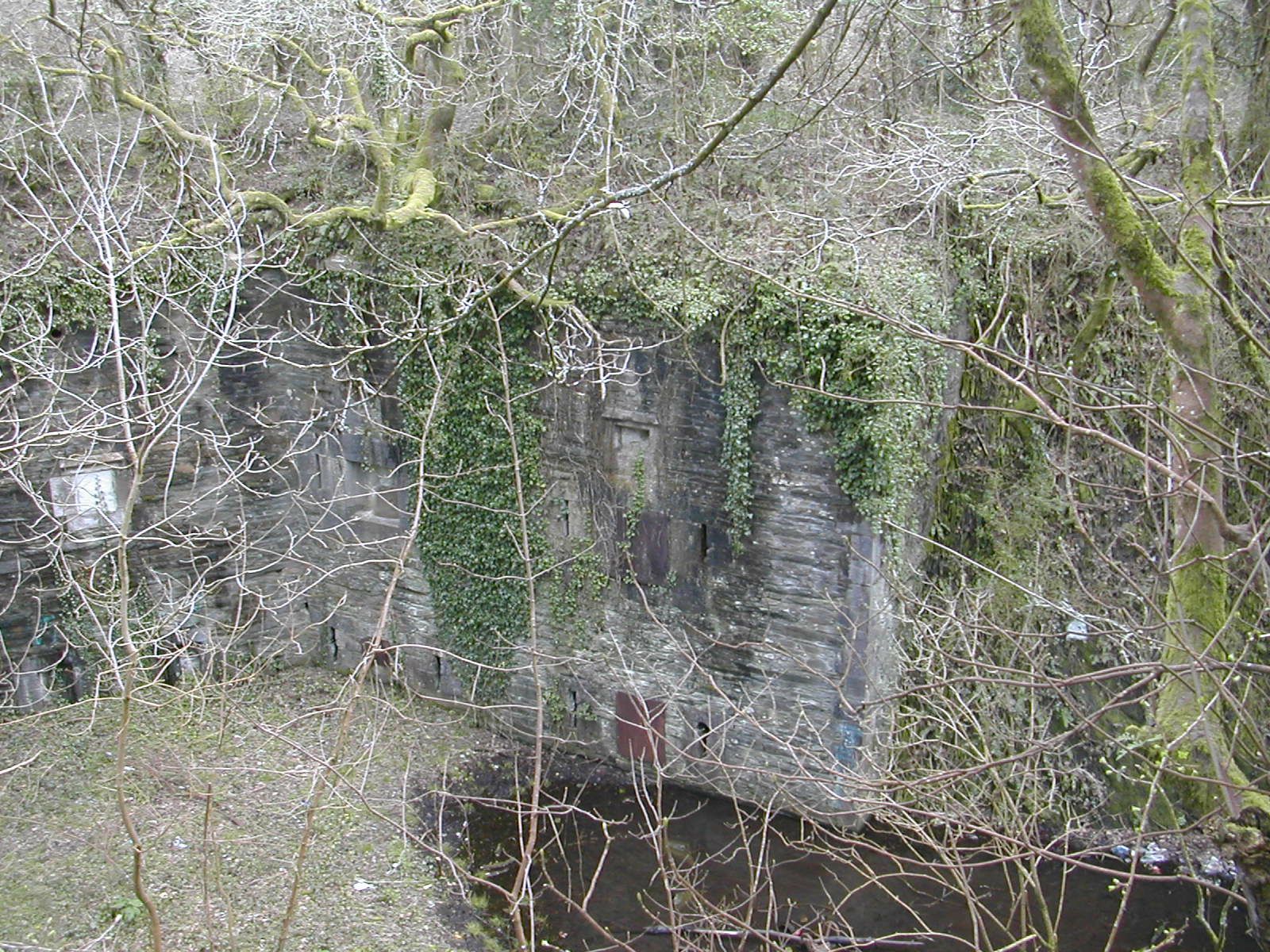
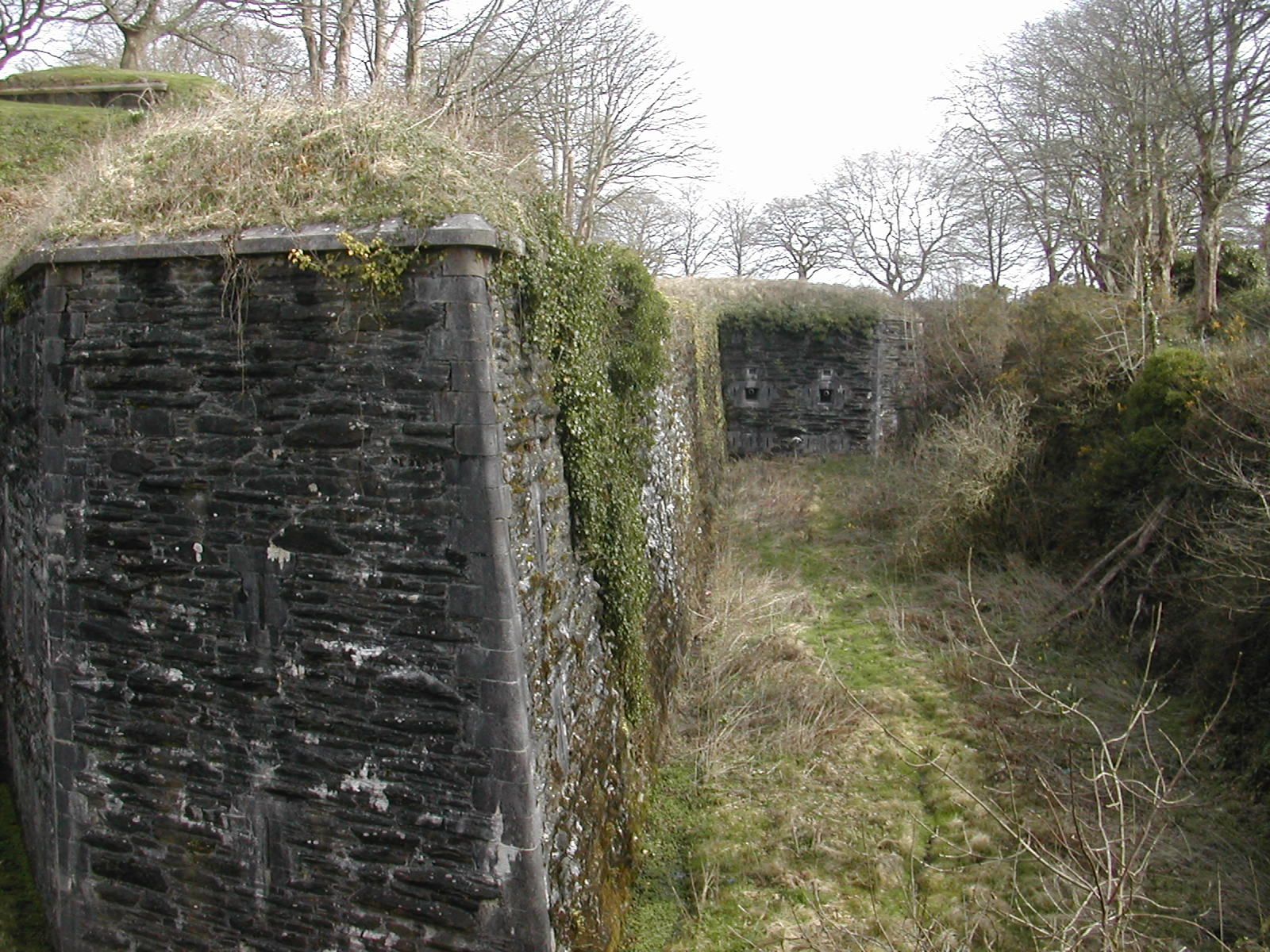
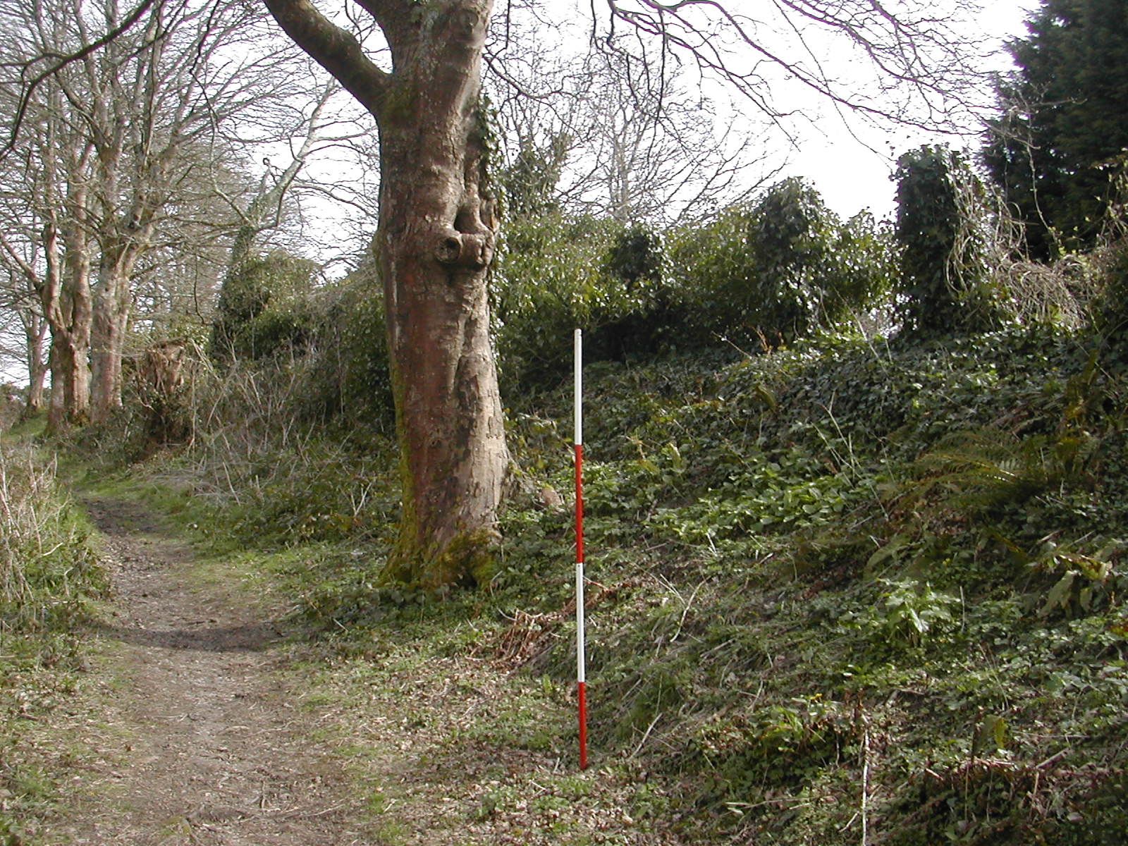
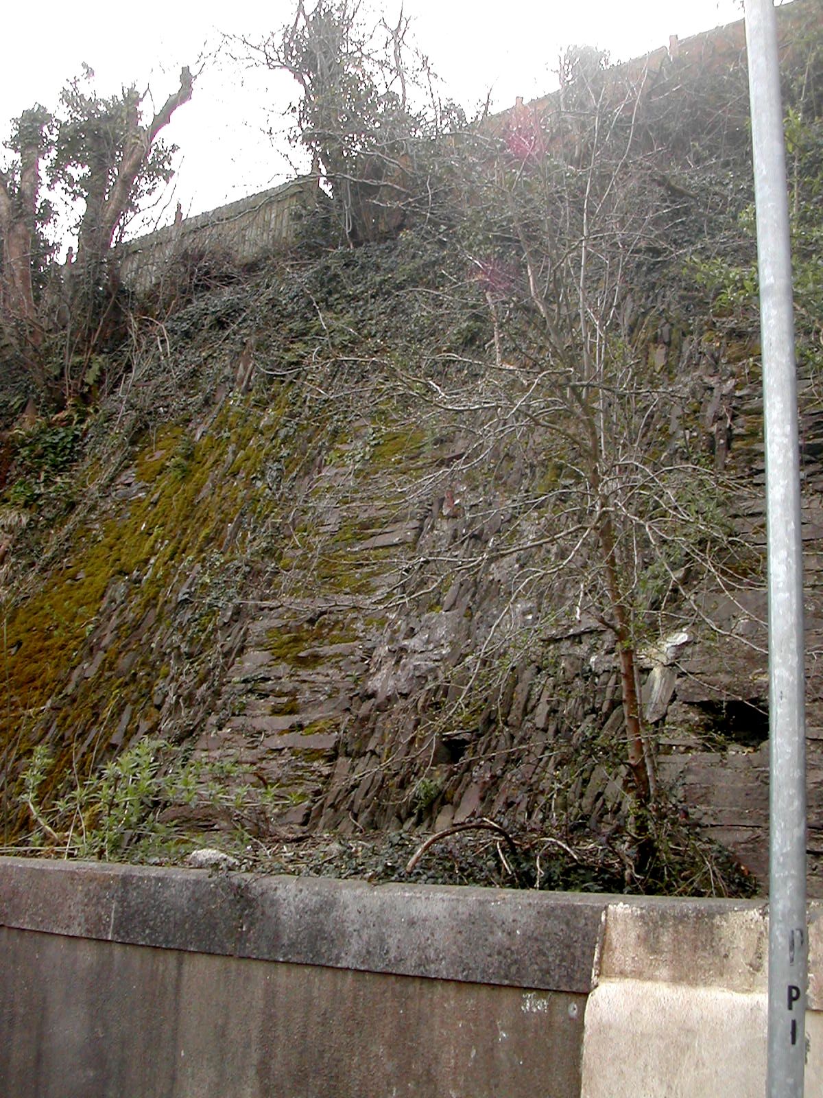
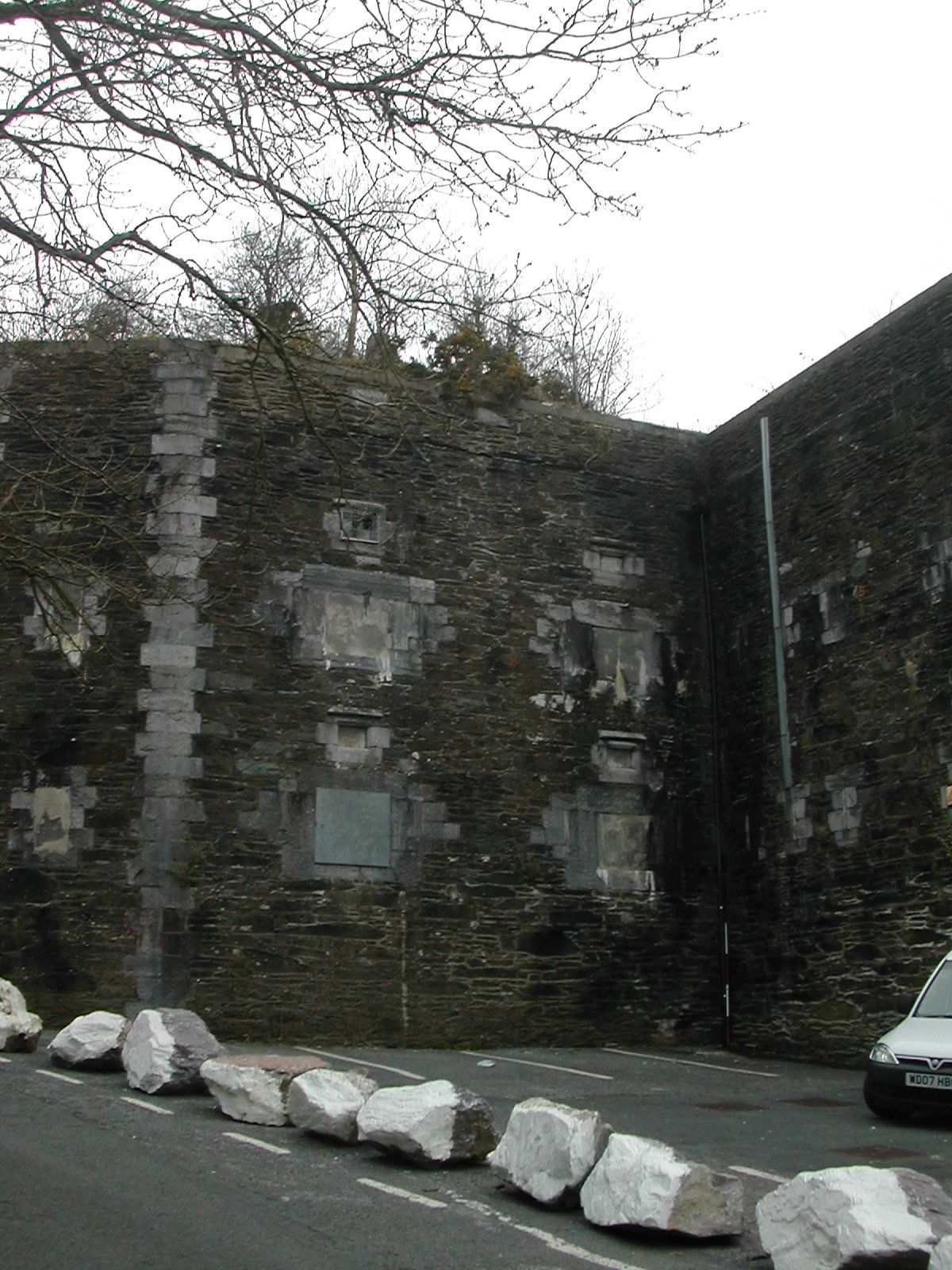
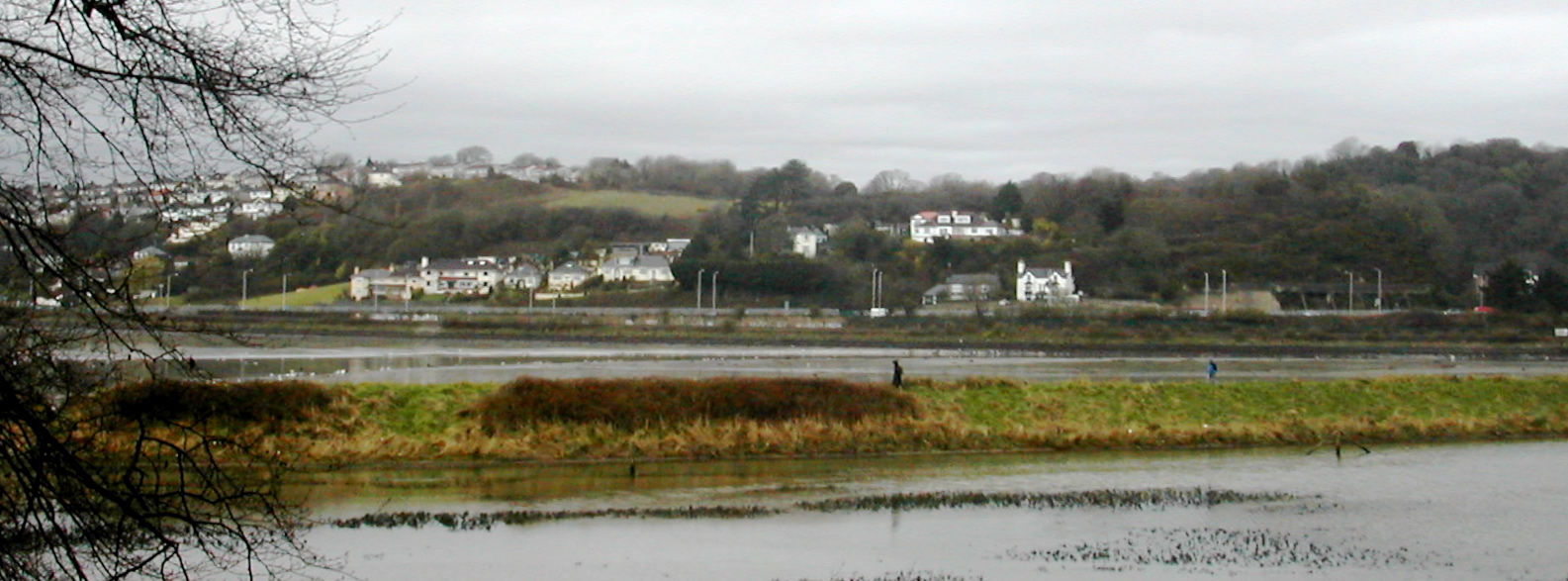
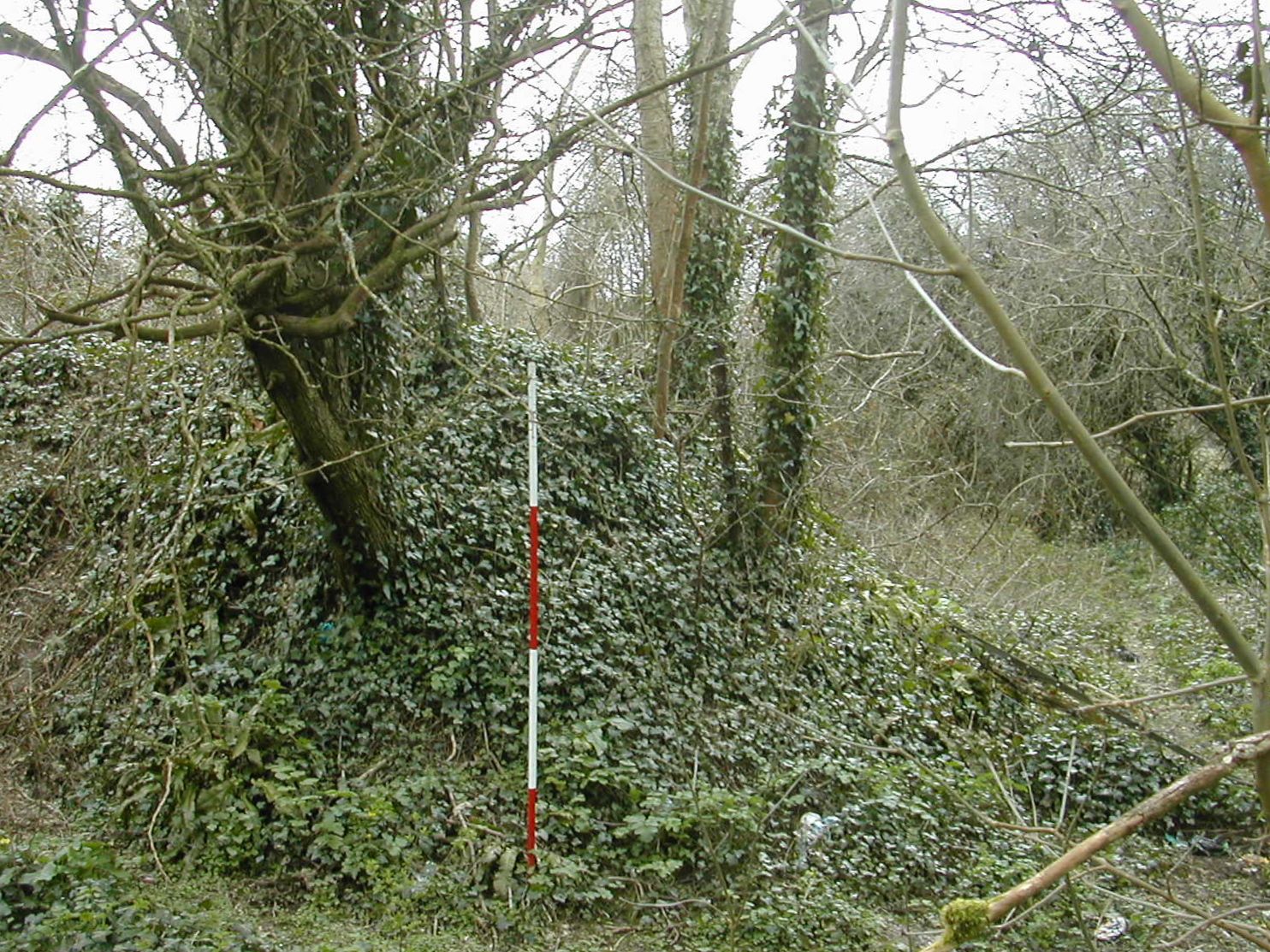
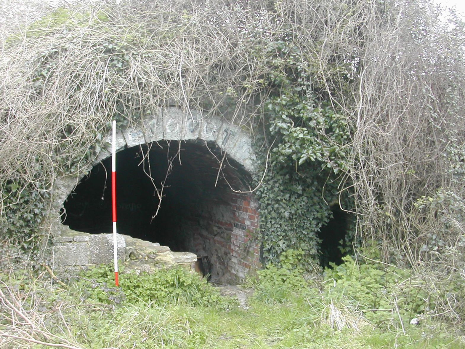
This is the western most work in the line and dominates the valley of the Tamar to the west. It was completed in 1868 at a cost of 17,630 GBP as a casemateed barrack for 60 men with 15 guns and 6 mortars mounted in open batteries. Armaments were removed from the site in 1893 although it may have been used as an observation post during World War II. By 1974 it was in use as a naval ammunition store. Today it is derelict but remains naval property and is well fenced and secure. The adjacent fields are signed as being 'off limits' but a local informant reported that many people use these fields to walk their dogs. The rear wall and gate remains in good condition but the ramparts and ditch are heavily overgrown. Access points to internal spaces are mainly bricked up. There seems to be no trace of the linear defences which characterise much of the work extending further west a distance of some 750 metres down to the water's edge but the line of the original track approaching the fort is clear as a terraced way snaking its way in from the south. This is backed by a large shallow bank up to 2 metres high and 15 metres wide which heads south east for around 80 metres. The curve of the track takes it round to the east where it joins the line of the well preserved bank in St. Budeaux Cemetery. A group participating in the UK UE Urbex Urban Exploration Forum has posted some interesting views of the current state of the battery on their web site . However for those with a penchant for poking about in forbidden places it is worth noting that the 'Community Risk Register' for Devon and Cornwell notes the possibility for, "Fire or Explosion at Underground Munitions Storage and Explosive Processing Areas. Defence Storage and Distribution Agency, Ernesettle... Explosion causing blast damage and scattering of debris over a wide area. Possible fatalities, serious injury and damage to property"! Palmerston Fort Society Log Page
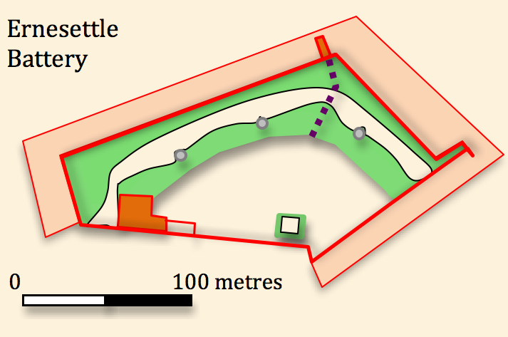
Ernesettle Battery SX 448592
This is the western most work in the line and dominates the valley of the Tamar to the west. It was completed in 1868 at a cost of 17,630 GBP as a casemateed barrack for 60 men with 15 guns and 6 mortars mounted in open batteries. Armaments were removed from the site in 1893 although it may have been used as an observation post during World War II. By 1974 it was in use as a naval ammunition store. Today it is derelict but remains naval property and is well fenced and secure. The adjacent fields are signed as being 'off limits' but a local informant reported that many people use these fields to walk their dogs. The rear wall and gate remains in good condition but the ramparts and ditch are heavily overgrown. Access points to internal spaces are mainly bricked up. There seems to be no trace of the linear defences which characterise much of the work extending further west a distance of some 750 metres down to the water's edge but the line of the original track approaching the fort is clear as a terraced way snaking its way in from the south. This is backed by a large shallow bank up to 2 metres high and 15 metres wide which heads south east for around 80 metres. The curve of the track takes it round to the east where it joins the line of the well preserved bank in St. Budeaux Cemetery. A group participating in the UK UE Urbex Urban Exploration Forum has posted some interesting views of the current state of the battery on their web site . However for those with a penchant for poking about in forbidden places it is worth noting that the 'Community Risk Register' for Devon and Cornwell notes the possibility for, "Fire or Explosion at Underground Munitions Storage and Explosive Processing Areas. Defence Storage and Distribution Agency, Ernesettle... Explosion causing blast damage and scattering of debris over a wide area. Possible fatalities, serious injury and damage to property"! Palmerston Fort Society Log Page
Ernesettle
Battery from SE
 | 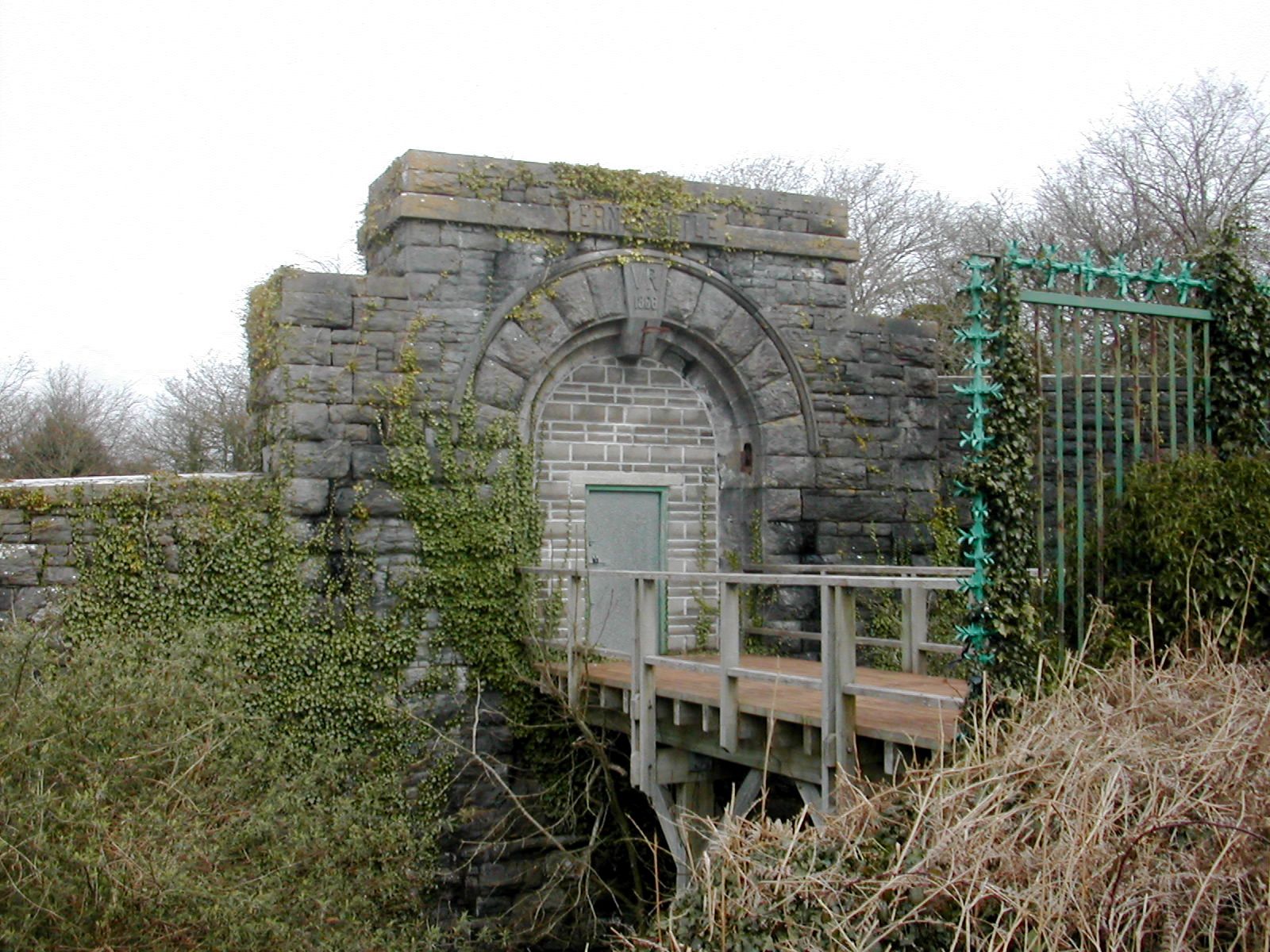 |  |
| Ernesettle Battery, original approach looking S | Ernesettle Battery main gate from S | Ernesettle Battery large bank looking S |
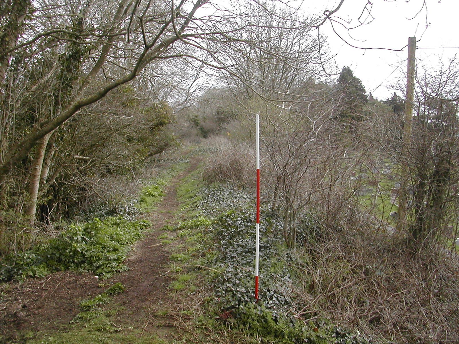
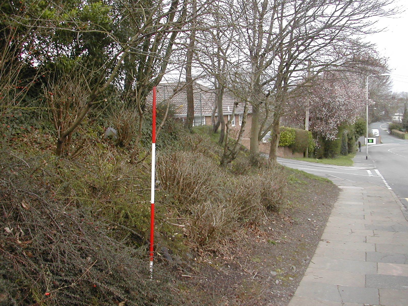
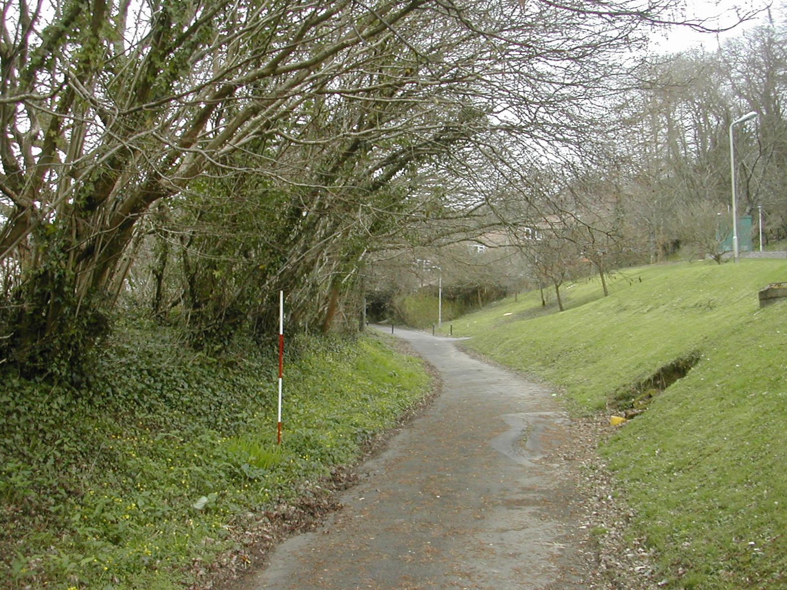
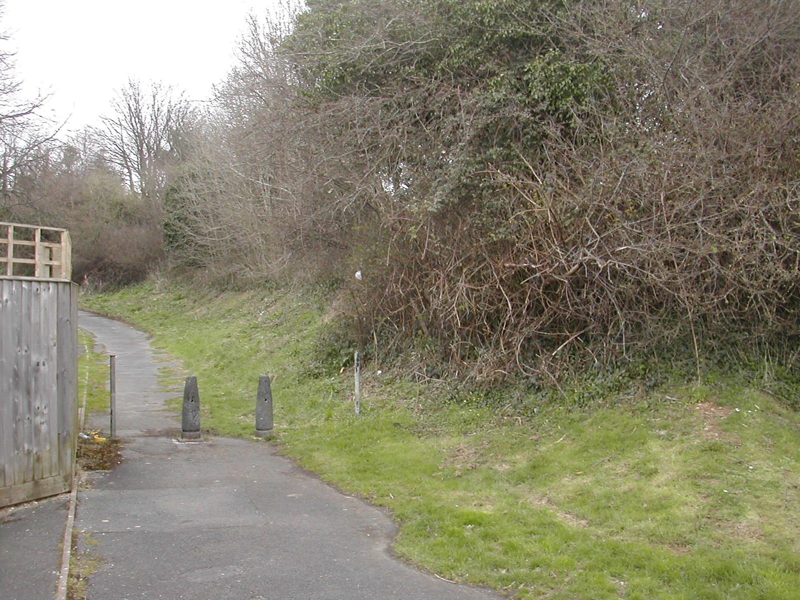
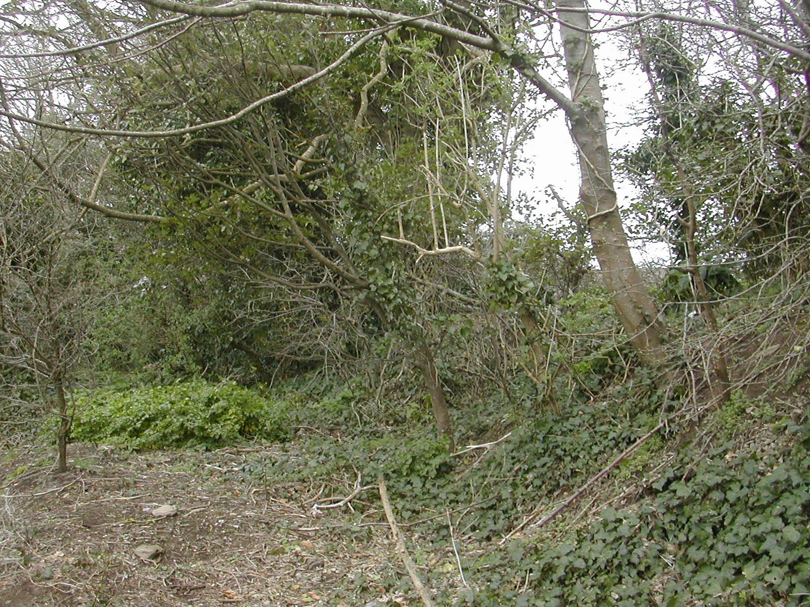
North of the battery is the
line of a terraced way
which runs along the face of the slope in an east - west
direction almost as far as Agaton Fort. This is shown as a track way on
the 1894 OS map and may represent earlier access to the Tamar valley
from the village of Agaton prior to the construction of the forts or
possibly the line of a temporary tramway to facititate work on the
line.
 |
 |
| Terraced way NE of Ernesettle looking W to Ernesettle Battery | Terraced way NE of Ernesettle looking E to Agaton Fort |
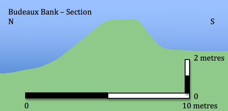
The
modern B3413 (Crownhill
Road) runs along the line of the military road whilst a
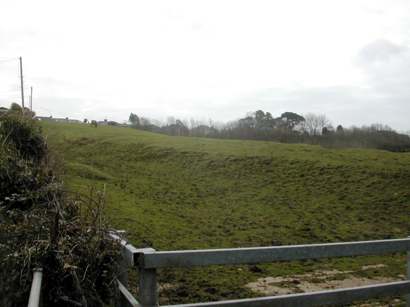
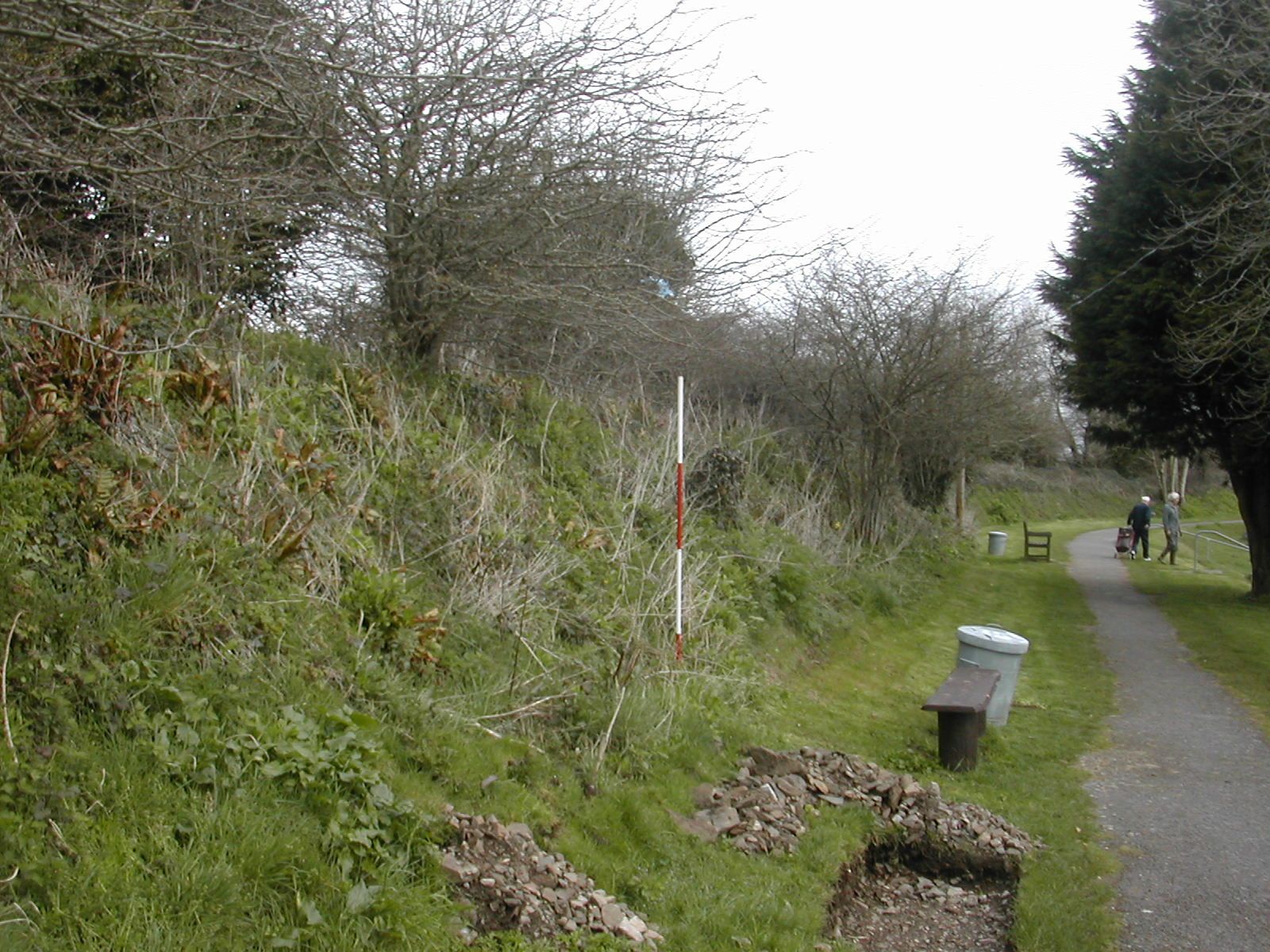
large bank is visible roughly half way between Ernesettle and Agaton
running west from St. Budeaux Church in a curving line for around 250
metres.This bank has a well preserved profile and is in the care of the
church. Some of the vegetation has been cleared from it and a path
laid out along the eastern portion which gives access to the
churchyard. Beyond it to the north west are the faint traces of
allotment gardens which show up very well in aerial photographs. These
were often set aside
for military use to enable the garrison troops to improve the diet for
themselves and their families. This particular plot seems earmarked for
development. At the western end of the bank are the partially buried
remains of an elegant metal gate and gatepost. Examples of this type are widely
seen throughout the Plymouth military zone and presumably represent a
standard issue military pattern for the works.
 |  |  |
| Budeaux Bank from NW looking across former allotments | Budeaux Bank, rear slope looking NE | Budeaux Bank, top looking NE |
 |  |
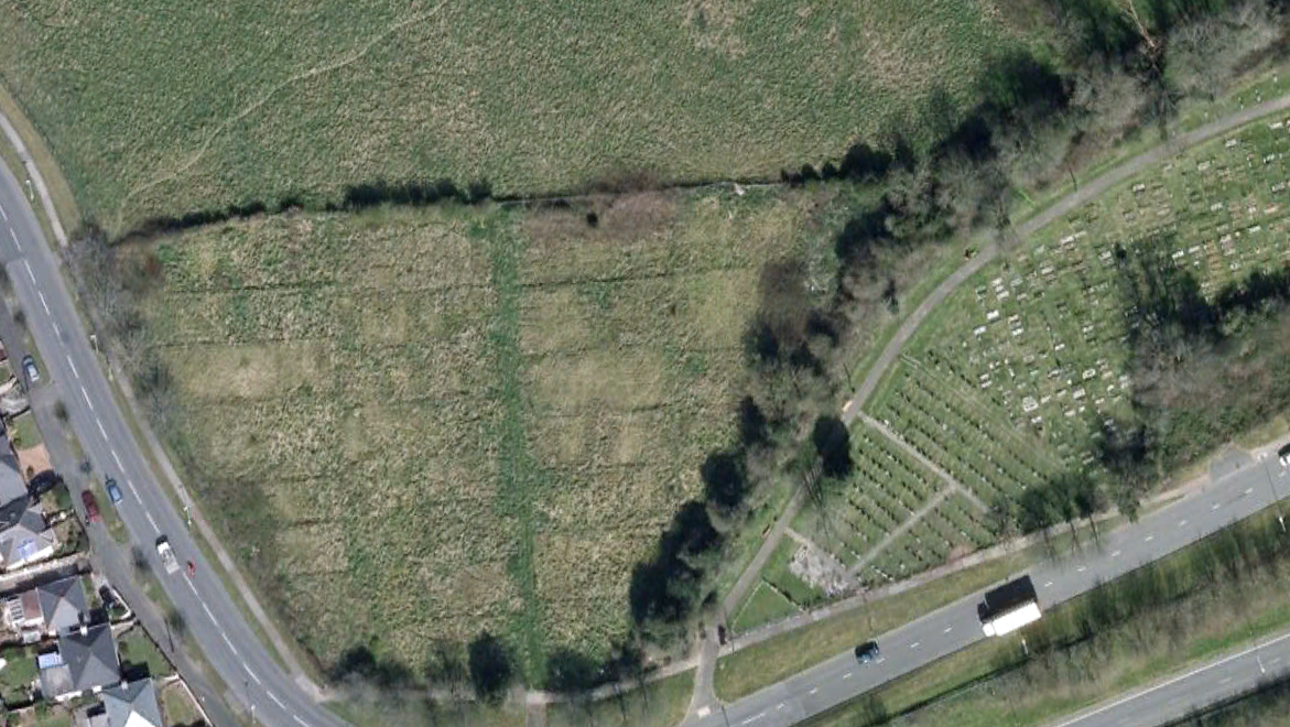 |
| Looking NE from Budeaux Bank to Agaton Fort | 19th. century 'military pattern' Gatepost | Budeaux Bank, aerial view of W section and 'soldiers' gardens'. N to the top |
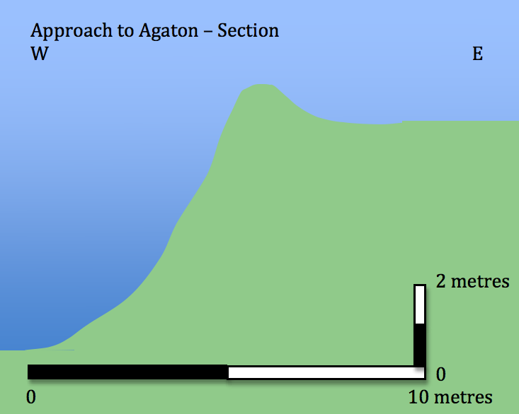
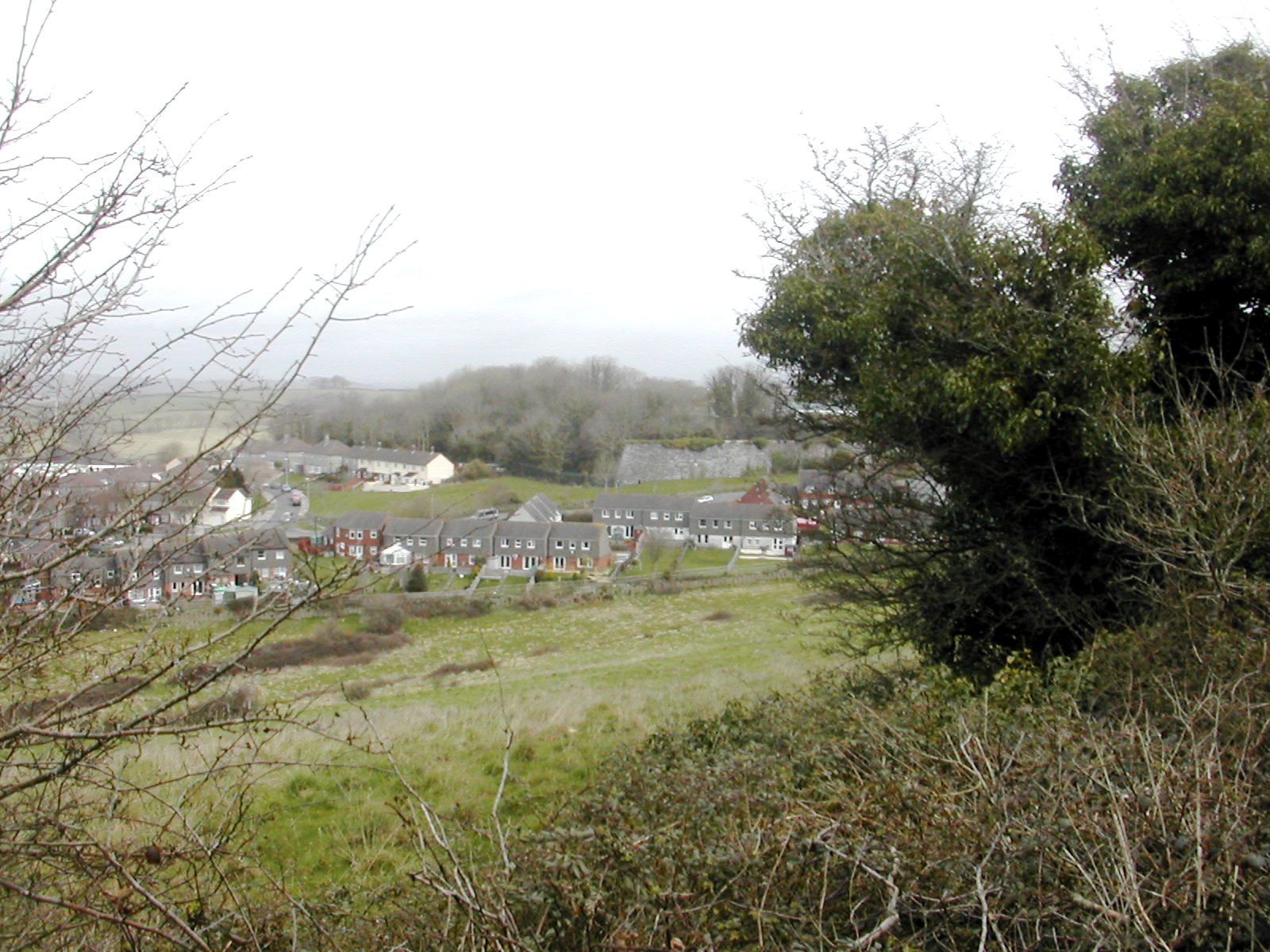
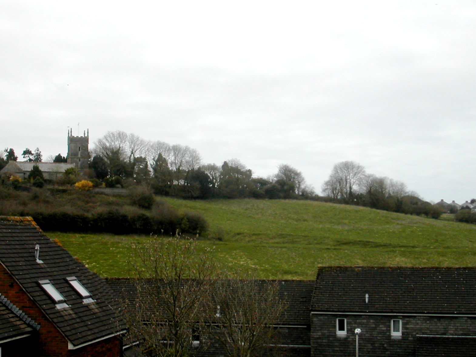
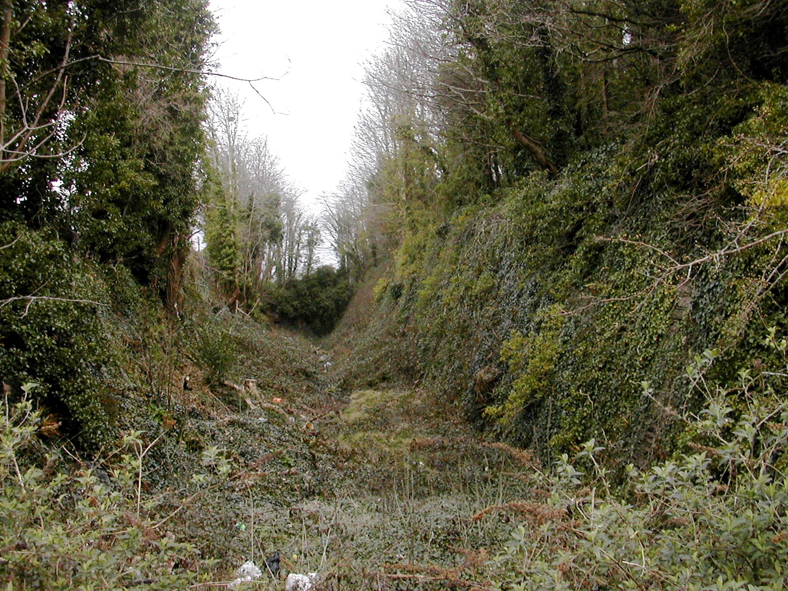
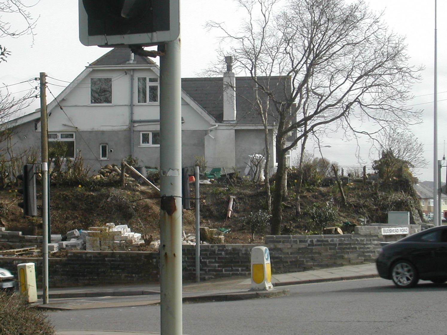
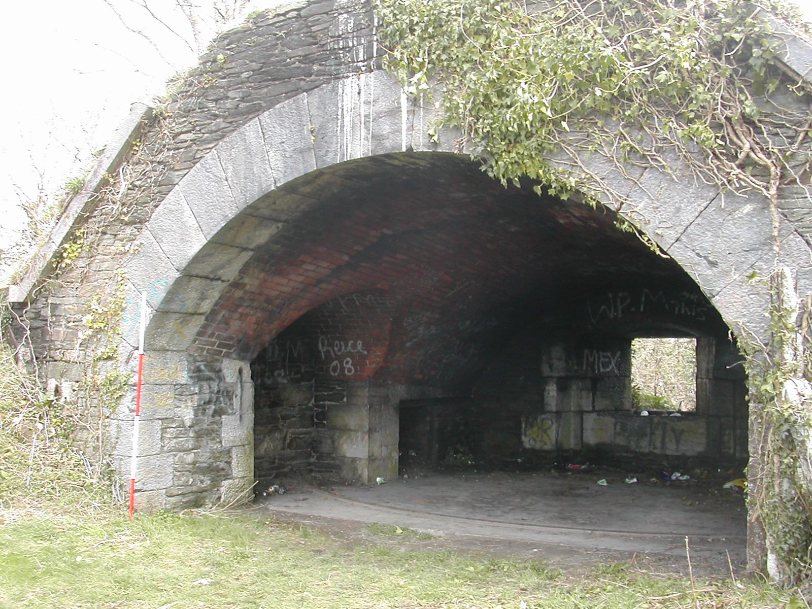
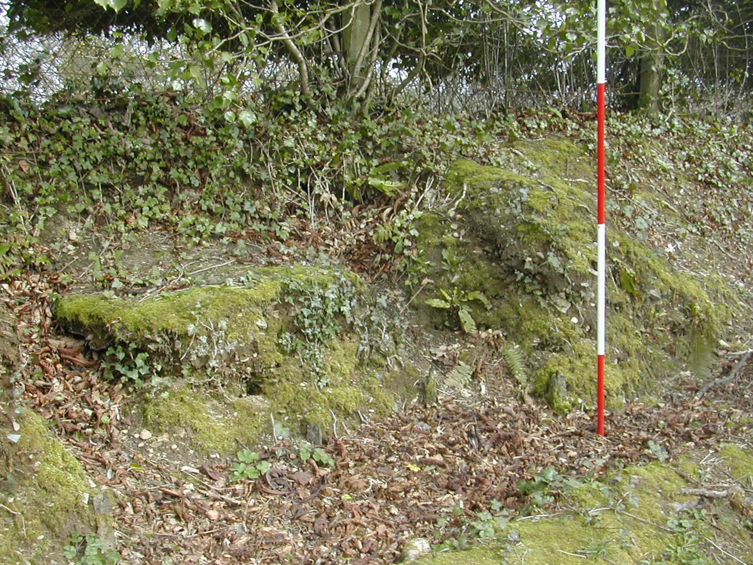
Agaton Fort SX 455595
Agaton stands forward of the main line on a rounded knoll which offers an arc of fire sweeping round from west to east and covering the ground in front of Ernesettle and Knowles. The approach to the fort is shown on early maps as being protected by a variety of earthworks, some of which remain. The ground from Budeaux Bank round to the fort is steeply terraced and this terrace is topped by a low back as it approaches the fort. banks which originally flanked the military road can be seen at the top of Budshead Road.
Whilst the casemates, ramparts and ditch remain well preserved, if inaccessible, the centre of the fort has been flattened to accommodate a vehicle testing station, as a result the fort is on English Heritage's 'at risk' register. The ditch is heavily overgrown and a certain amount of rubbish has been dumped in it. The fort is pentagonal in shape with a number of caponiers approached by tunnels from the terreplein flanking the ditch. Before modification the armament consisted of 20 guns in open batteries and one haxo casemate on the west flank. There were also two mortar 'nests' to the east and west of the rampart. Subsequent changes involved the construction of four further Haxo casemates and eight open positions for 64-pounder guns. There is a moving account on the BBC's "WW2 People's War" website mentioning the use of Agaton as an air raid shelter. Whilst access is for 'authorised' visitors only the walk up to the reception desk affords an opportunity to view the interior of the fort.
Agaton stands forward of the main line on a rounded knoll which offers an arc of fire sweeping round from west to east and covering the ground in front of Ernesettle and Knowles. The approach to the fort is shown on early maps as being protected by a variety of earthworks, some of which remain. The ground from Budeaux Bank round to the fort is steeply terraced and this terrace is topped by a low back as it approaches the fort. banks which originally flanked the military road can be seen at the top of Budshead Road.
 |
 |
| View to SW towards Budeaux Bank from Agaton | Agaton Fort, W ditch looking N |
 |
 |  |
| Agaton Fort, SW corner from SW |
Agaton Fort, Entrance from SW | Agaton Fort, SE corner from SW |
Whilst the casemates, ramparts and ditch remain well preserved, if inaccessible, the centre of the fort has been flattened to accommodate a vehicle testing station, as a result the fort is on English Heritage's 'at risk' register. The ditch is heavily overgrown and a certain amount of rubbish has been dumped in it. The fort is pentagonal in shape with a number of caponiers approached by tunnels from the terreplein flanking the ditch. Before modification the armament consisted of 20 guns in open batteries and one haxo casemate on the west flank. There were also two mortar 'nests' to the east and west of the rampart. Subsequent changes involved the construction of four further Haxo casemates and eight open positions for 64-pounder guns. There is a moving account on the BBC's "WW2 People's War" website mentioning the use of Agaton as an air raid shelter. Whilst access is for 'authorised' visitors only the walk up to the reception desk affords an opportunity to view the interior of the fort.
 |
 |
|
| Agaton Fort, bank W of approach road from S | Agaton Fort, gorge wall from SE | Agaton Fort, old MOD sign |
 |
 |
| Bank defending approach to Agaton, W side of Budshead Rd. from SE | Bank defending approach to Agaton, E side of Budshead Rd. from SW |
Nineteenth century maps show that Agaton seems to have been connected with the next work on the line: Knowles Battery, by two lines of communication. The first was the main military road just set a little back from the crest of the ridge and protected by a substantial earth bank, today followed by Crownhill Road. The second which appears to be more of a covered way runs slightly down the face of the ridge and is currently represented by Marina Road .
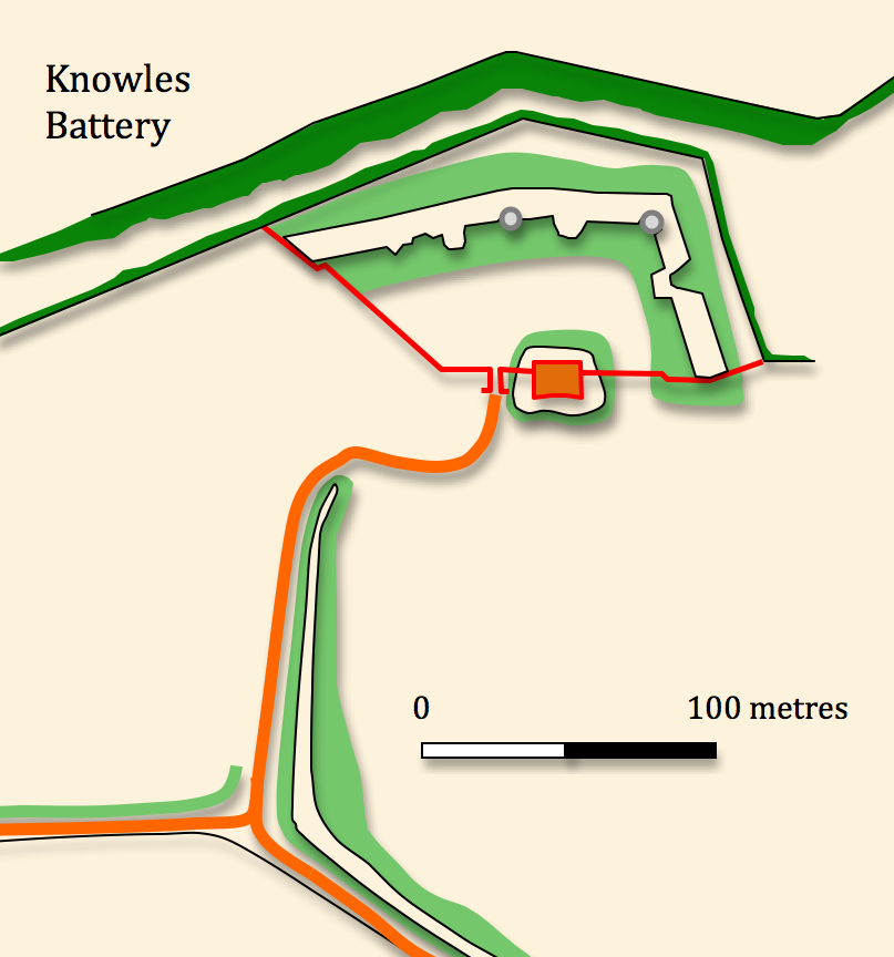
Knowles Battery SX
463596
Presently occupied by the premises of Knowle Primary School this work was constructed on a knoll which again pushes forward a little from the main line of defence and was approached by a long curving defended way from the south east. The gorge wall and and a two storey guardhouse are well preserved although the original entrance to the west has been destroyed. All of the gun positions and magazines on the ramparts have been demolished or covered over except for a single 64-pounder rifled muzzle loader position at the NE salient. The northern side of the work was protected by a rock cut ditch of which only the southern face remains, the rest having been removed by modern housing development. the rampart is quite overgrown but accessible although obviously the grounds of the primary school remain out of bounds. The stone built portions of the work whilst shuttered and secure are not well cared for. There is considerable water damage and some grafitti.
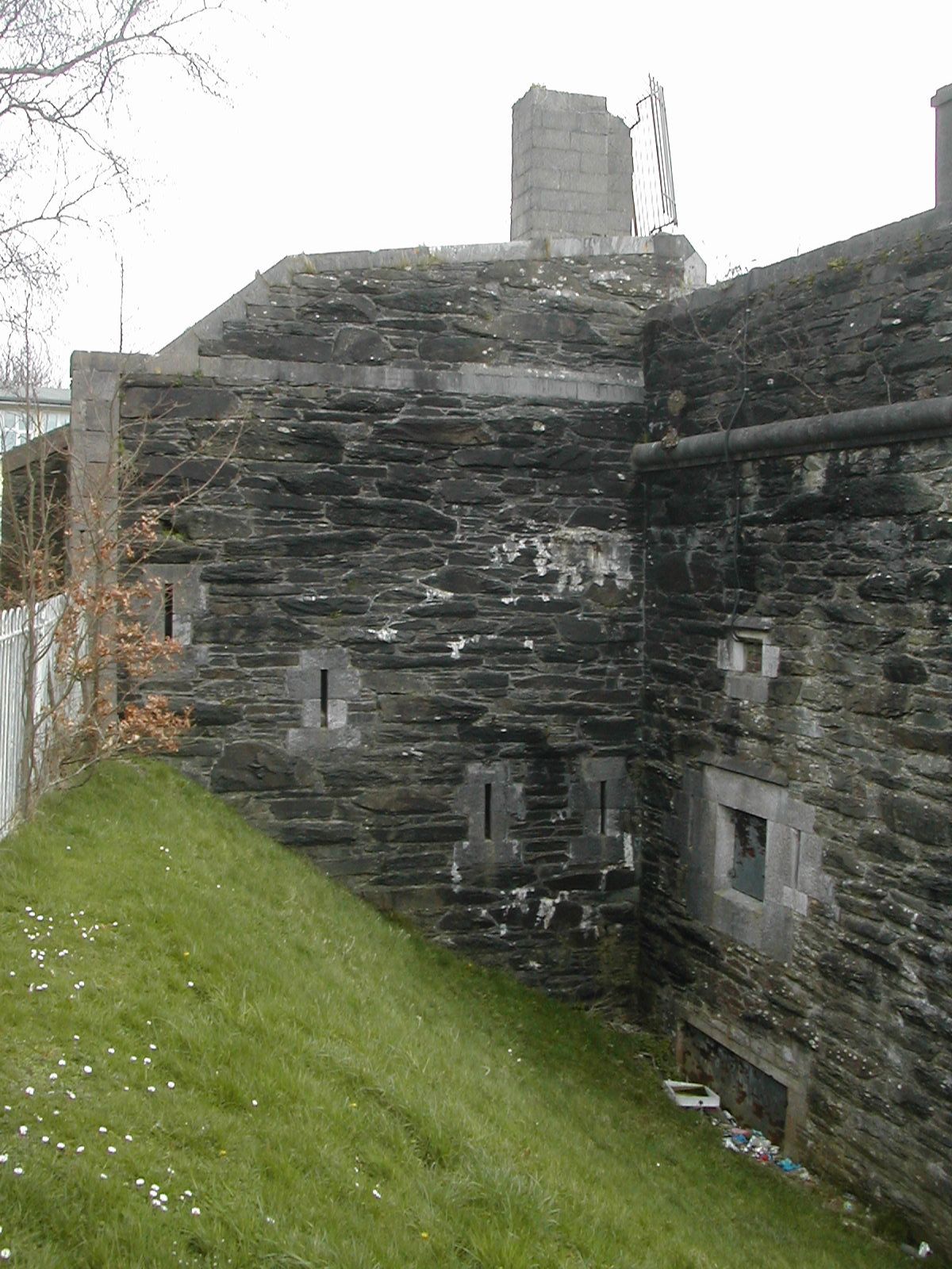
Knowles Battery W flank of guardhouse
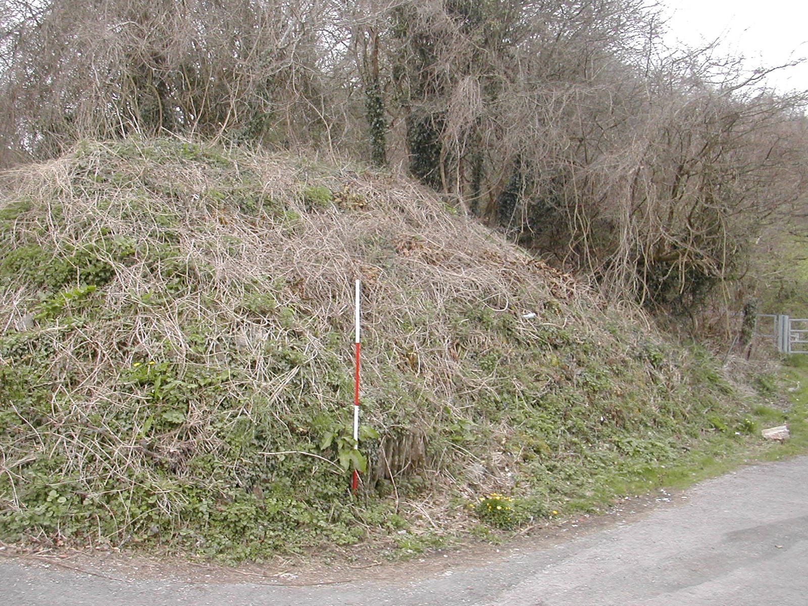
from SW
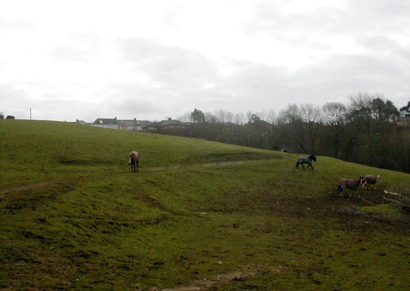
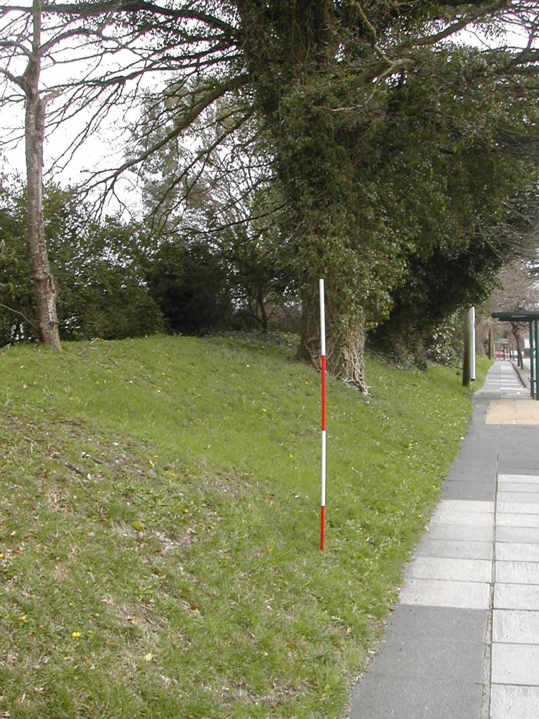
Several sections of the protective bank which would have covered the military road exist south of Knowles Battery and from there to the east towards Woodlands Fort. Up to 2.5 metres high in the vicinity of the junction between Crownhill Road and Ringmore Way the bank is slightly diminished towards its eastern end dropping down to a metre or less. In a number of places it has been destroyed by modern housing developments. Extensive modern landscaping with terracing makes it impossible to identify any forward lines between Knowles and Woodlands but the fall of the land suggests that the line of the military road and its bank may have been deemed sufficient.
Bank 600 metres west of Woodland Fort looking E
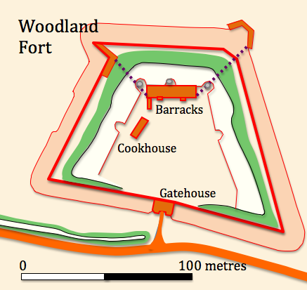
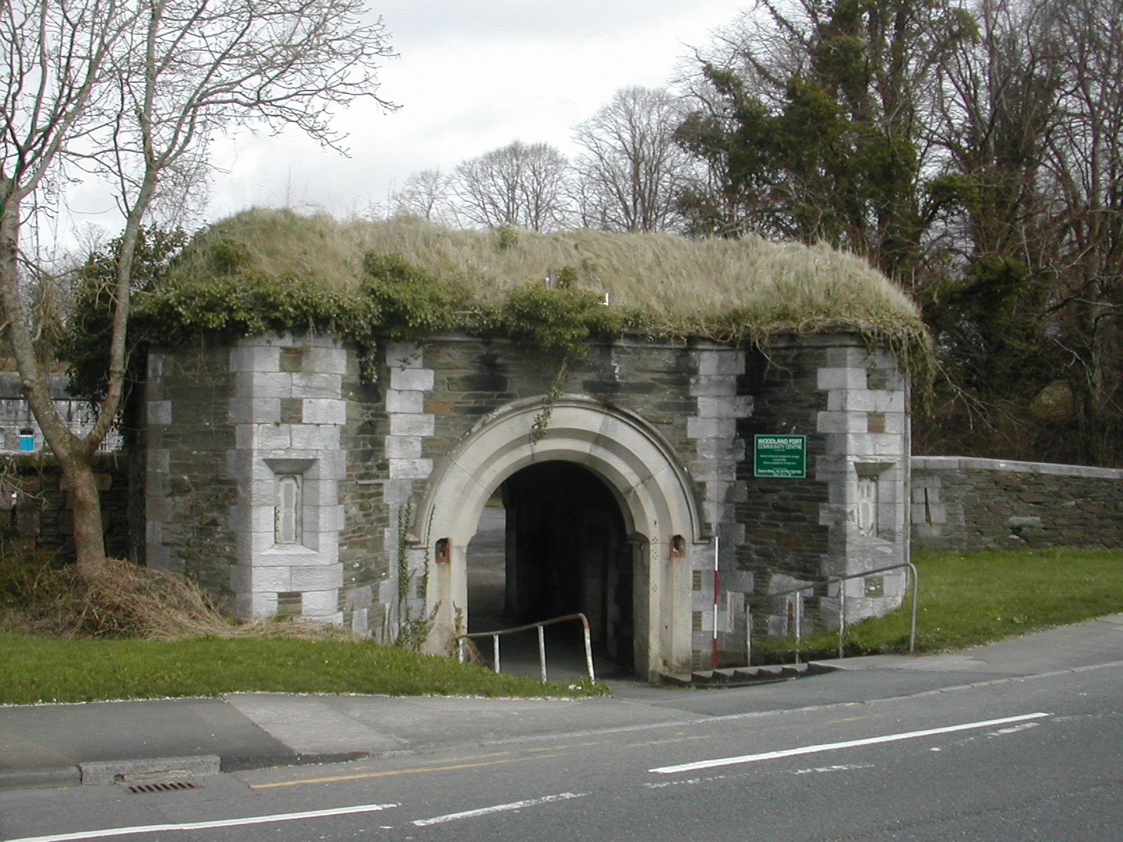
Woodland Fort SX 470593
Sandwiched between the top of the valley slope to the north and the military road to the south this trapezoidal work was completed between 1869 and 1870 at a cost of just under 30,000 GBP. Whilst the previous three works lay some distance in advance of the line of the military support road the lie of the land means that Woodland is on the line. The valley to the north remains a serious obstacle as can be seen by the height of the modern concrete bridge which crosses it shortly to the east of the fort. It was planned to have 16 guns in open batteries plus 2 in casemates to cover the flanks. Hogg writing in 1974 suggested that, "some of the armament was intended to be on Moncrieff mountings behind high parapets". The north and east ditch is flanked by a counterscarp gallery connected to the fort by a tunnel under the rampart and ditch intriguingly explored, photographed and reported on by the 'Derelict Places' team. A caponier flanks the west ditch. Surviving accommodation consists of a two storey barrack block with four vaulted casemates on each floor. The main magazine lies at the east end of the barracks and the cook house still exists on the west of the terreplein although in a state of collapse. Although much of the gorge wall has been destroyed a loopholed section and a small gatehouse fronting on to the road survive. The site is currently occupied by a community centre but is on the English Heritage 'at risk' register because the 'site is prone to vandalism and rubbish dumping'. Access to the site remains open and at present it is possible to complete the entire circuit of the defences following a path on top of the inner scarp face of the ditch thus enabling good views of the counterscarp gallery and caponier. It is also possible to explore the complex details of the rampart top including the haxo casemates and a number of small scale trenches and 'rifle pits' as quite extensive work has been undertaken to clear some of the undergrowth which chokes so many sites. Palmerston Fort Society Log Page
Woodland Fort, barrack accommodation in casemates from S
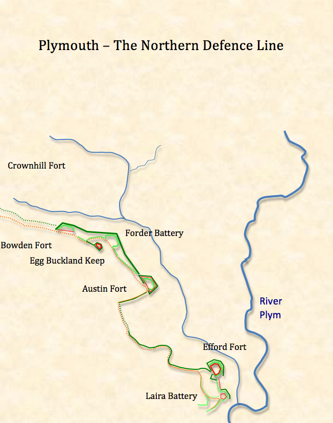
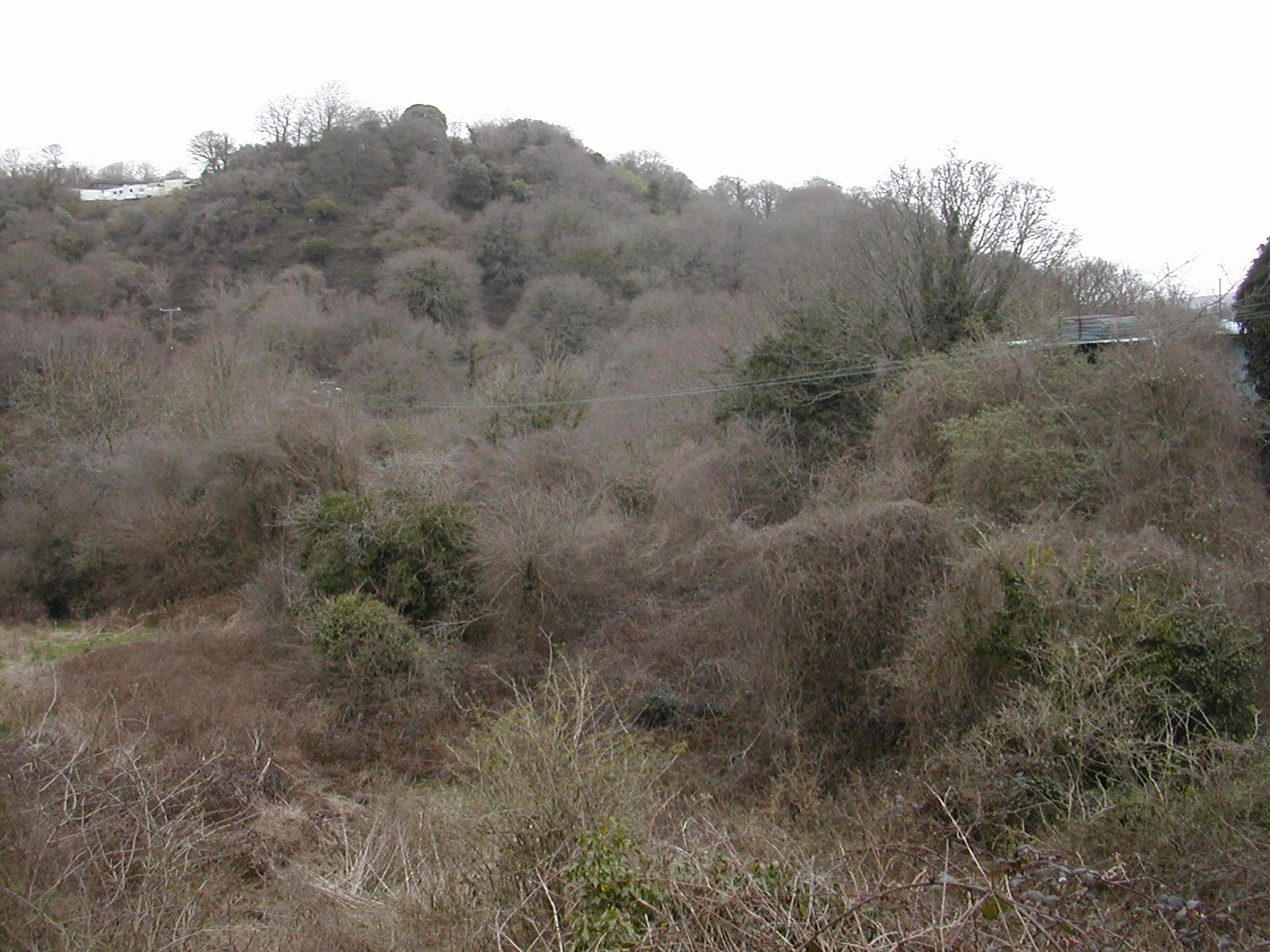
There are few traces of linear works between Woodland Fort and Crownhill. There is a very steep scarp slope running east - west parallel to the line of military road and some 150 metres to the north. There is no sign that this was capped by a bank so again a natural feature may have been regarded as part of the defensive scheme.
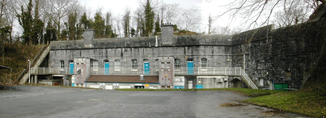
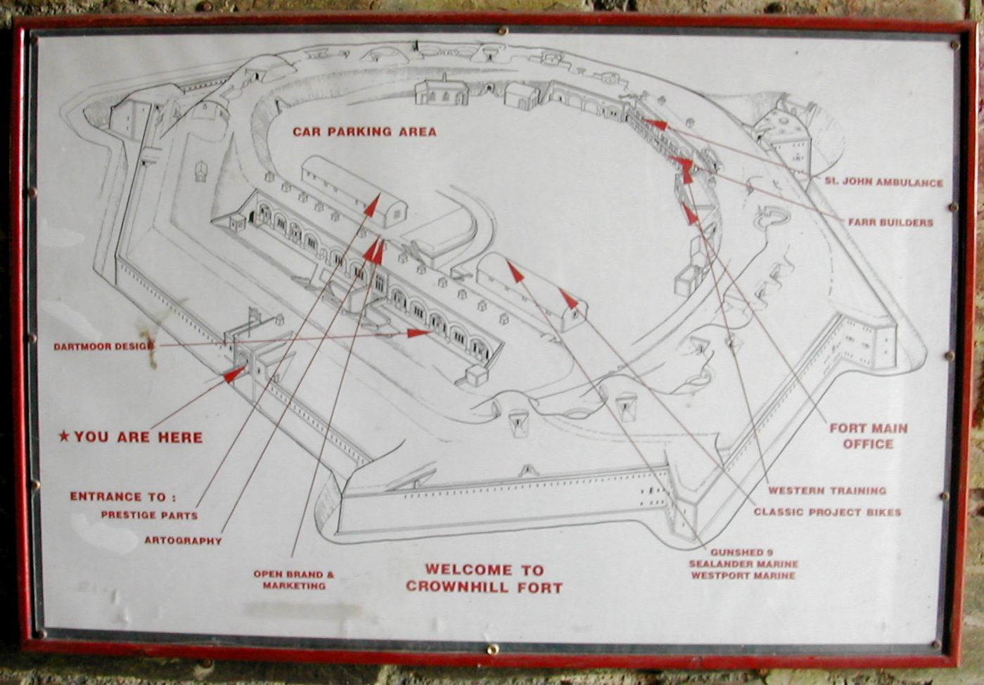
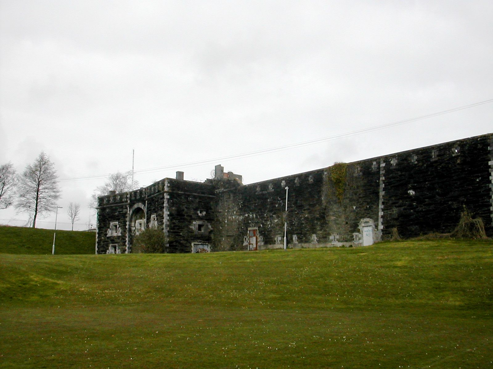
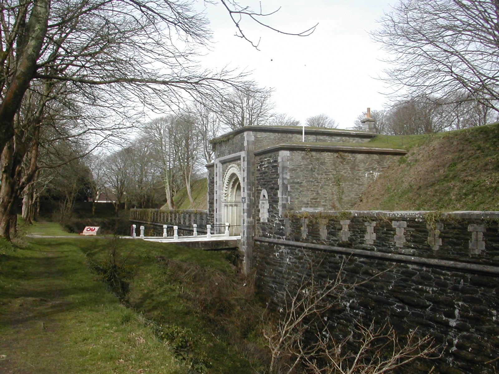
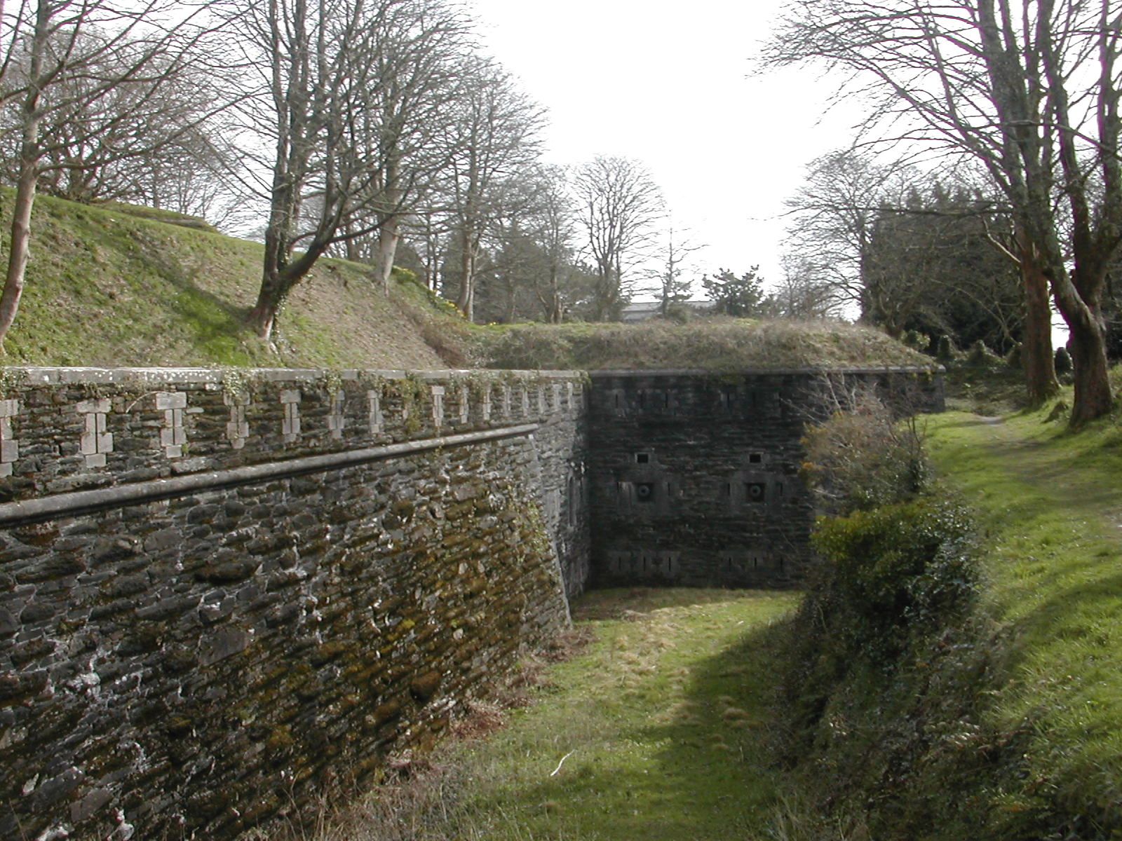
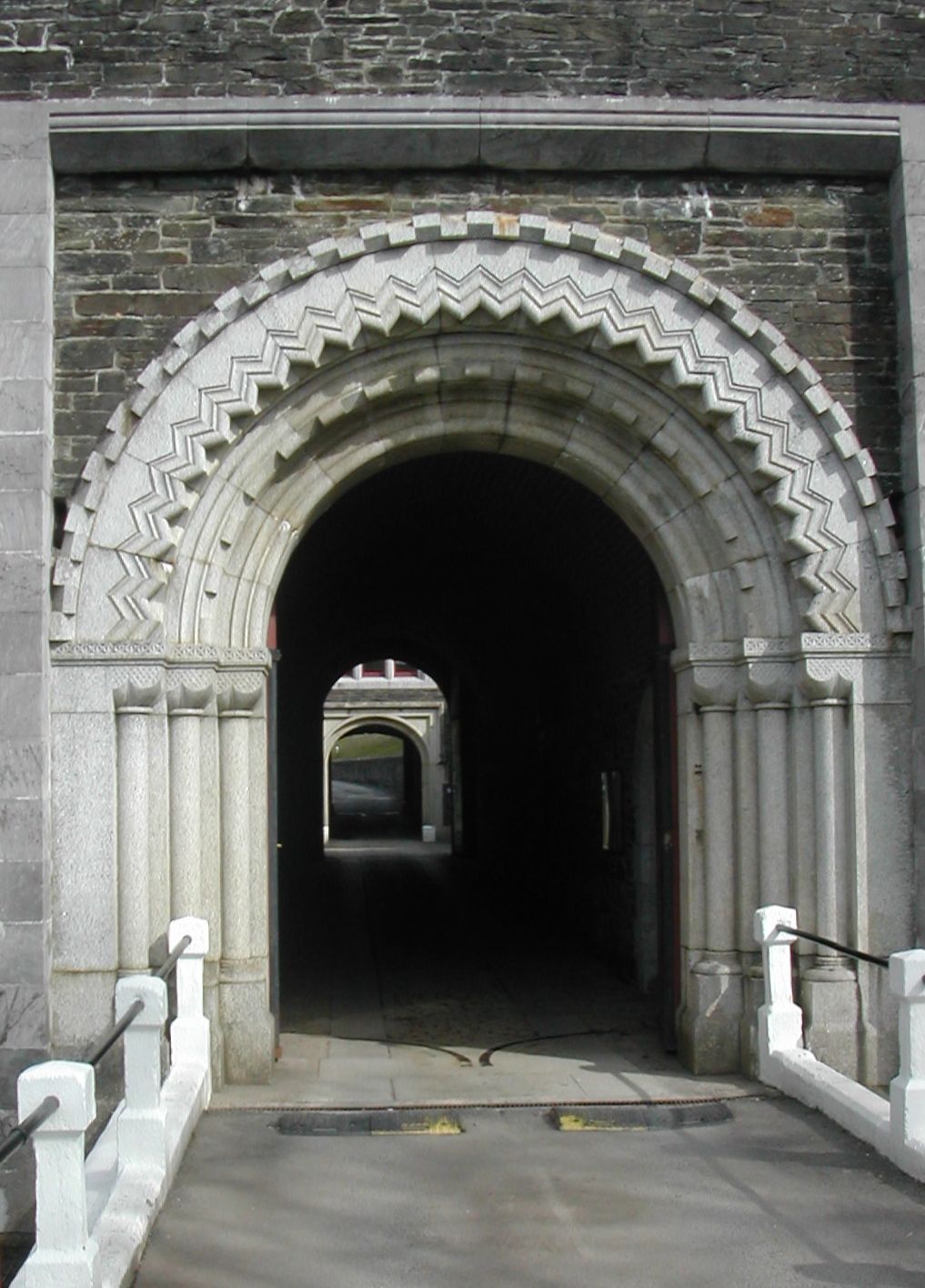
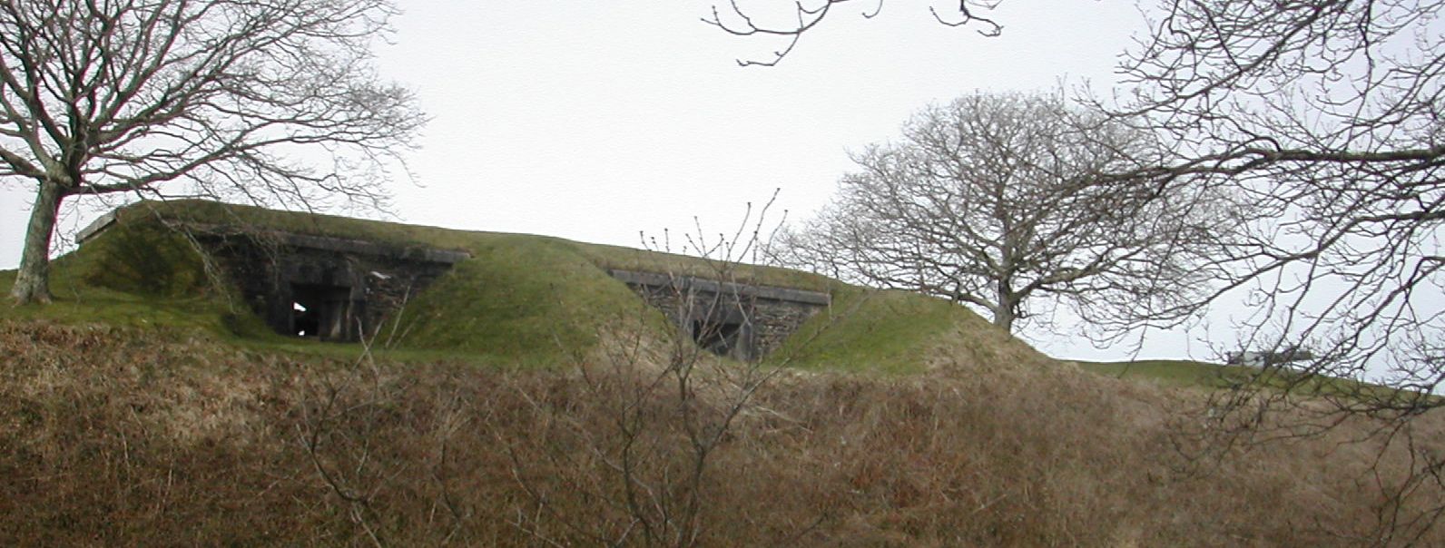
Crownhill Fort
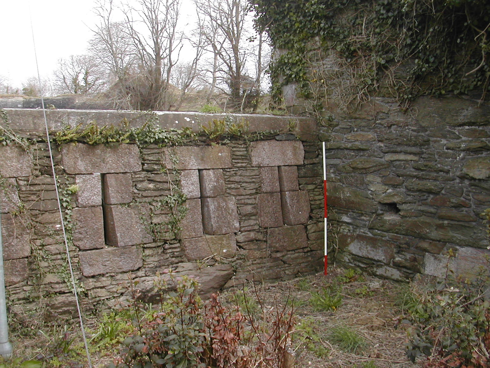
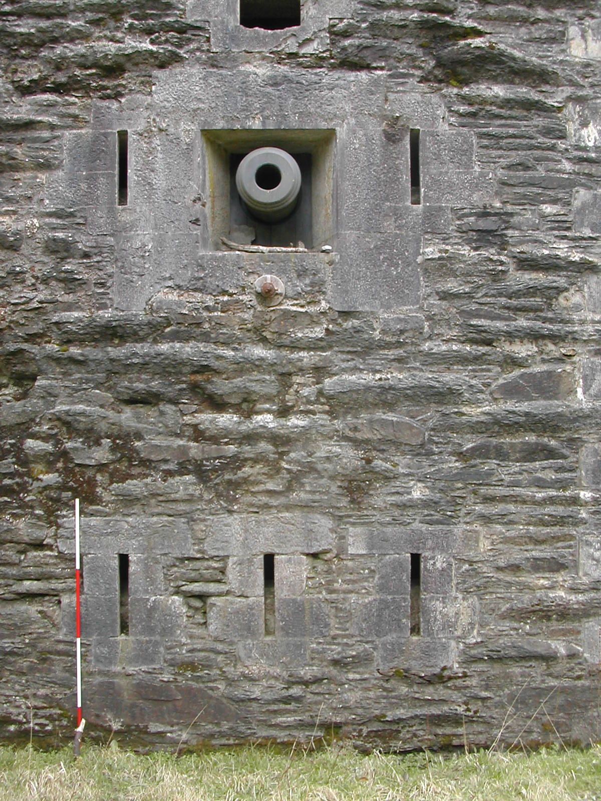
Well named for its central and commanding position in the northern defensive line Crownhill is the largest, most sophisticated and best preserved work in the whole scheme. It was also the most expensive being completed in 1869 at a cost of 76,409 GBP. It had extensive barrack accommodation for officers and men and housed other support facilities. The fort was actually armed with 32 guns on the ramparts, some in Haxo casemates and with 6 mortars in two batteries built into the west and north west ramparts. These mortar batteries are presumably sited on this side of the fort because the land falls away quite steeply here into two small but steep valleys which would be difficult to command with standard artillery. The defences consisted of the usual rock cut ditch backed by wall and thick earth rampart, less typically was a continuous earth bank beyond the ditch to create a covered way round the outside of the ditch. The heptagonal fort had flanking caponiers carefully arranged so that the one on the northern salient covered the two northern most sections of ditch, the north west and north east caponiers covered the west and east ditches respectively and the two southern sections of ditch which met at a shallow angle west of the gatehouse were covered from the south west and south east corners.
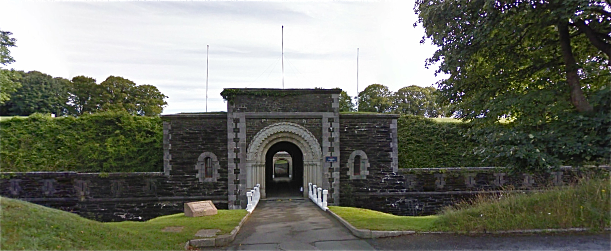
Crownhill Fort, main gate from S
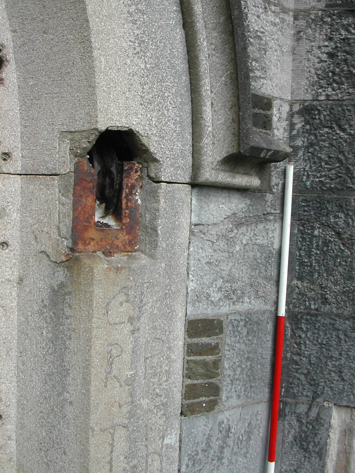
The armaments were updated a number of times during the late 19th. century and during the First World War was employed as an assembly post for troops destined to be stationed on the Turkish and African Fronts. Military occupation was maintained during the inter war years by the Corps of Royal Signals and the 2nd. Battalion the Royal Devonshire Regiment and post Dunkirk it again became a strong point in Plymouth's defences. A number of features cut into the counterscarp bank of the northern glacis and partially revetted with angle irons may reflect this World War II use. In the 1950s it became the headquarters for the Plymouth Garrison and later for the Commando Support Squadron R.E. Nearly 650 troops and just under 2,000 tonnes of War material were dispatched from the fort during the Falklands War in 1982. Finally decommissioned in 1985 it was taken over by the Landmark Trust and considerable restoration undertaken to suit it for small business use, holiday accommodation and intermittent use as a 'heritage' site. A huge amount of work has been done to clear trees and vegetation from the ramparts.
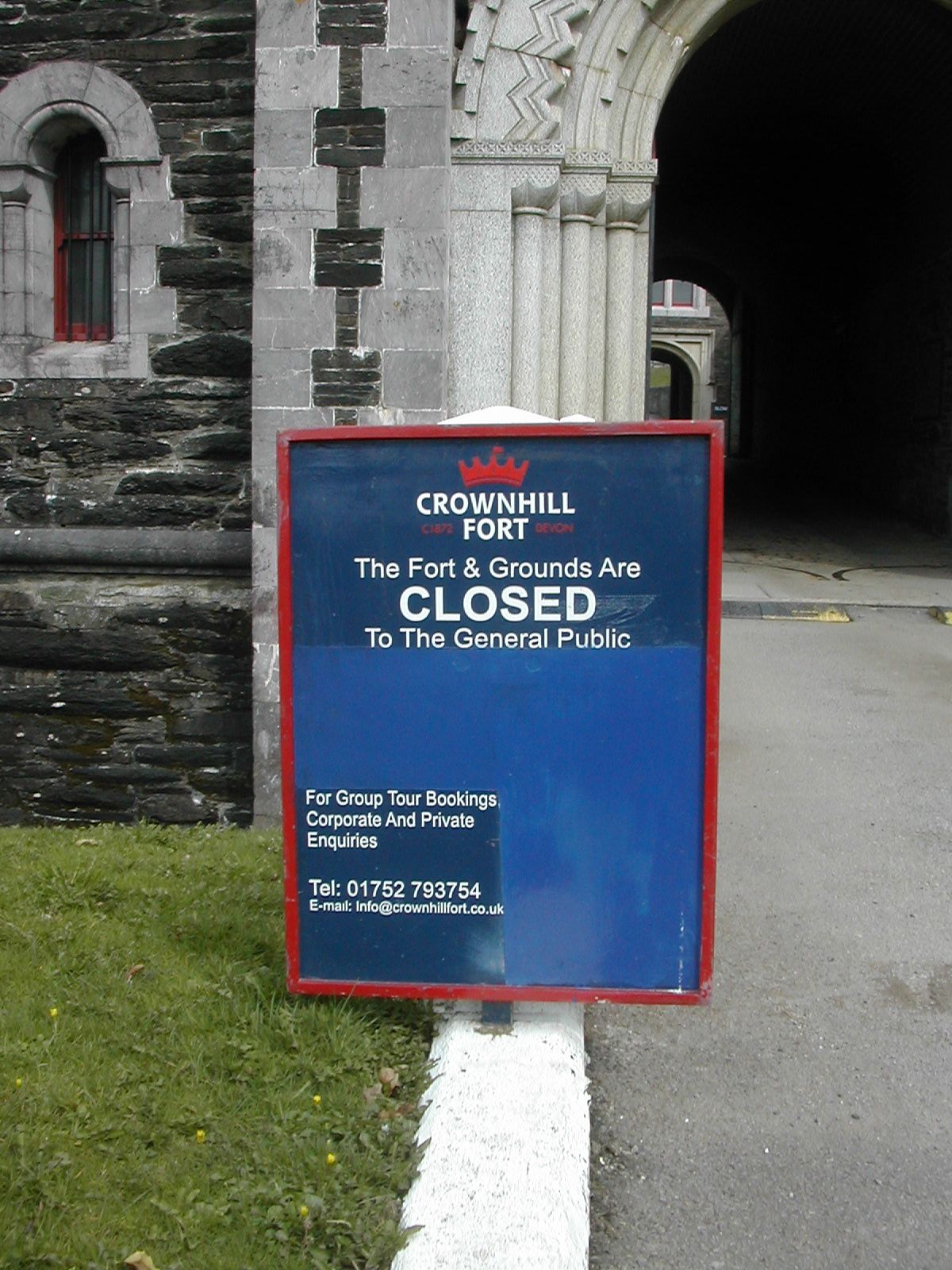
The fort is open to individual visitors on monthly Tuesdays. Interested individuals can walk around the open areas of the Fort (the ramparts, parade ground and museum rooms) once they have signed in at the Fort office. There is no charge for this but all visits need to be pre-arranged. The gun emplacements are not generally open on these days. Anybody can book a guided tour of the Fort, but this is best suited to schools, local history societies and scouts/guides etc so that the cost of the tour guide is split between a larger number of people. The Fort office is on 01752 793754, call to make an appointment. The fort was open as an attraction between 1997 and 2005 and a number of misleading signs and web-site entries are still around to confuse tourists.
CLICK HERE FOR A QUICKTIME VIDEO TOUR OF CROWNHILL FORT
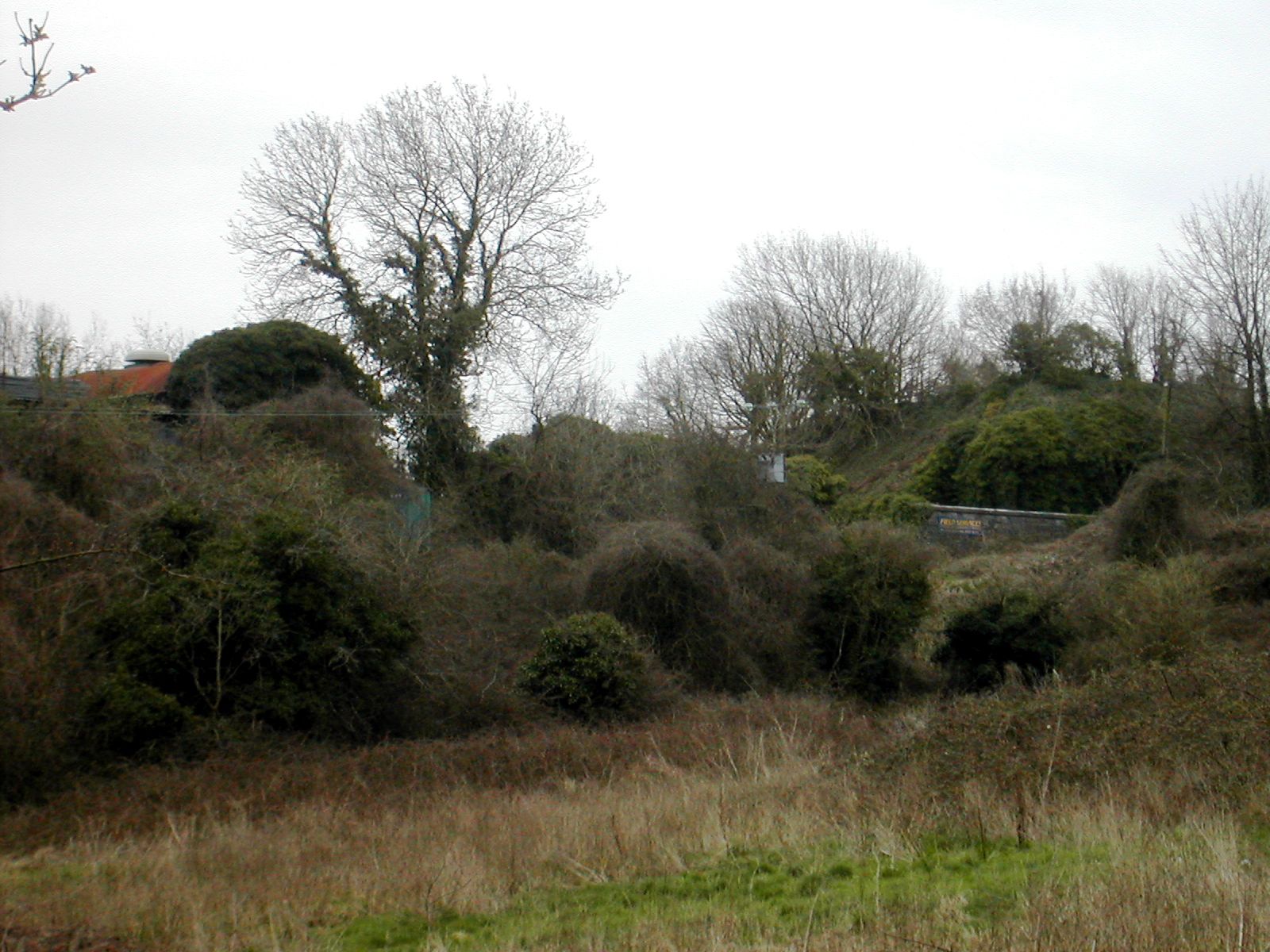
The layout of the defensive line to the west of Crownhill is fairly straightforward the military road, defended by a bank ran just below the crest of the ridge with the forts and batteries a little ahead of the line so as to dominate the east west valley to the north. To the east of Crownhill the situation becomes a deal more complicated as the engineers had to allow for a more complex topographical situation. As the line bent to the south to follow the valley of the Plym the land becomes more deeply dissected with a series of tributary valleys. While this provided a further degree of hindrance to attackers it also provided additional cover and divided the defences into two sections: the Buckland complex to the north and the Efford sector to the south. Modern building work has obscured much of the line linking Crownhill to Bowden although a few sections of the rampart protecting the military road are visible.
The Buckland section consisted of a deep rock cut ditch protecting the whole salient and backed by Forder Battery in the centre and flanked by Bowden Fort to the west and Fort Austin to the west. Set to the rear of Forder Battery and servicing the two forts as well was the defensible barracks known as Egg Buckland Keep.
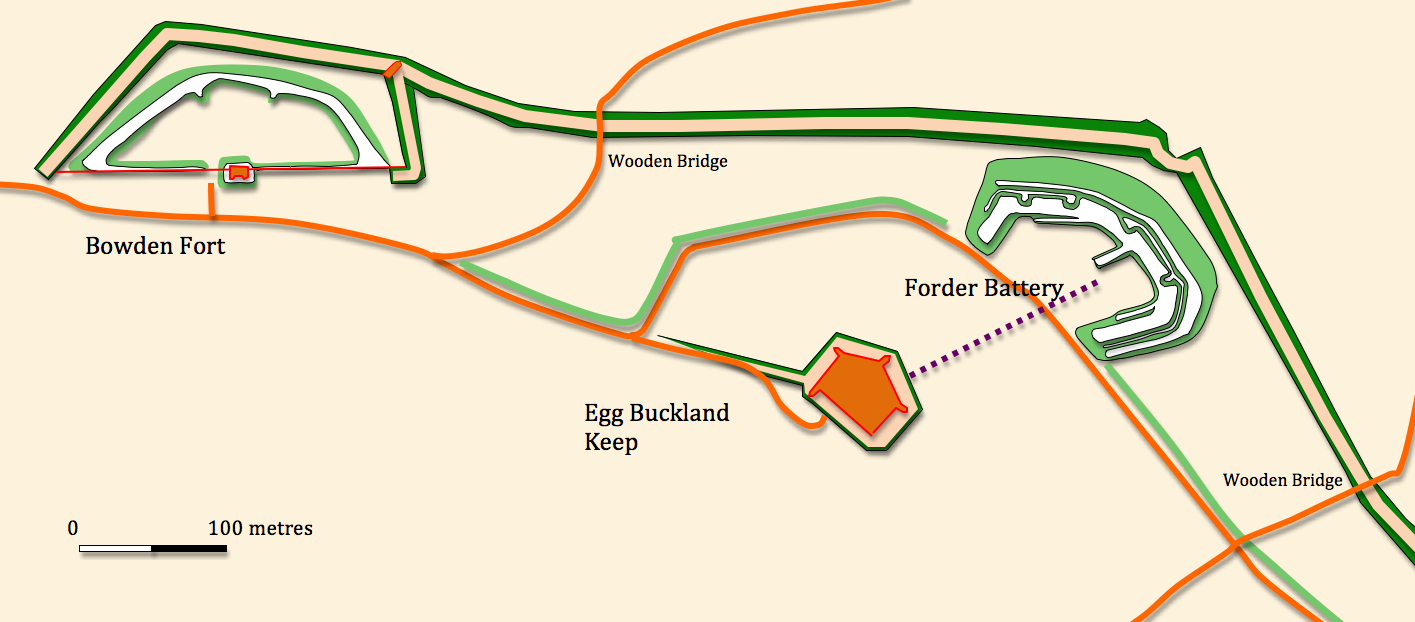
Bowden Fort
SX 496583
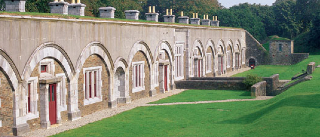
Covering both the eastern flank and approaches to Crownhill and linked to it by the embanked military road, now known as Fort Austin Avenue, and possibly a covered way running parallel to the north, Bowden is the western most element of the Buckland complex. A bow shaped rampart is fronted by the beginning of the large rock cut ditch that protects this north east salient of the sector. A caponier or 'flanking gallery' is shown on nineteenth century maps projecting into this ditch from the north west corner of the fort. The gorge was closed by a wall with a defended guardhouse half way along its length. The two curious triangular projections from the outer face of this building are presumably the roofs of small scale caponiers buried when the ditch was filled in, see the similar feature at Crownhill. Parts of the drawbridge mechansim are preserved west of the guardhouse. The fort was designed to carry an armament of twenty guns in open batteries and three mortars. Today it is home to Plymouth Garden Centre who are clearly quite proud of their unusual location:
The management are particularly keen that anyone who wishes to photograph the fort approaches a member of staff first.
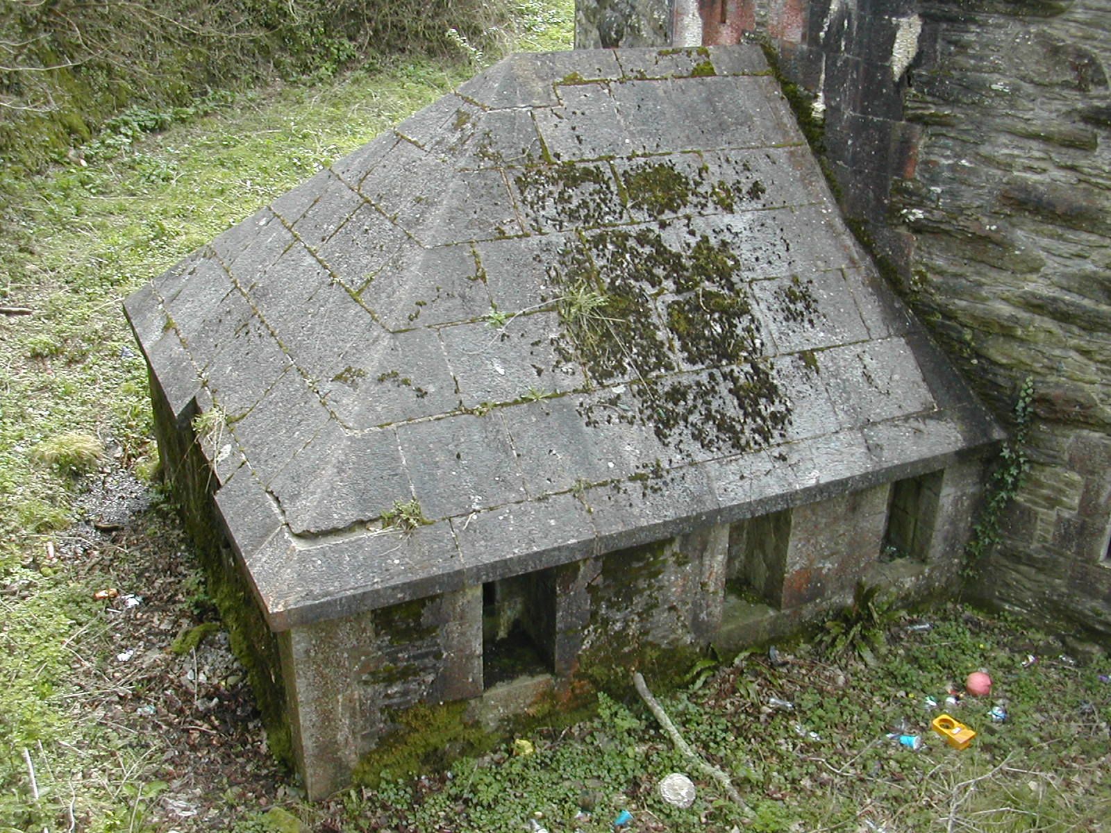
Egg Buckland Keep SX 500581
Ian Hogg's phrase, "the last building ever erected in England to be officially termed as a 'keep'" is much quoted and refers to this large pentagonal, two storey, defensible barracks completed by 1872. The whole is surrounded by a dry ditch, originally crossed by a drawbridge and defended by four caponiers and now overgrown. The roof is covered in earth up to 3 metres in depth and formed into ramparts. The keep was designed by Captain Du Cane under the supervision of Major Jervois and accommodated 230 men as well as munitions and other supplies for the adjacent batteries and forts. The intended armament of five 7 inch rifled breech-loading guns was not installed but by 1893 three machine guns were in place. A line of air shafts marked on the nineteenth century OS map reveals the line of a tunnel designed to link the keep with Forder Battery and Fort Austin. In 1943 the Anti-aircraft gun operations room (AA GOR) was moved here before its final transfer to Crownhill in 1948. The fort is on the English Heritage 'at risk' register but no details are currently on-line. Recent listings have A. Whiteway-Wilkinson, sand and gravel suppliers, as the occupiers and the keep, intriguingly, is also host to a 'school of boxing'. The management were happy to be approached about photographing the exterior of the building.
Forder Battery SX501581
This simple earth battery lies some 400 metres north east of Egg Buckland Keep. The crescent shaped rampart is fronted by the large ditch which runs along the north east edge of the area, and once mounted sixteen guns with the magazines in the earthen traverses between the positions. The rear of the work is covered by the keep and so there is neither a gorge wall nor any accommodation. BT are the current occupiers of the site which has the engineering code 'YFOR' . The ramparts are very overgrown but appear to be largely intact.
Presently occupied by the premises of Knowle Primary School this work was constructed on a knoll which again pushes forward a little from the main line of defence and was approached by a long curving defended way from the south east. The gorge wall and and a two storey guardhouse are well preserved although the original entrance to the west has been destroyed. All of the gun positions and magazines on the ramparts have been demolished or covered over except for a single 64-pounder rifled muzzle loader position at the NE salient. The northern side of the work was protected by a rock cut ditch of which only the southern face remains, the rest having been removed by modern housing development. the rampart is quite overgrown but accessible although obviously the grounds of the primary school remain out of bounds. The stone built portions of the work whilst shuttered and secure are not well cared for. There is considerable water damage and some grafitti.
 |  |
 |
| Knowles Battery Guardhouse and gorge wall from SE | Knowles Battery, interior from S | Knowles Battery, guardhouse from SW |
Several sections of the protective bank which would have covered the military road exist south of Knowles Battery and from there to the east towards Woodlands Fort. Up to 2.5 metres high in the vicinity of the junction between Crownhill Road and Ringmore Way the bank is slightly diminished towards its eastern end dropping down to a metre or less. In a number of places it has been destroyed by modern housing developments. Extensive modern landscaping with terracing makes it impossible to identify any forward lines between Knowles and Woodlands but the fall of the land suggests that the line of the military road and its bank may have been deemed sufficient.
Bank 600 metres west of Woodland Fort looking E
CLICK HERE FOR QUICKTIME VIDEO TOUR OF THE LANDSCAPE FROM ERNESETTLE TO KNOWLES
Woodland Fort SX 470593
Sandwiched between the top of the valley slope to the north and the military road to the south this trapezoidal work was completed between 1869 and 1870 at a cost of just under 30,000 GBP. Whilst the previous three works lay some distance in advance of the line of the military support road the lie of the land means that Woodland is on the line. The valley to the north remains a serious obstacle as can be seen by the height of the modern concrete bridge which crosses it shortly to the east of the fort. It was planned to have 16 guns in open batteries plus 2 in casemates to cover the flanks. Hogg writing in 1974 suggested that, "some of the armament was intended to be on Moncrieff mountings behind high parapets". The north and east ditch is flanked by a counterscarp gallery connected to the fort by a tunnel under the rampart and ditch intriguingly explored, photographed and reported on by the 'Derelict Places' team. A caponier flanks the west ditch. Surviving accommodation consists of a two storey barrack block with four vaulted casemates on each floor. The main magazine lies at the east end of the barracks and the cook house still exists on the west of the terreplein although in a state of collapse. Although much of the gorge wall has been destroyed a loopholed section and a small gatehouse fronting on to the road survive. The site is currently occupied by a community centre but is on the English Heritage 'at risk' register because the 'site is prone to vandalism and rubbish dumping'. Access to the site remains open and at present it is possible to complete the entire circuit of the defences following a path on top of the inner scarp face of the ditch thus enabling good views of the counterscarp gallery and caponier. It is also possible to explore the complex details of the rampart top including the haxo casemates and a number of small scale trenches and 'rifle pits' as quite extensive work has been undertaken to clear some of the undergrowth which chokes so many sites. Palmerston Fort Society Log Page
Woodland Fort, barrack accommodation in casemates from S
 |
 |
 |
| Woodland Fort, Gatehouse from S | Woodland Fort, loopholes flanking Gatehouse from SW | Woodland Fort, eastern rampart looking N |
 |
 |  |
| Woodland Fort, NW caponier from SE |
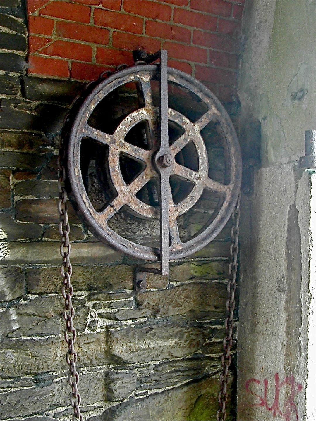
Woodland Fort: drawbridge pulley, Gatehouse from SW | Woodland Fort, chain wheel, Gatehouse from NW |
 |
 |
 |
| Woodland Fort, Cook house from NE | Woodland Fort, counterscarp gallery from SW | Woodland Fort, E haxo casemate from SW |
CLICK HERE FOR QUICKTIME VIDEO TOUR OF WOODLAND FORT
There are few traces of linear works between Woodland Fort and Crownhill. There is a very steep scarp slope running east - west parallel to the line of military road and some 150 metres to the north. There is no sign that this was capped by a bank so again a natural feature may have been regarded as part of the defensive scheme.
Crownhill Fort
Well named for its central and commanding position in the northern defensive line Crownhill is the largest, most sophisticated and best preserved work in the whole scheme. It was also the most expensive being completed in 1869 at a cost of 76,409 GBP. It had extensive barrack accommodation for officers and men and housed other support facilities. The fort was actually armed with 32 guns on the ramparts, some in Haxo casemates and with 6 mortars in two batteries built into the west and north west ramparts. These mortar batteries are presumably sited on this side of the fort because the land falls away quite steeply here into two small but steep valleys which would be difficult to command with standard artillery. The defences consisted of the usual rock cut ditch backed by wall and thick earth rampart, less typically was a continuous earth bank beyond the ditch to create a covered way round the outside of the ditch. The heptagonal fort had flanking caponiers carefully arranged so that the one on the northern salient covered the two northern most sections of ditch, the north west and north east caponiers covered the west and east ditches respectively and the two southern sections of ditch which met at a shallow angle west of the gatehouse were covered from the south west and south east corners.
Crownhill Fort, main gate from S
The armaments were updated a number of times during the late 19th. century and during the First World War was employed as an assembly post for troops destined to be stationed on the Turkish and African Fronts. Military occupation was maintained during the inter war years by the Corps of Royal Signals and the 2nd. Battalion the Royal Devonshire Regiment and post Dunkirk it again became a strong point in Plymouth's defences. A number of features cut into the counterscarp bank of the northern glacis and partially revetted with angle irons may reflect this World War II use. In the 1950s it became the headquarters for the Plymouth Garrison and later for the Commando Support Squadron R.E. Nearly 650 troops and just under 2,000 tonnes of War material were dispatched from the fort during the Falklands War in 1982. Finally decommissioned in 1985 it was taken over by the Landmark Trust and considerable restoration undertaken to suit it for small business use, holiday accommodation and intermittent use as a 'heritage' site. A huge amount of work has been done to clear trees and vegetation from the ramparts.
The fort is open to individual visitors on monthly Tuesdays. Interested individuals can walk around the open areas of the Fort (the ramparts, parade ground and museum rooms) once they have signed in at the Fort office. There is no charge for this but all visits need to be pre-arranged. The gun emplacements are not generally open on these days. Anybody can book a guided tour of the Fort, but this is best suited to schools, local history societies and scouts/guides etc so that the cost of the tour guide is split between a larger number of people. The Fort office is on 01752 793754, call to make an appointment. The fort was open as an attraction between 1997 and 2005 and a number of misleading signs and web-site entries are still around to confuse tourists.
Inside
the tunnel there is a helpful noticeboard should you be looking to buy
a bike or find a first aider but nothing about the history of the
fort and nothing to aid the casual visitor with an interest in the site
in its own right, information panels were put up but sadly have been vandalised. The Landmark Trust would prefer it if casual visitors do not enter the
site unannounced as there are significant insurance issues. There is a well maintained, if slightly
boggy path around the covered way. Palmerston
Fort Society Log Page
 |
 |
 |
| Crownhill Fort, Gatehouse from SE | Crownhill Fort, SE caponier from W | Crownhill Fort, SE ditch looking NE |
 |
 |  |
| Crownhill Fort, entrance arch from S |
Crownhill Fort detail of SE caponier from W | Crownhill Fort, tunnel in counterscarp gallery looking N |
 |
 |
 |
| Crownhill Fort, E covered way looking N | Crownhill Fort, feature cut into counterscarp bank of glacis from SW | Crownhill Fort, 'mini' caponier attached to double caponier from NW |
 |
 |
| Crownhill Fort, double haxo casemate from SE | Officers accommodation block from SW |
CLICK HERE FOR A QUICKTIME VIDEO TOUR OF CROWNHILL FORT
The layout of the defensive line to the west of Crownhill is fairly straightforward the military road, defended by a bank ran just below the crest of the ridge with the forts and batteries a little ahead of the line so as to dominate the east west valley to the north. To the east of Crownhill the situation becomes a deal more complicated as the engineers had to allow for a more complex topographical situation. As the line bent to the south to follow the valley of the Plym the land becomes more deeply dissected with a series of tributary valleys. While this provided a further degree of hindrance to attackers it also provided additional cover and divided the defences into two sections: the Buckland complex to the north and the Efford sector to the south. Modern building work has obscured much of the line linking Crownhill to Bowden although a few sections of the rampart protecting the military road are visible.
The Buckland section consisted of a deep rock cut ditch protecting the whole salient and backed by Forder Battery in the centre and flanked by Bowden Fort to the west and Fort Austin to the west. Set to the rear of Forder Battery and servicing the two forts as well was the defensible barracks known as Egg Buckland Keep.
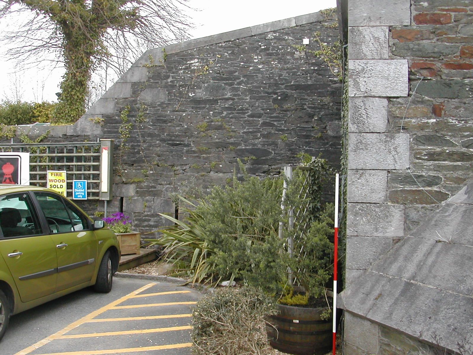
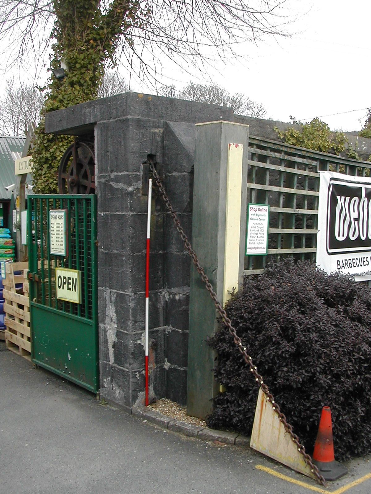
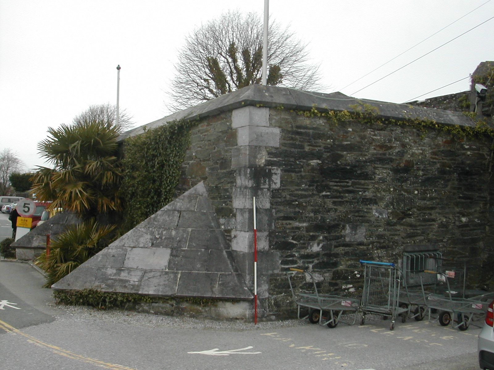
Covering both the eastern flank and approaches to Crownhill and linked to it by the embanked military road, now known as Fort Austin Avenue, and possibly a covered way running parallel to the north, Bowden is the western most element of the Buckland complex. A bow shaped rampart is fronted by the beginning of the large rock cut ditch that protects this north east salient of the sector. A caponier or 'flanking gallery' is shown on nineteenth century maps projecting into this ditch from the north west corner of the fort. The gorge was closed by a wall with a defended guardhouse half way along its length. The two curious triangular projections from the outer face of this building are presumably the roofs of small scale caponiers buried when the ditch was filled in, see the similar feature at Crownhill. Parts of the drawbridge mechansim are preserved west of the guardhouse. The fort was designed to carry an armament of twenty guns in open batteries and three mortars. Today it is home to Plymouth Garden Centre who are clearly quite proud of their unusual location:
| "Plymouth Garden Centre is also more than just a shopping experience. A surprise is that you will notice we are located within a Victorian Fort. Bowden Battery was built in the 1870’s as part of a ring of defences around Plymouth to protect the Naval Dockyard from a land attack. Many of the original features remain. The outer wall with rifle slits runs along the back of the car parks. The original entrance remains and the drawbridge mechanism is visible. As you walk through the gates you are walking over the original drawbridge which lies beneath you. The main guardhouse block is at the entrance too. You can find other original features as you walk around including gun emplacements with circular railways; tunnel entrances and ammunition stores." |
The management are particularly keen that anyone who wishes to photograph the fort approaches a member of staff first.
 |  |
 |
| Bowden Fort, gorge wall and W flank of guardhouse from S | Remains of drawbridge from SW | Bowden Fort, guard house with roof of buried caponiers? from SE |
 |
 |
|
| Stone facing to S scarp of ditch, 300 m E of Bowden | Bowden Fort from E, rock cut ditch to right | Bank covering approach to Buckland Keep looking E |
Egg Buckland Keep SX 500581
Ian Hogg's phrase, "the last building ever erected in England to be officially termed as a 'keep'" is much quoted and refers to this large pentagonal, two storey, defensible barracks completed by 1872. The whole is surrounded by a dry ditch, originally crossed by a drawbridge and defended by four caponiers and now overgrown. The roof is covered in earth up to 3 metres in depth and formed into ramparts. The keep was designed by Captain Du Cane under the supervision of Major Jervois and accommodated 230 men as well as munitions and other supplies for the adjacent batteries and forts. The intended armament of five 7 inch rifled breech-loading guns was not installed but by 1893 three machine guns were in place. A line of air shafts marked on the nineteenth century OS map reveals the line of a tunnel designed to link the keep with Forder Battery and Fort Austin. In 1943 the Anti-aircraft gun operations room (AA GOR) was moved here before its final transfer to Crownhill in 1948. The fort is on the English Heritage 'at risk' register but no details are currently on-line. Recent listings have A. Whiteway-Wilkinson, sand and gravel suppliers, as the occupiers and the keep, intriguingly, is also host to a 'school of boxing'. The management were happy to be approached about photographing the exterior of the building.
 |
 |  |
| Buckland Keep, W ditch looking N |
Buckland Keep, entrance from SW | Buckland Keep, SW corner and caponier from SE |
Forder Battery SX501581
This simple earth battery lies some 400 metres north east of Egg Buckland Keep. The crescent shaped rampart is fronted by the large ditch which runs along the north east edge of the area, and once mounted sixteen guns with the magazines in the earthen traverses between the positions. The rear of the work is covered by the keep and so there is neither a gorge wall nor any accommodation. BT are the current occupiers of the site which has the engineering code 'YFOR' . The ramparts are very overgrown but appear to be largely intact.
 |
 |
| Modern gate to Forder Battery from SW | Forder Battery, W section of rampart from SW |
 |
 |
 |
| Line of military road W of Keep looking W to Bowden | W face of rock cut ditch N of Fort Austin from SE | W face of rock cut ditch N of Fort Austin from SE |
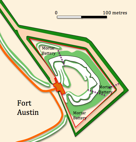
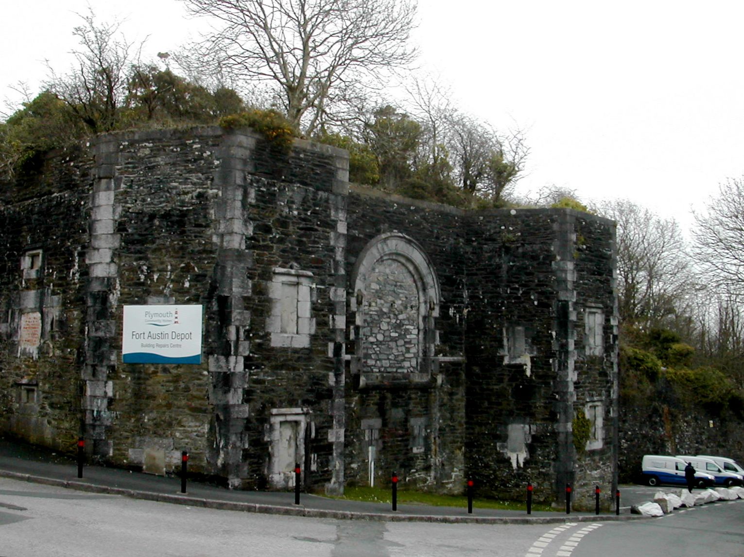
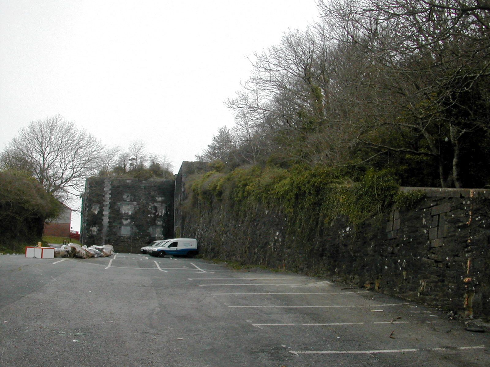
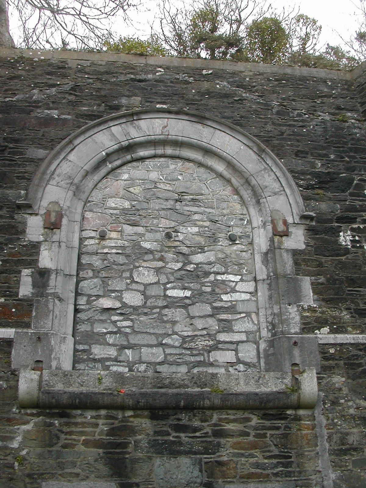
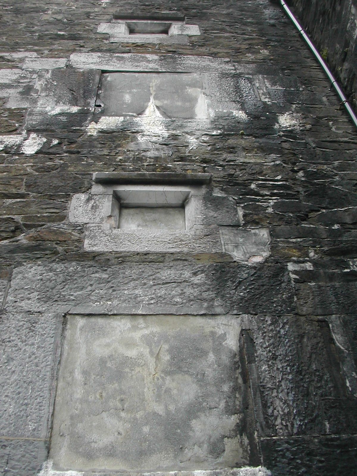
Fort Austin SX506576
Built between 1863 and 1869 and positioned at the south eastern end of the Buckland sector Fort Austin completes the defence of the north east salient and also overlooks both the valley of the Plym to the east and also a tributary valley which cuts through the defensive line running in a west to east direction. The fort is fronted by the continuation of the huge rock cut ditch which provides additional defence for this part of the line. The fort is trapezoidal in plan with a gorge wall and gatehouse but has no caponiers flanking the ditch. The planned armament was to be fifteen guns and five mortars shared between three batteries.
In the postwar period the buildings were converted for use as the emergency control centre for Plymouth, Subterranea Britannica have a very detailed account of this with plans and photographs. The site is currently in use as a depot for Plymouth City Council who use a mixture of buildings of World War II vintage and some modern constructions. Yet again the defences are heavily wooded. The military road approached the fort from the north and swung round to the south west to run along the upper edge of the tributary valley. This length which runs for around 400 metres retains its well preserved defensive bank along its southern side.
 |
 |
| Fort Austin, gatehouse from W | Fort Austin, gorge and gatehouse from S |
 |
 |  |
| Fort Austin, blocked entrance arch from SW |
Fort Austin, detail of gatehouse from from SE | Fort Austin, S flank of gatehouse from S |
 |
 |
|
| Start of bank and military road west from Austin, looking W | View from Fort Austin across valley to Deerpark Emplacement | Looking E along military road back towards Austin |
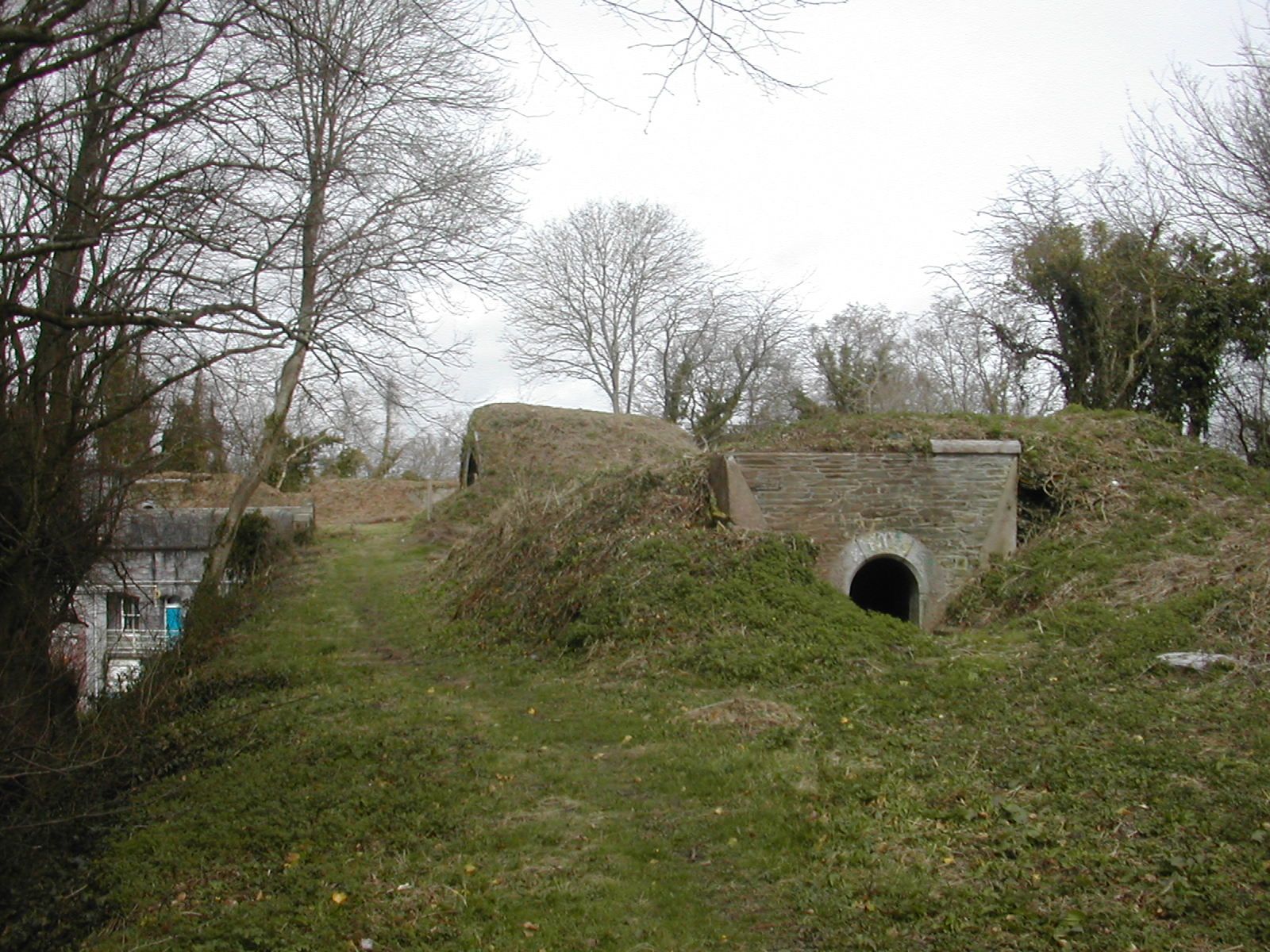
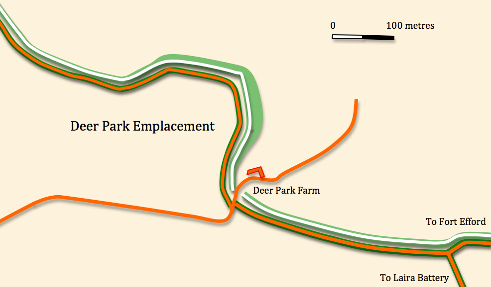
Deerpark Emplacement
SX508568
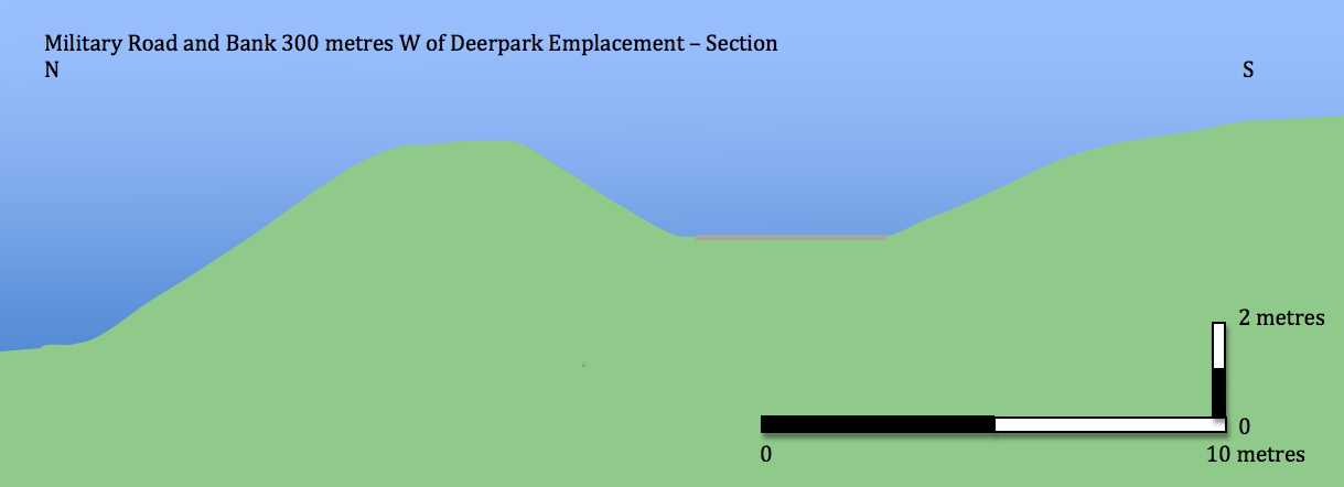
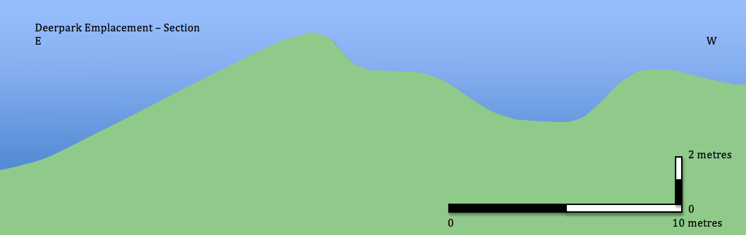
Some 400 metres west of Fort Austin the line of the military road and rampart takes a 90 degree turn and runs south across the valley of a small stream now taken up by the dual carriageway A38 'Parkway'. On the other side of the valley it starts to climb again and following the 60 metre contour bends out once more towards the north east. As we are still some way from the commanding knoll on which Fort Efford is based it was clearly important to offer some additional strength to the salient. This was provided by strengthening the bank at this point and ear-marking it as a the site of a temporary battery called Deer Park Emplacement. In plan this resembles a pentagonal bastion which could almost date back to the Civil War period. Today it lies stranded in the middle of a modern housing estate. Whilst heavily overgrown the entire course of the embankment is accessible here. The battery itself is marked by a widening of the bank which has a clearly defined 'fire step'.
From this point the rest of the sector lies on land which has become marginal. The area is a curious mixture of residential developments and wasteland and in general terms poorly managed as a landscape.
Laira Battery SX524563
This is the final work in the line and was connected directly to Fort Austin by the military road. The 1643 map of the siege of Plymouth indicates that batteries lined the western bank of the Plym as far back as the seventeenth century. Resembling a large pentagonal bastion the present battery was defended by a rampart and ditch with a simple loop holed wall closing the gorge. It was designed for ten guns in emplacements and three in casemates. There was casemated accommodation along the south and east sides of the rampart. Most of the interior of the battery is currently used by 'Field Services', a plant hire firm for storage. Some efforts have recently gone in to clearing and consolidating some of the casemates. There is an interesting account on line of one Gerald Thomas Gorst, one of the Accrington Pals who was stationed at the battery during the First World War.
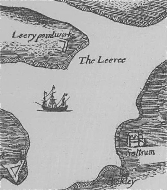
Detail from seventeenth century map of the siege of Plymouth
Just off to the south west lies the Laira Emplacement, a large crescent shaped earthwork offering additional cover to the southern approach to the battery and carrying two haxo casemates one of which is clearly used by underage drinkers for this and possibly other illegal activities.
The various cuttings, ramparts, ditches and covered ways which linked the works in this sector are very well preserved but sadly marred by extensive tipping of rubbish and litter,
You can read the PDAS report on Laira Battery here.
There is a fascinating analysis of the whole community around Efford and Laira which analyses links between the historic landscape and current land use.
Laira Battery, Efford Emplacement. Efford Fort from E
Principal Sources:
'Coast Defences of England and Wales' by Ian V. Hogg, David and Charles, Newton Abbot 1974
'The Historic Defences of Plymouth' by Andrew Pye and Freddy Woodward, 1996
On-line resources are linked to from the text.
Some 400 metres west of Fort Austin the line of the military road and rampart takes a 90 degree turn and runs south across the valley of a small stream now taken up by the dual carriageway A38 'Parkway'. On the other side of the valley it starts to climb again and following the 60 metre contour bends out once more towards the north east. As we are still some way from the commanding knoll on which Fort Efford is based it was clearly important to offer some additional strength to the salient. This was provided by strengthening the bank at this point and ear-marking it as a the site of a temporary battery called Deer Park Emplacement. In plan this resembles a pentagonal bastion which could almost date back to the Civil War period. Today it lies stranded in the middle of a modern housing estate. Whilst heavily overgrown the entire course of the embankment is accessible here. The battery itself is marked by a widening of the bank which has a clearly defined 'fire step'.
From this point the rest of the sector lies on land which has become marginal. The area is a curious mixture of residential developments and wasteland and in general terms poorly managed as a landscape.
 |
 |
 |
| Military road and bank 250 m W of Deerpark looking E | Deerpark Emplacement, S end from S | Deerpark Emplacement, 'fire step' from S |
 |
 |
| Military road S of Deerpark cutting through bank looking S | Cutting for military road to Laira Battery looking S |
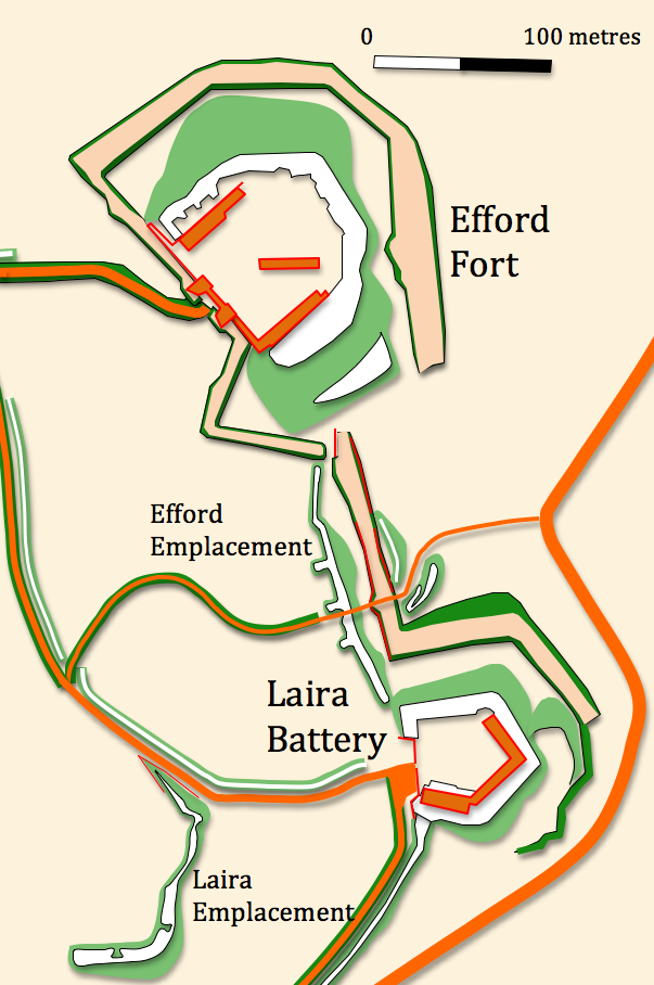
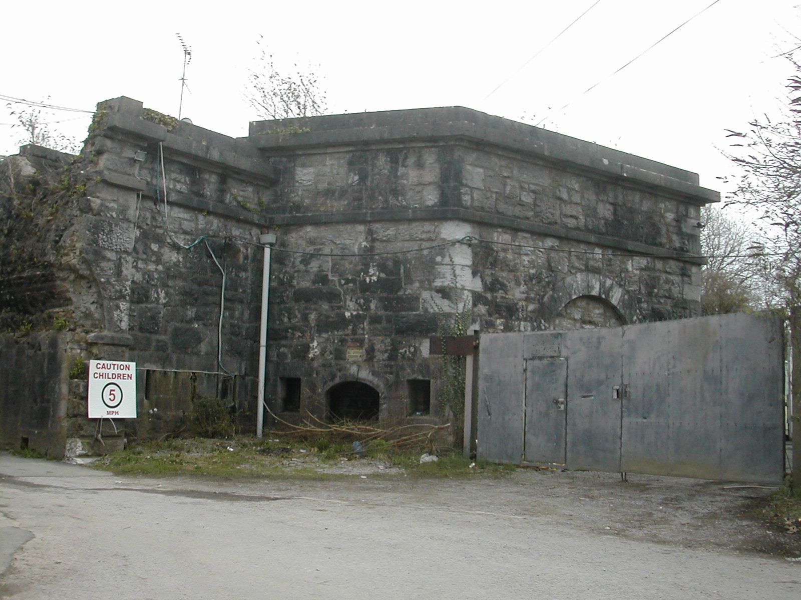
Fort Efford SX513566
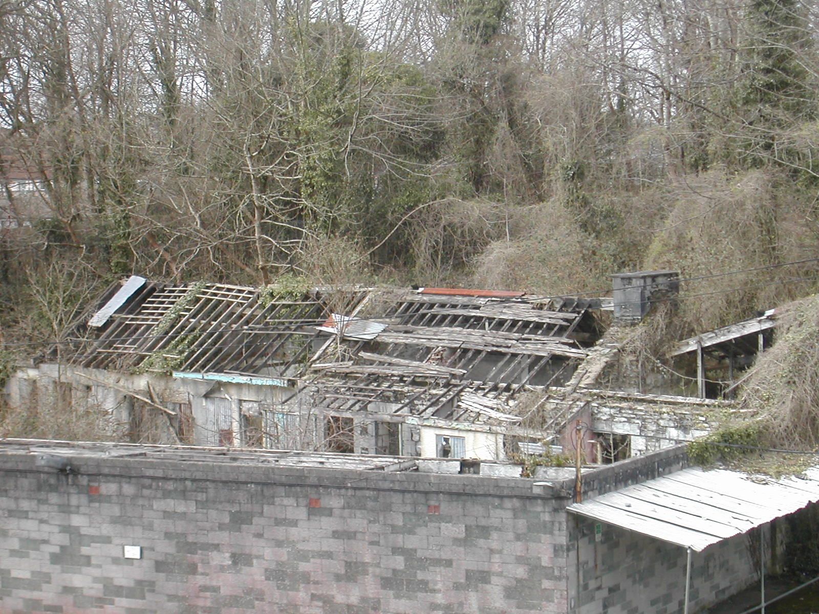
Fort Efford is the second largest work in the line and together with the adjacent emplacements and Laira Battery forms a strong combination to defend the east end of the line and command the Plym valley. This pentagonal fort follows the usual plan with an earth rampart backing a deep ditch and the gorge closed by a wall with gatehouse which mounted 32-pounder guns; the gate arch was demolished in the late 20th century. Work on the fort began around 1865 and was completed shortly after 1868 when work began on Efford Emplacement. Captain Du Cane designed the fort to mount 21 guns on the rampart with three Haxo gun casemates and a additional battery of five guns in casemates to cover the approach to the Efford Emplacement and the northern flank of Laira Battery. Hogg suggests that towards the end of the century some form of armament, probably... a siege battery was accommodated at the fort. It contained casemated barracks for five officers and 108 men as well as number of other sheds for storage and workshops. The fort was used as an ammunition store in World War II and a light-gauge railway was installed.
The summer of 2009 saw a decision by Plymouth City Council to site a permanent camp for ten caravans close to the fort "amid protests from up to 50 placard-waving residents". In July 2009 the Plymouth Express and Echo described the effects of a fire at the fort in the following terms: "Four fire crews tackled a blaze in a store shed at historic Efford Fort last night. The crews were sent to the fort just before 3 p.m. after reports of a shed on fire.A spokesman for the fire service said: "Because of the nature of the building, that's why so many crews were sent. There is a labyrinth of tunnels down there... Breathing apparatus sets, two thermal imaging cameras and three positive pressure fans were used to try 'to help ventilate the labyrinth of underground passages and buildings, where the smoke invaded'."The site is currently occupied by Anderton and Rowland's fairground store and some families live on site making access to the interior of the fort very difficult. Once again the surrounding earthworks are very overgrown
English Heritage has a very detailed description of the monument at www.magic.gov.uk/ and in its 'at risk' register describe the condition as "very bad" and that, "buildings are suffering from extreme neglect and decay and heavy vegetation growth. Extensive water penetration and structural problems are apparent." The The UK UE Urbex Urban Exploration Forum have some remarkable pictures of the interior of the fort on their web site. The approach road is marked private and at least some of the current occupants are not particularly welcoming of visitors.
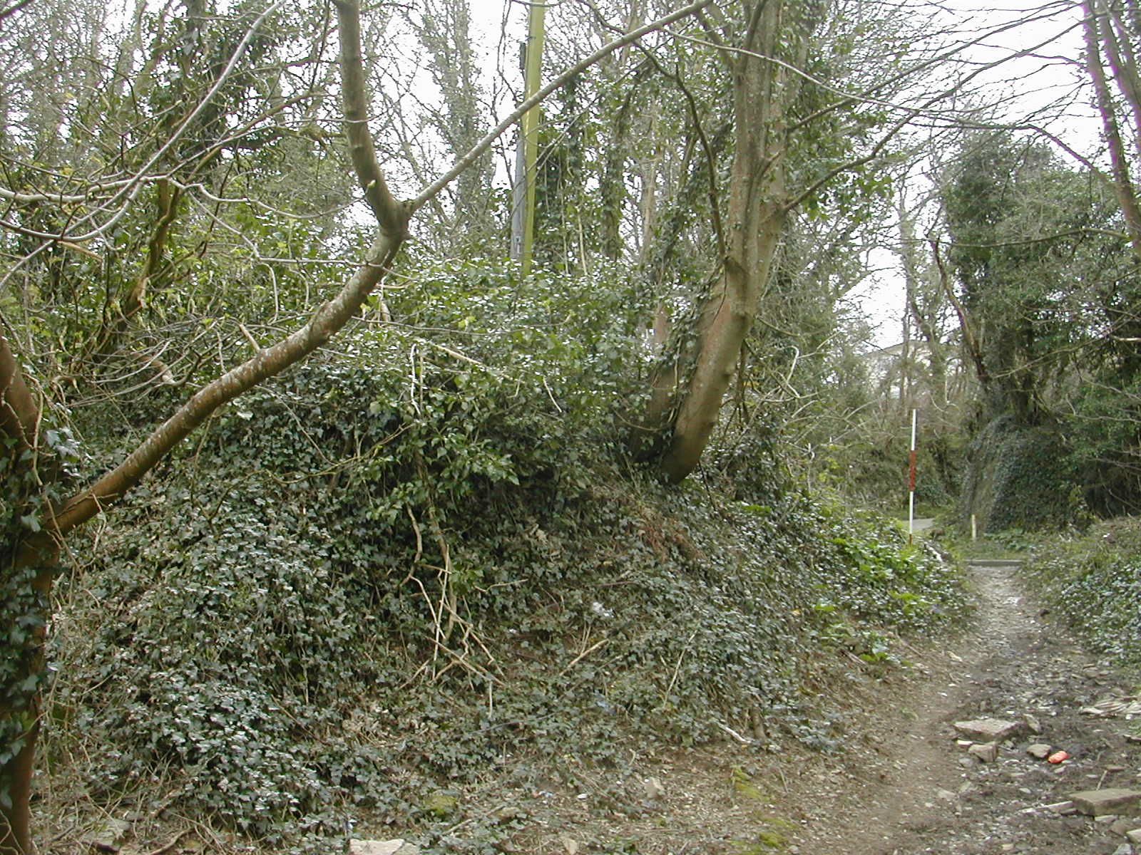
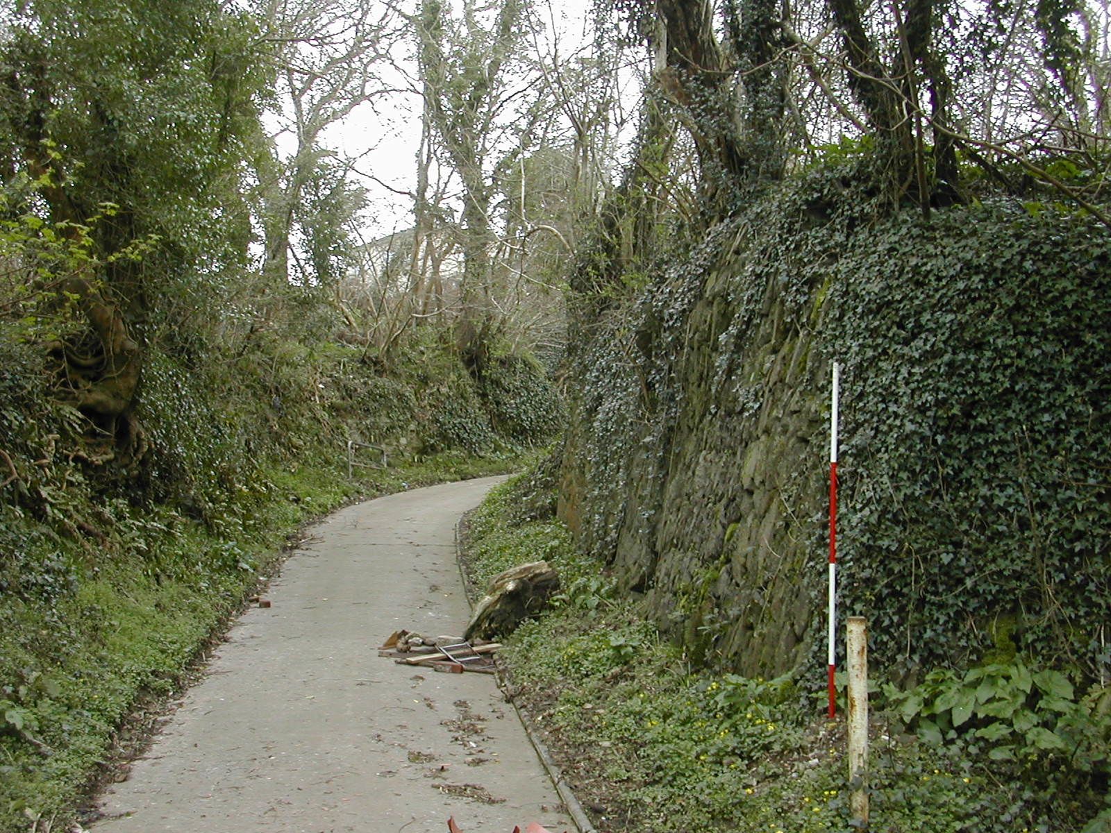
The Efford Emplacement lies immediately south of the fort and was a major work designed to block the small valley and close the gap between Efford and Laira. It consists of a deep rock cut ditch backed by a rampart for which four 64-pounder Rifled Muzzle-Loading (RML) guns were planned, as it happened, eventually six 8-inch RML howitzers were installed. Access from Efford Fort was by a long sloping stepped tunnel.
Bob Bruce of the Plymouth and District Archaeology Society described the emplacement thus:
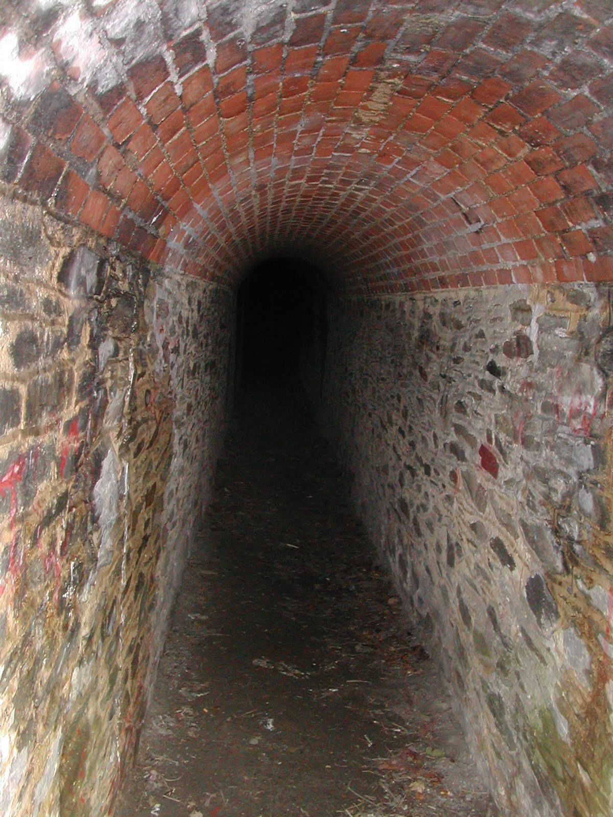
"... an open earthwork battery, facing east, sited across a shallow valley between Efford Fort and Laira Battery. We passed through a sally port and across a filled-in part of the deep rock-cut ditch which defended its east face. Further gun and rifle positions were sited to enfilade the length of the ditch. From the sally port, for troops going to defend the Longbridge crossing, the route went over a drawbridge and via an embanked chicane. Our route brought us surprisingly quickly among the houses of Crabtree, our last point of interest being War Department Boundary Stone No.8 in Crabtree Close... Most of us were surprised how extensive the Palmerston works were and how much had survived, though often concealed by vegetation. Some of us wondered whether Plymouth should be making more of this part of its military heritage." The current condition of the monument is poor. Despite signs to the contrary the ditch is becoming rapidly filled with rubbish and the remainder of the work is heavily overgrown. A tarmacked public footpath runs up through the long brick lined tunnel described above as a sally port
Fort Efford is the second largest work in the line and together with the adjacent emplacements and Laira Battery forms a strong combination to defend the east end of the line and command the Plym valley. This pentagonal fort follows the usual plan with an earth rampart backing a deep ditch and the gorge closed by a wall with gatehouse which mounted 32-pounder guns; the gate arch was demolished in the late 20th century. Work on the fort began around 1865 and was completed shortly after 1868 when work began on Efford Emplacement. Captain Du Cane designed the fort to mount 21 guns on the rampart with three Haxo gun casemates and a additional battery of five guns in casemates to cover the approach to the Efford Emplacement and the northern flank of Laira Battery. Hogg suggests that towards the end of the century some form of armament, probably... a siege battery was accommodated at the fort. It contained casemated barracks for five officers and 108 men as well as number of other sheds for storage and workshops. The fort was used as an ammunition store in World War II and a light-gauge railway was installed.
 |
 |
| Fort Efford, S Bastion of gatehouse from W | Fort Efford, remains of entry arch from W |
The summer of 2009 saw a decision by Plymouth City Council to site a permanent camp for ten caravans close to the fort "amid protests from up to 50 placard-waving residents". In July 2009 the Plymouth Express and Echo described the effects of a fire at the fort in the following terms: "Four fire crews tackled a blaze in a store shed at historic Efford Fort last night. The crews were sent to the fort just before 3 p.m. after reports of a shed on fire.A spokesman for the fire service said: "Because of the nature of the building, that's why so many crews were sent. There is a labyrinth of tunnels down there... Breathing apparatus sets, two thermal imaging cameras and three positive pressure fans were used to try 'to help ventilate the labyrinth of underground passages and buildings, where the smoke invaded'."The site is currently occupied by Anderton and Rowland's fairground store and some families live on site making access to the interior of the fort very difficult. Once again the surrounding earthworks are very overgrown
English Heritage has a very detailed description of the monument at www.magic.gov.uk/ and in its 'at risk' register describe the condition as "very bad" and that, "buildings are suffering from extreme neglect and decay and heavy vegetation growth. Extensive water penetration and structural problems are apparent." The The UK UE Urbex Urban Exploration Forum have some remarkable pictures of the interior of the fort on their web site. The approach road is marked private and at least some of the current occupants are not particularly welcoming of visitors.
 |
 |  |
| Efford Emplacement, ditch from E |
Efford Emplacement, sally port from E | Efford Emplacement, sally port from W |
The Efford Emplacement lies immediately south of the fort and was a major work designed to block the small valley and close the gap between Efford and Laira. It consists of a deep rock cut ditch backed by a rampart for which four 64-pounder Rifled Muzzle-Loading (RML) guns were planned, as it happened, eventually six 8-inch RML howitzers were installed. Access from Efford Fort was by a long sloping stepped tunnel.
Bob Bruce of the Plymouth and District Archaeology Society described the emplacement thus:
"... an open earthwork battery, facing east, sited across a shallow valley between Efford Fort and Laira Battery. We passed through a sally port and across a filled-in part of the deep rock-cut ditch which defended its east face. Further gun and rifle positions were sited to enfilade the length of the ditch. From the sally port, for troops going to defend the Longbridge crossing, the route went over a drawbridge and via an embanked chicane. Our route brought us surprisingly quickly among the houses of Crabtree, our last point of interest being War Department Boundary Stone No.8 in Crabtree Close... Most of us were surprised how extensive the Palmerston works were and how much had survived, though often concealed by vegetation. Some of us wondered whether Plymouth should be making more of this part of its military heritage." The current condition of the monument is poor. Despite signs to the contrary the ditch is becoming rapidly filled with rubbish and the remainder of the work is heavily overgrown. A tarmacked public footpath runs up through the long brick lined tunnel described above as a sally port
 |
 |
 |
| Efford Emplacement, traverse from NW | Efford Emplacement and Fort, general view looking N | Bank on approach road to Efford Emplacement from S |
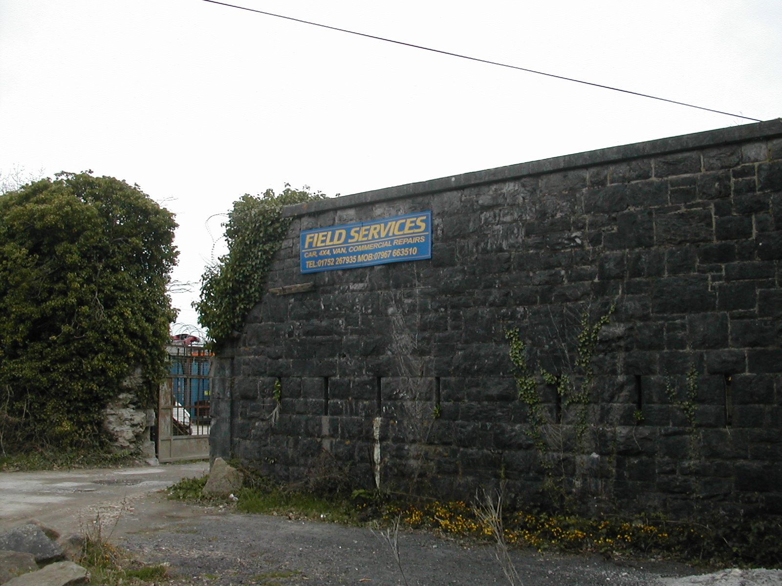
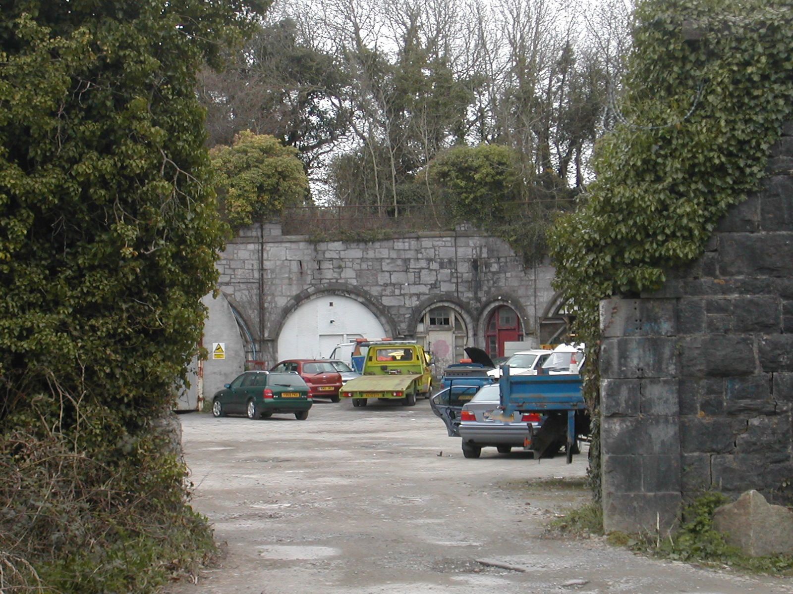
This is the final work in the line and was connected directly to Fort Austin by the military road. The 1643 map of the siege of Plymouth indicates that batteries lined the western bank of the Plym as far back as the seventeenth century. Resembling a large pentagonal bastion the present battery was defended by a rampart and ditch with a simple loop holed wall closing the gorge. It was designed for ten guns in emplacements and three in casemates. There was casemated accommodation along the south and east sides of the rampart. Most of the interior of the battery is currently used by 'Field Services', a plant hire firm for storage. Some efforts have recently gone in to clearing and consolidating some of the casemates. There is an interesting account on line of one Gerald Thomas Gorst, one of the Accrington Pals who was stationed at the battery during the First World War.
Detail from seventeenth century map of the siege of Plymouth
 |
 |
 |
| Laira Battery from NW | Laira Battery, gorge wall from SW | Laira Battery Interior looking E |
Just off to the south west lies the Laira Emplacement, a large crescent shaped earthwork offering additional cover to the southern approach to the battery and carrying two haxo casemates one of which is clearly used by underage drinkers for this and possibly other illegal activities.
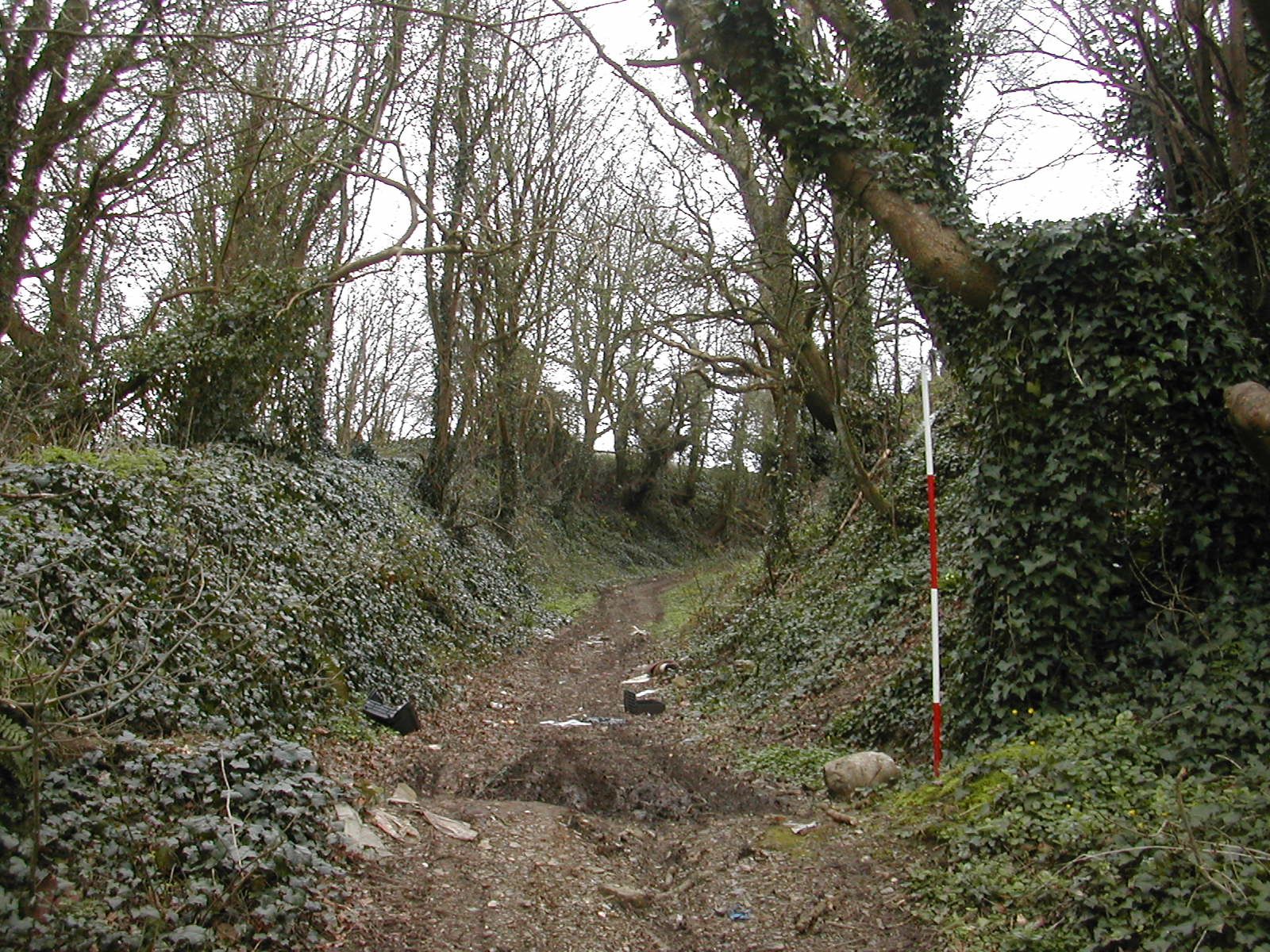
The various cuttings, ramparts, ditches and covered ways which linked the works in this sector are very well preserved but sadly marred by extensive tipping of rubbish and litter,
You can read the PDAS report on Laira Battery here.
There is a fascinating analysis of the whole community around Efford and Laira which analyses links between the historic landscape and current land use.
 |
 |
 |
| Laira Emplacement, approach road looking SE | Laira Emplacement from NE | Laira Emplacement, haxo casemate from W |
Laira Battery, Efford Emplacement. Efford Fort from E
CLICK HERE FOR A QUICKTIME VIDEO TOUR OF THE EAST END OF THE NORTHERN LINE
Principal Sources:
'Coast Defences of England and Wales' by Ian V. Hogg, David and Charles, Newton Abbot 1974
'The Historic Defences of Plymouth' by Andrew Pye and Freddy Woodward, 1996
On-line resources are linked to from the text.
Stephen Wass April 2010